

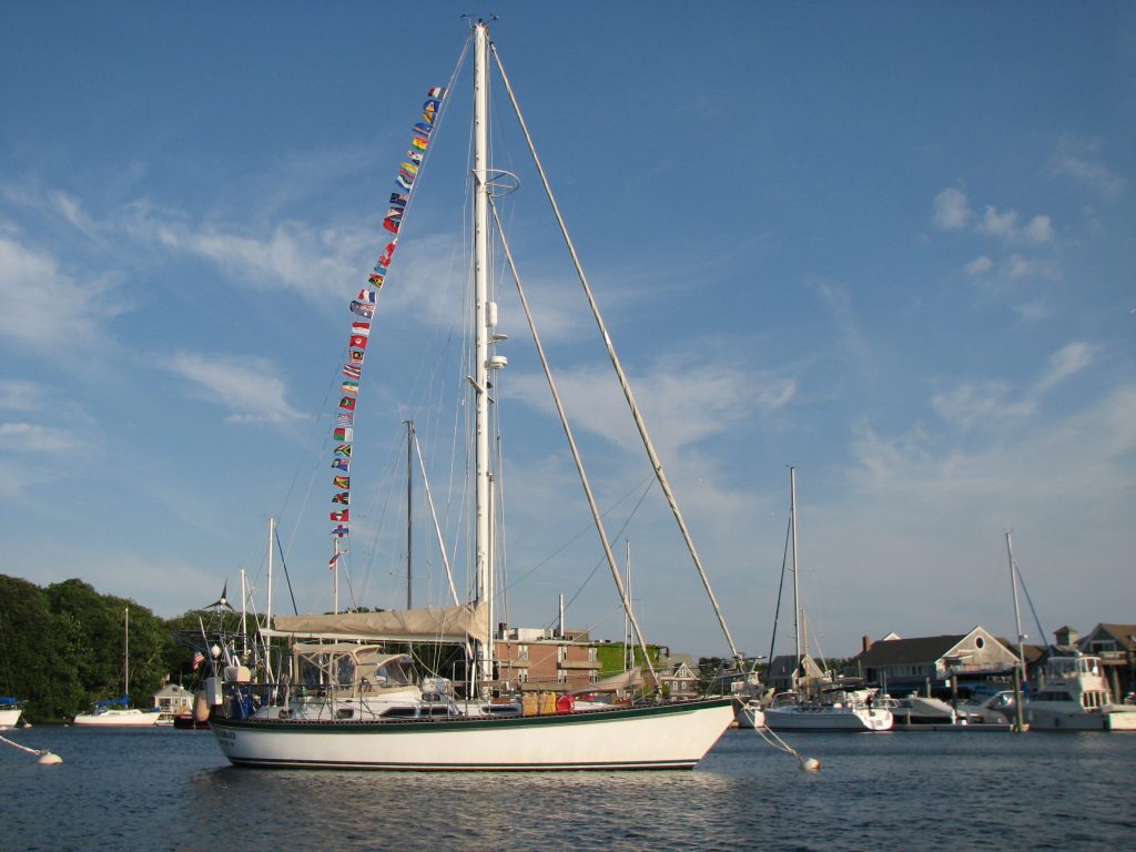
After almost 6 years of traveling, we sailed into Woods Hole on Cape Cod. We continued living aboard for the next five years and I wrote about that, adding ‘and Beyond’ to the title of the blog. Then shortly before Mark’s death in 2016, we sold our beloved Windbird and my travel logs became land logs. At this point, I had written a daily account for each and every day for 11 years. I fully intended to end the blog at that point, but when I wrote that news in a log, I got many responses saying that I really needed to keep posting. At the same time, I realized that I couldn’t stop writing. Summarizing each day had become a permanent part of my life and I will probably continue writing until I can no longer. These postings reflect the ordinary, and sometimes the extraordinary, days in my life and I would like to invite you to join me on my journey.
NZ Land Logs 28, Year 2: North Island—Auckland’s Rangitoto Island
NZ Land Logs 28, Year 2: North Island—Auckland’s Rangitoto Island
Date: Sunday, March 18, 2007
Weather Today: Sunny with Clouds AM, Overcast with Sprinkles PM
Location: Auckland, Takapuna on the North Shore, New Zealand
Rangitoto Island in Auckland’s Hauraki Gulf was our goal for today. We took the 9:15 am ferry for the 30 minute ride to this volcanic island and spent the rest of the day exploring. Rangitoto was formed 600 years ago when the volcano erupted from the sea. This makes it a ‘one of a kind’ in Auckland’s volcanic field of about 50 cones and craters. The other volcanoes are dormant, while Rangitoto is extinct. This means that at sometime one of the other 49 volcanoes in the Auckland area will probably become active again–not a happy thought for the two million people who live in this area. Rangitoto, and its neighbor, Mototapu, are now joined by a causeway although there is no permanent population on either island. They are managed by the Department of Conservation and Rangitoto is studied for its botanic significance. At only 600 years old, it is home to some 200 different native species of plants and 40 different types of ferns.
We arrived at the Rangitoto Wharf at 9:45 am and took the walking track to the summit. This volcano is only 253 metres high which makes the walk to the summit a fairly easy one-hour walk. At first the track goes through A’a lava which is broken and rough, and then closer to the summit we found ourselves walking over Pahoehoe lava which is solid and flowing. There were lots of lookouts along the way with great information boards. We were all amazed at the amount of vegetation on this relatively new volanic island. I was particularly taken with the kidney ferns. They have a flat leaf smaller than the palm of your hand that curls up when it is too hot to conserve moisture. They are very different from the ferns that we are used to seeing. Once we reached the summit and took in the views of Auckland, we walked to the lava caves that were just down from the summit. We explored a little and then walked back through the lava fields to the wharf. There were many students on the island today surveying the fields. We asked them what they were doing, but even when they told us, we were not totally sure of their task. Regardless, they seemed to be enjoying the day. By the time we were nearing the bottom of the mountain, afternoon sprinkles set in and we needed our jackets. The rain was light and short, and soon the sun was shining once again.
We returned to Auckland on the 3:30 pm ferry and found ourselves on the waterfront which all of four of us love and enjoy. There was a big and beautiful yacht on one of the quays–90 metres or 180 feet. She was beautiful and her name was Athena. While walking down the dock looking at this beauty, we walked by the waterfront restaurants tauting their specials for the evening. We hadn’t planned to eat in Auckland, but the Y Not restaurant caught our attention with they seafood platter for two. We ended up eating here and meeting the owners, James and Lisa Hendry. James is an ‘old’ rugby player and Lisa was a most welcoming host. They were playing the music of what they called an up and coming musician, Patrizio Buanne. It was a delightful stop for dinner.
Tomorrow we will be going to Kelly Tarlton’s Antarctic Adventure in Auckland to see Gentoo and Emperor penguins before heading north to Whangarei. Yikes! Can’t believe we will be home on Windbird tomorrow night.
 |
| 070318 Web Pics–Rangitoto Island and Auckland Waterfront |
NZ Land Logs 27, Year 2: North Island—Back to Auckland
NZ Land Logs 27, Year 2: North Island—Back to Auckland
Date: Saturday, March 17, 2007
Weather Today: Party Sunny
Location: Auckland, Takapuna on the North Shore, New Zealand
First of all, Happy St. Patrick’s Day. We are back where we started three weeks ago. We arrived in Auckland in the late afternoon and went across the harbor bridge to the North Shore of the city to a suburb called Takapuna. This is the location of the only Top 10 Campground in or north of the city, so we had made reservations to stay here. It was the right price, but not a Top 10 that was up to the standards to which we have become accustomed. The first apartment they put us in was just not going to work, so we tried for a second one. The problem with the first one was that one couple was going to have to sleep in the living area on a pullout sofa, but the pullout was made of a light-weight metal that had bent and sagged terribly in the middle. It was so bad that you couldn’t even sit on the sofa. The second motel unit they offered us was much better. We didn’t have separate bedrooms, but after three weeks of traveling together, that was not a problem. The second disappointment here was that there was internet, but it was not working. We explored the area around the Top 10, but we found no internet anywhere. We thought that now that we were back in a city, internet would not be a problem, but obviously we thought wrong. Mark and I actually got in the van and drove all the way out to a seaside town called Devonport. We found lots of great restaurants for dinner, but still no internet. So we decided we would have to send a log the next day and just go back and get Alan and Helaine and head to dinner. After all, it is St. Patrick’s Day and time to celebrate the Handley Irish heritage.
Now back to Waitomo Caves and the beginning of the day. Alan and Helaine went for a tour of the Waitomo Glowworm Caves and then we drove a short distance to the next town of Otorohanga. This is a cute little one street town that is very representative of small New Zealand communities and the home of the Otorohanga Kiwi House. This was our stop to see live kiwis. They have escaped us in the wild, and we just couldn’t end our tour of New Zealand without seeing one of these little guys. We went in and immediately a guide ‘took us under her wing.’ The kiwis are kept in a dark room and you observe them from behind glass. We got to see a Great Spotted female named Atu and a Northern Brown male named Ipo. Both kiwis were born at the Kiwi House in captivity. Ipo, the male, was born on September 14, 1990. He shares our son’s birth date, just not the same year. Ipo is 17 and Justin is 29. Atu, on the other hand, is a just a young one. She was born on December 2, 2001, and has been on display long enough that she was not shy about coming right up to the glass close to us. Ipo has only been on display for a short time and was very shy. He kept his distance, but we could still see him and it was wonderful to watch both birds as they busily poked their long beaks into everything looking for a grub for breakfast. We were not able to get pictures of the kiwi because it was so dark and flash was not allowed. We took them anyway and just got bare shadows of the birds, but at least we got some image to remind us of our experience. Alan’s digital camera has a way to set ASA speed, so he was able to get some decent pictures. I haven’t seen those yet, but will be anxious to ‘borrow’ one to put with the pictures we upload on the website. In addition to kiwis, we got to see a huge number of New Zealand birds on display. Most were on display behind wire mesh, so again pictures were a little tricky, but we did capture some great photos of Kaka, Kea, and Pukahe, among others. We have truly enjoyed learning about and seeing many of the species of birds endemic and native to this country.
Tomorrow we plan to visit the volcanic island of Rangitoto just off the coast of Auckland. The volcano on this island is not longer active, unlike many other volcanoes in the Auckland area that are only dormant. More about that tomorrow.
 |
| 070317 Web Pics–Waitomo Caves to Auckland |
NZ Land Logs 26, Year 2: North Island—Waitomo Cave Glow Worms
NZ Land Logs 26, Year 2: North Island—Waitomo Cave Glow Worms
Date: Friday, March 16, 2007
Weather Today: Partly Sunny
Location: Waitomo Caves, New Zealand
Our day started in New Plymouth, but as suspected, there was still no Mt. Taranaki. The low clouds completely veiled the “massive cone of Mt. Taranaki that dominates the area”. It was as if someone had taken White-Out and erased the mountain from sight. We had to drive on and count our blessings of having great weather on this trip that has allowed us to see so much everywhere else. We drove north up the coast from New Plymouth and explored the area called the Northern Taranaki on our way to Waitomo Caves. Unfortunately, it was too early in the morning to stop and taste test the organic beers at the White Cliffs Brewing Company, but we did stop to see the White Cliffs. Again, our efforts were thwarted–this time by high tide, not clouds. We saw the cliffs in the immediate area, but we could not walk out on the beach to look up the coast and see the main cliffs. We had learned in the Information Center in New Plymouth that tide was not going to be on our side today, but we made one more stop on our trip north to see the Three Sisters and Elephant Rock. We thought we might be able to somehow circumvent the high tide. We could see Elephant Rock, but the three rocks (really only two and a ‘bit’ after a storm a couple of years ago) were not visible from the car park and high tide did indeed keep us from walking out to view them. We did catch a glimpse of the ‘sisters’ once we were back on the curvy road, but there was no place to stop and take a picture. We had a wonderful time in the Taranaki region, but we don’t have many pictures to show for it.
Highway 3 turned inland and we drove through the Awakino River Gorge. This gorge was much greener than others we have seen and there were not the sheer cliffs of other gorges we have viewed. This made it not as dramatic, but the giant ponga tree ferns that filled the mountain sides were beautiful. We stopped at a pull off to take pictures of the giant ferns and were delighted to find an insect camouflaged on the fern frond we were photographing. It looked like a green Walking Stick and when we examined the frond further, we found more of these insects. Nature is amazing. From the gorge, we went over hill and dale, up and down, around and around curves, through beautiful farm country. And on the other side of the mountain, we found ourselves in the Waitomo region. We drove to Waitomo Caves and checked in at the Top 10 Holiday Park. Our cottage here was really delightful. This is a new camping park and everything is still sparkly new. It was mid-afternoon by now and time for cave explorations. We decided to just go to the Waitomo Glowworm Cave, but Alan and Helaine went for a package deal to visit both Ruakuri Cave and the Waitomo Glowworm Cave. They had a wonderful time in the Ruakuri Cave, got to see some glowworms there as well as examine the beautiful formations of stalactites and stalagmites, and they were allowed to take pictures. The Waitomo Glowworm Caves does not allow any photography. While they did this, Mark and I relaxed and did laundry and then went for a late afternoon tour of the Waitomo Glowworm Caves. Wow! Those little glowworms really do glow. We explored the cave and found deep tubes that have been formed by running water. These shafts went from the cave floor staight down to the river below and were totally fascinating. We went into a chamber called the “cathedral” which was also beautiful. The acoustics here are fantastic and many famous singers have come here from all parts of the globe to exercise their vocal chords. From the “cathedral” we walked down to a place where we could examine the glowworm threads up close. The female glowworm lays eggs and when the eggs hatch the larva builds a nest on the cave ceiling and sends down sticky threads. The purpose of the sticky threads that hang down about a foot from the cave ceiling is to catch insects. This is how the larvae feed themselves and it is during this feeding time that the tail end of the larvae glow. In about nine months, the larvae are about the size of wooden match stick and they then go into the pupa stage. This is the same as forming a cocoon. This lasts about two weeks and then the adult glowworm emerges looking much like a large mosquito. These interesting insects have no mouth and their only function in their short three to four day life is to reproduce. As I said previously, it is the larvae stage that glows, not the adult. The hungrier the larvae, the brighter the glow. And in the glowworm cave, there are hundreds of these little guys in masses that emit the most magical natural lights we have ever seen. After observing the glowworm threads up close, we walked back through the cave and went down some steps that have been built that lead to the river that runs through this cave. Glowworms need a moist environment and the river provides the level of moisture necessary to keep glowworms healthy and happy. We got in boats and truly enjoyed the ride observing the masses of glowing lights. It felt like a Disney ride, but it was just nature working its magic.
When we returned to our cottage, Alan and Helaine were back from their cave exploration and we traded stories of what we had seen. They will have to go through the glowworm cave in the morning as time ran out today. Helaine fixed a great dinner of red cod, mashed sweet potatoes, known as kumara here, and a green salad. It was delicious. Tomorrow we will drive to the next town north of here, Otorohanga, to see the Kiwi House. This is a bird sanctuary that houses kiwis and many other New Zealand birds. We have not been in areas to observe kiwis in a natural setting, so we want to take this opportunity to see them before returning to Auckland. From Otorohanga, we will drive north to Auckland. We started our adventure there three weeks ago today, but we will not end it there. At least not tomorrow. We will stay there for a day to explore the volcanic island of Rangitoto and then head to the Northland to explore that area. Hang on for more adventure.
 |
| 070316 Web Pics–New Plymouth to Waitomo Caves |
NZ Land Logs 25, Year 2: North Island—New Plymouth and Mt. Taranaki
NZ Land Logs 25, Year 2: North Island—New Plymouth and Mt. Taranaki
Date: Thursday, March 15, 2007
Weather Today: Windy, Rainy, and Cool
Location: New Plymouth, New Zealand
Yesterday’s winds were strong and they continued into this morning. The reported winds were 50 to 60 knots which is somewhere between 57.5 and 69 miles an hour. That’s almost hurricane force and people around here act like it is just normal. We checked the newspaper and found that winds like this blow here three or four times a year, just not at this particular time. If there are winds over 50 knots at this time of year they are usually associated with cylones in the South Pacific to the north. These winds came from the south and winds this strong from the south are usually associated with winter storms. The problem is that it is not quite fall yet. Oh, well. I guess the strange weather conditions we had last season are going to continue.
We actually got a good night’s sleep in our little chicken coop last night and got an early start this morning. I didn’t get to see the Otaki Gorge, but life will go on. We are trying, but we can’t see it all. We drove for about an hour and a half and made an internet stop in the town of Wanganui. We first stopped at the Information Center where a very nice woman gave us some ideas for how best to see Mt. Taranaki. We then went to the internet shop and sent yesterday’s log. Alan had them take a look at his computer which will not boot, but after an hour and half of trying, his computer was still refusing to budge. It was almost noon by this time and the clouds were getting heavier and heavier. We were getting intermittent rain and had a sinking feeling in our stomachs that we were not going to see Mt. Taranki on this day. As we drove closer, we could see the base of the mountain, but that base was only climbing into a total cloud cover. We stopped and had lunch in hopes that the clouds would blow away, but no such luck. Still not willing to give in, we decided to drive up to Dawson’s Falls at the base of the mountain and see what we could see from there. The woman at the Information Center in Wanganui had told us that the drive up to Dawson Fall’s at the base of the mountain would take us on a road with overhanging trees forming a canopy. At first we were traveling through farmland, but then the canopy overtook us. It was quite charming. When we got to the end of the road, we found the Dawson Falls Information Center. The young woman inside was very nice, but she gave us the bad news that we probably wouldn’t see this mountain today and probably not even tomorrow morning. We were disappointed, but we do have to remember that we got to see Mt. Cook on a stellar day and those don’t happen often. I guess it just wasn’t in the cards for Mt. Taranaki. We climbed down to see Dawson Falls and then headed for our next destination. Helaine and I had read about the little town of Whangamomona and we wanted to see it. There is actually nothing there but the old Whangamomona Hotel which is now just a pub, but this is a little town of distinction. With a population of only 30, Whangamomona became an independent republic after disagreements with other local councils over who could play on which rugby team back in 1988. There is a ‘border guard’ when you enter the town, but it happens to be an outdoor toilet! Every other year in January over 5,000 New Zealanders descend on this little town to celebrate its independence as New Zealand’s’other nation.’ On the road to Whangamomona we also planned to take a detour to see the Makahu Tunnel. This tunnel, like many others in New Zealand, was dug out with pick and chisel in the early 1900’s and is still used today as a one-lane road tunnel. If our information is correct, this tunnel was also used in parts of The Lord of the Rings. Our Lord of the Rings Guide Book doesn’t mention it, but the woman at the Information Center in Wanganui was definite about this. The other thing she told us was that if we went all the way to Whangamomona, on the return trip we would have great views of Mt. Taranaki if it was clear. We started on our journey and found the Makhu Tunnel. It has been reinforced with concrete, but it is tiny. We drove through and then turned around and continued on the VERY curvy “Forgotten Highway” to Whangamomona. We were 18 kilometres from reaching our destination when time and patience ran out and we turned around to head to New Plymouth for the night. Alan really didn’t want to continue and I was the only die-hard who really wanted to go all the way, we we made a group decision to turn around. Unfortunately, it was still cloudy and we had no great views of Mt. Taranaki on the return trip. Maybe tomorrow morning . . .
We reached New Plymouth, a town on the far West Coast of New Zealand’s North Island, and checked into the Top 10 Campground for the night. Our cottage accommodations are a little nicer than last night. We took time to walk down to the beach before going into town for a great Indian dinner. Tomorrow it is on to Waitomo Caves to see those little glowworms. The trip there has some great scenery and once there we hope to see the caves, go to the Kiwi House in Otorohanga just north of Waitomo Caves to see live kiwis in the native bird park, and possibly watch sheep shearing in Te Kuiti just south of Waitomo Caves. This town just happens to be the “Sheep Shearing Capital of the World.” After that, it is back to Auckland to do some more exploring in that area and then on to the Northland.
 |
| 070315 Web Pics–Otaki to New Plymouth |
NZ Land Logs 24, Year 2: Back to the North Island–Otaki
NZ Land Logs 24, Year 2: Back to the North Island–Otaki
Date: Wednesday, March 14, 2007
Weather Today: Beautiful Early Morning, Midday Rain, Clearing Afternoon
Location: Otaki, New Zealand
In parts of New Zealand they claim to have four seasons in one day. Well, today was almost one of those days. I saw ‘almost’ because we didn’t have snow and for that we are most thankful. We had a lovely sunrise in Kaikoura and enjoyed our ride up the coast with the Seaward Kaikouras to our left and the ocean to our right. We intentionally did not eat breakfast before we left as we had read about a place called The Store at Kekerengu. The Lonely Planet advises stopping there even if you don’t need anything to eat, and we are glad that we followed their advice. In the middle of nowhere, this lovely restaurant appeared on the ocean’s edge. We had Eggs Benedict, Mark’s favorite, and topped that off with a blueberry and pear muffin, all made with local fruit. It was delightful and at this point the sun was still shining. Shortly after we left Kekerengu, however, the rain started. At first it was just a sprinkle, but by the time we reached Picton, it was pouring. Shortly after we got on the ferry, the rain did subside and the sun was shining brightly as we neared Wellington on the North Island, but once again the rain came pouring and blowing down. The winds were blowing about 60 knots today, so in addition to sun, rain, sun, rain, we had lots of wind and a bit of chill at times.
We made the reverse trip to the South Island fifteen days ago and we certainly have enjoyed each and every one of those days. The landscape is beautiful beyond words and I loved getting to see the Yellow-eyed and Little Blue penguins. What a treat it was to see these creatures come home from the sea. It is a sight I will never forget. The rain in Milford Sound is something else I will never forget. I’m not a lover of rain, but the waterfalls that were generated by the rain that day were just gorgeous. And then there were the glaciers and snow-capped peaks of Mt. Cook, Mt. Tasman, and Mt. Aspiring and the rides along the narrow roads between mountain and ocean. Wow! It was a great two weeks. And now we are off to explore more of the North Island. We have chosen to go back up the more rugged west coast on our way home. Our stop tonight is in the town of Otaki about an hour and a half from Wellington. Tomorrow we will be on our way to see Mt. Egmont, the Mt. Fuji of New Zealand. But back to today. We chose to stay in Otaki because the Lonely Planet guide we are using had nothing else listed between here and Wanganui. Wanganui was too far to drive, so Otaki won. There were only two places listed to stay, so we booked the Otaki Oasis Backpacker for the night. It sounded delightful–hobby farm, pick all the fruit you can eat, etc. But this one was not as advertised. Our room looks like a chicken coop stuck on to the side of the main house. Two rooms with a bathroom between meant two rooms with a bathroom at one end. And the price was higher than anything we have paid for in days. Since one of the rooms had three beds, we talked the guy into letting us stay in the one room. He is still charging us more than the place is worth, but since the winds are now blowing about 55 to 60 knots and it is getting late in the evening, this will be home for the night. The only internet in this town is in the library which is closed, so this log won’t be sent until tomorrow. If we survive Otaki, we’ll send the log from the first town north.
 |
| 070314 Web Pics–Kaikoura to Otaki |
NZ Land Logs 23, Year 2: South Island–Christchurch to Kaikoura
NZ Land Logs 23, Year 2: South Island–Christchurch to Kaikoura
Date: Tuesday, March 13, 2007
Weather Today: Temperature Dropping and Rain
Location: Kaikoura, New Zealand
Yesterday was beautiful and sunny, but we are getting our share of cool and rainy weather once again. I’m not a lover of rain, but actually I prefer the rain to the cooler weather. For the most part, the rain is light, it’s supposed to be in the 50’s for the next couple of days, so I guess I have to put the sandals away and get out real shoes and jeans.
We only made one stop on our way here to Kaikora and that was at the Cathedral Cliffs in a place called Gore. The cliffs were soil, not rock, and looked like they might give way at any moment. That gave us pause as we neared the edge to view. We stopped only long enough for pictures and then it was on to Kaikora. This little seaside town is tucked between the ocean and the coastal mountain range, the Seaward Kaikouras, which provides beautiful views. This is the place to come if you want to do whale watching or swim with the dolphins or seals, but in weather like this it doesn’t sound very inviting. We did take a walk along the rocky beach at lowtide and saw a few fur seals. With the rain and cool weather, we are also getting a lot of wind, so our walk was a wee bit chilly. At least the rain stopped for our walk and we enjoyed watching the huge waves crashing on the rocks just offshore.
Tomorrow we leave here and get on the Interisland Ferry at 1:15 pm. We will cross Cook’s Strait and find ourselves back on the North Island. The fifteen days here on the South Island have been magical. And we still have more of the North Island to explore. So on we go.
 |
| 070313 Web Pics–Christchurch to Kaikora |
NZ Land Logs 22, Year 2: South Island–Christchurch
NZ Land Logs 22, Year 2: South Island–Christchurch
Date: Monday, March 12, 2007
Weather Today: Sunny and Warm
Location: Christchurch, New Zealand
Yesterday was a down day; today was the opposite. Today we were up early and Mark fixed a big breakfast for all of us in the backpacker kitchen. Then Alan and Helaine were off to Akaroa where Helaine was going swimming with the Hector’s dolphins–endemic to New Zealand and the world’s smallest and rarest. Mark and I went into the .Com Internet Cafe to send yesterday’s log and upload some pictures, and then we took the public bus into Christchurch.
Helaine’s swim with the dolphins was moderately successful. She saw lots of dolphins from the boat, but when the group got into the water the dolphins were not anxious to play. She did get to swim with one group and was very excited about the trip. Alan stayed on the dock and met the owner of a J40. Alan and Helaine’s sailboat, Atlantis, is a J40, so Alan was excited to meet the owner of Soulmate, J40 #47, registered in Melbourne, Australia. Currently this boat is doing a figure-8 circumnavigation of the North and South islands by cutting between the two islands through Cook’s Strait. This boat will be traveling to Vanuatu for the winter (your summer), so we might meet them there.
Our trip to Christchurch was delightful. We walked from the bus station in city centre to Cathedral Square and visited Christchurch Cathedral. In the same square with the cathedral is the 18 metre-high Metal Chalice, a sculpture done by Neil Dawson to welcome the new millenium. Christchurch Cathedral was built in the early 1880’s and has a wood-ribbed ceiling, beautiful stained-glass windows, and some Maori Tukutuki panels. After leaving the cathedral, we followed the tracks of the Tramway to New Regent Street where we saw the pastel-colored Spanish mission-style apartments above the stores on the street. The Tramway comes down this narrow street lined with outdoor cafe tables. We enjoyed the second floor apartments that had stuffed animals climbing down ladders from the windows–cute. It was then on to Victoria Square, a lovely inner-city park with beautiful flowers, even a flower clock, and the Avon River running along side. There were inflatables shaped like exotic fish and boats all along the river’s edge. There was even one shaped like a container ship and labeled Costco. They were not there later in the day, so we have no idea what they were for–maybe a wedding. From Victoria Park we walked to the Canterbury Provincial Council, built in the Victorian Gothic style. We walked inside and found a large governing chamber and many small classroom-type rooms with large tables in the center. It reminded us of St. Paul’s School back in Concord, New Hampshire, where our children attended secondary school. Just down from the Provencial Council buildings we found “Our City O-Tautahi.” This Queen Anne building is the home of the Christchurch first City Council where major issues are presented. This building also houses many local exhibitions. We made a turn here and headed down Gloucester Street where we saw Christ’s College, the Centre of Contemporary Art, and The Arts Centre. All of these buildings are Victorian-style stone buildings, and The Arts Centre now houses everything from up-scale shops where you can buy New Zealand-made goods or where you can go to the cinema or eat lunch and dinner. If you have enough money, you can also live there. It is quite a showcase. Just a few more steps down the street we found the Canterbury Museum that displays New Zealand life, old and new, and the Churchchrist Botanic Gardens next door. We strolled through the beautiful gardens along the Avon and wound around until we reached the street once again and found a little cafe at Punting in the Park. Punts are flat-bottomed boats that require a pilot who pushes the boat along with a long pole in shallow water to “punt” you along at a leisurely pace. We ate lunch in the cafe, but then headed back to another spot for punting. I wanted to float along in the section of the river with willow trees, so that we did. What an enjoyable ride.
It was time to get ourselves to the bus station to head back to Sumner, so we hiked across town and caught the next bus. Alan and Helaine got back shortly after we did and it is now time to fix dinner and get ready for another day. While fixing dinner a woman named Christy from Minnesota shared pictures of her recent experiences in Antarctica. She was at McMurdo Station working in communications and supplies. It was absolutely fascinating to watch her slide show. This is one of the neat things about staying in a backpacker. You do get to meet some very interesting people.
Tomorrow we go to Kaikoura and the following day we will take the ferry back to the North Island. We will have spent fifteen glorious days on the South Island and take many memories north with us.
 |
| 070312 Web Pics–Sumner and Christchurch |
NZ Land Logs 21, Year 2: South Island–Fairlie to Christchurch
NZ Land Logs 21, Year 2: South Island–Fairlie to Christchurch
Date: Sunday, March 11, 2007
Weather Today: Sunny and in the Upper 60’s
Location: Christchurch, New Zealand
We actually did it. We drove from Fairlie to Christchurch this morning and headed directly for the beach just out of town and just took the rest of the day off. We checked into the Marine Bar and Backpacker in a town on the beach named Sumner. This was an Author’s Choice in the Lonely Planet New Zealand Guide and it was a good choice. Our accommodations for tonight are a little cramped–all four of us in a tiny room with bunk beds. But tomorrow night they have two double rooms (a double here has only one bed) for us. The place is immaculately clean and there is a big kitchen with eating tables and a huge living room. As I write this log, Alan and Helaine, and Mark and I, are the only people in the living room and it is really delightful. All of this, only two blocks from the beach, for $20 per person. Not bad.
We took a walk down to the beach after we got here and watched all of the local New Zealanders enjoying a lazy Sunday at the beach. There were lots of surfers and even more people just having fun on the beach. Tomorrow morning Helaine is going to go swimming with the dolphins while the rest of us head into Christchurch. We will do a walking tour of the city and go punting on the River Avon. Until tomorrow evening . . . Cheerio.
 |
| 070311 Web Pics–Fairlie to Sumner |
NZ Land Logs 20, Year 2: South Island–Majestic Mt. Cook to Fairlie
NZ Land Logs 20, Year 2: South Island–Majestic Mt. Cook to Fairlie
Date: Saturday, March 10, 2007
Weather Today: Absolutely Beautiful–Warm, Sunny, and Clear Blue Skies
Location: Fairlie, New Zealand
What a day! We got up in Oamaru with overcast skies and headed to Mt. Cook with low expectations for seeing the mountain. Mt. Cook, Aoraki in Maori, means Cloud in the Sky, so you know you don’t have a great chance of seeing this spectacular mountain right from the start. But we had high hopes and headed in that direction anyway, taking a chance on what we would really get to see. We had a couple of stops planned on the way and the first was at Elephant Rocks. These rock formations in the middle of a sheep pasture were the setting for the “otherworldly” Aslan Camp in the 2005 film The Chronicles of Narnia: The Lion, the Witch & the Wardrobe. It was a bizarre contrast to see these rocks in a sheep pasture setting, but they provided a great photo opportunity. It also got us closer to the sheep than we have been by being in the middle of their pasture. We drove on to the next stop, the Takiroa Maori Rock Art Site. Here we saw red ocre and charcoal drawings–some from the 1800’s and some dating back many centuries. After viewing the drawings, we drove past beautiful Lake Aviemore on our way to Omarama where turned north toward Mt. Cook. As you drive toward this mighty mountain, you first drive through the town of Twizel. It was in this area that the largest battle scene film in the Lord of the Rings was set. The Ered Nimrais or snow-covered mountain chain was filmed from here. We were in awe at fields of gold and bronze Tussock grass sliding up to the base of majestic mountains. As we drove further north, we were then driving along the fantastically beautiful Lake Pukaki. The “blazing turquoise color” of this lake, as well as neighboring Lake Tekapo comes from the sediment created when this basin was ground out by glaciers. The result of the grinding was “rock flour” which suspends in the water to create a milky quality that produces the beautiful colors of green and blue in the water. Seeing the ice-capped Mt. Cook and her surrounding mountains with this surreal blue water in the foreground was really spectacular.
The main stop for the day was Mt. Cook and we arrived there around noon with absolutely clear blue skies with not a cloud in sight. We went to the Information Centre and then walked up to The Hermitage. This is New Zealand’s most famous hotel, not for its beauty but for its location, location, location. The first Hermitage was destroyed by a flood in 1913, and the second Hermitage was destroyed by fire in 1957. This third rendition was built around 1960 and is still standing. It provides a staging for fantastic views of Mt. Cook and the surrounding mountains. We had lunch in the hotel cafe and really basked in the beauty of the surroundings. We then took the most popular short walk up the Hooker Valley. You walk a short way and then climb to a lookout that gives a great view of Mt. Cook. You then walk on up the valley and cross a swing bridge across the steam created by glacial melt. This was as far as we planned to go today, so once we crossed the bridge, we reversed our trail and headed back. Our drive out was as beautiful as our drive in and we made one more stop at the Information Center at the end of the lake to take our last pictures of Mt. Cook. Our last stop of the day was at Lake Tekapo on our way to Fairlie. We visited the Church of the Good Shepherd on the lakefront and took pictures of the quaint little church and the beautiful surroundings. It was then time to head over Burke’s Pass to Fairlie. Once we reached the pass and headed down the other side, the terrain changed abrubtly. We were no longer in golden grass country, but found ourselves in a much greener terrain. we got to Fairlie and checked into our Top 10 Holiday Park and then went to the Old Library Cafe for dinner. It is a great restaurant with good food and even better music. The owner chooses the music selections, and his choices of everything from Nora Jones to opera kept our interest. We are now back in our cabin at the Top 10 and enjoying the luxury of having wireless internet. Life is good and we are happy. Tomorrow we go to Sumner, just outside of Christchurch. We chose this little place as it is on the ocean. We are hoping for a little beach time and relaxation before heading into Christchurch on Monday morning.
By the time I write the next log, it is my understanding that you will have moved into Daylight Savings Time. That means you will be seven hours ahead of us instead of six. But remember that we are still one day ahead. In another week New Zealand will be going off Daylight Savings Time which will put you another hour ahead of us. But then remember, we are still one day ahead of you. How confusing!
Majestic Mt. Cook
Date: Saturday, March 10, 2007
Weather Today: Absolutely Beautiful–Warm, Sunny, and Clear Blue Skies
Location: Fairlie, New Zealand
What a day! We got up in Oamaru with overcast skies and headed to Mt. Cook with low expectations for seeing the mountain. Mt. Cook, Aoraki in Maori, means Cloud in the Sky, so you know you don’t have a great chance of seeing this spectacular mountain right from the start. But we had high hopes and headed in that direction anyway, taking a chance on what we would really get to see. We had a couple of stops planned on the way and the first was at Elephant Rocks. These rock formations in the middle of a sheep pasture were the setting for the “otherworldly” Aslan Camp in the 2005 film The Chronicles of Narnia: The Lion, the Witch & the Wardrobe. It was a bizarre contrast to see these rocks in a sheep pasture setting, but they provided a great photo opportunity. It also got us closer to the sheep than we have been by being in the middle of their pasture. We drove on to the next stop, the Takiroa Maori Rock Art Site. Here we saw red ocre and charcoal drawings–some from the 1800’s and some dating back many centuries. After viewing the drawings, we drove past beautiful Lake Aviemore on our way to Omarama where turned north toward Mt. Cook. As you drive toward this mighty mountain, you first drive through the town of Twizel. It was in this area that the largest battle scene film in the Lord of the Rings was set. The Ered Nimrais or snow-covered mountain chain was filmed from here. We were in awe at fields of gold and bronze Tussock grass sliding up to the base of majestic mountains. As we drove further north, we were then driving along the fantastically beautiful Lake Pukaki. The “blazing turquoise color” of this lake, as well as neighboring Lake Tekapo comes from the sediment created when this basin was ground out by glaciers. The result of the grinding was “rock flour” which suspends in the water to create a milky quality that produces the beautiful colors of green and blue in the water. Seeing the ice-capped Mt. Cook and her surrounding mountains with this surreal blue water in the foreground was really spectacular.
The main stop for the day was Mt. Cook and we arrived there around noon with absolutely clear blue skies with not a cloud in sight. We went to the Information Centre and then walked up to The Hermitage. This is New Zealand’s most famous hotel, not for its beauty but for its location, location, location. The first Hermitage was destroyed by a flood in 1913, and the second Hermitage was destroyed by fire in 1957. This third rendition was built around 1960 and is still standing. It provides a staging for fantastic views of Mt. Cook and the surrounding mountains. We had lunch in the hotel cafe and really basked in the beauty of the surroundings. We then took the most popular short walk up the Hooker Valley. You walk a short way and then climb to a lookout that gives a great view of Mt. Cook. You then walk on up the valley and cross a swing bridge across the steam created by glacial melt. This was as far as we planned to go today, so once we crossed the bridge, we reversed our trail and headed back. Our drive out was as beautiful as our drive in and we made one more stop at the Information Center at the end of the lake to take our last pictures of Mt. Cook. Our last stop of the day was at Lake Tekapo on our way to Fairlie. We visited the Church of the Good Shepherd on the lakefront and took pictures of the quaint little church and the beautiful surroundings. It was then time to head over Burke’s Pass to Fairlie. Once we reached the pass and headed down the other side, the terrain changed abrubtly. We were no longer in golden grass country, but found ourselves in a much greener terrain. we go to Fairlie and checked into our Top 10 Holiday Park and then went to the Old Library Cafe for dinner. It is a great restaurant with good food and even better music. The owner chooses the music selections, and his choices of everything from Nora Jones to opera kept our interest. We are now back in our cabin at the Top 10 and enjoying the luxury of having wireless internet. Life is good and we are happy. Tomorrow we go to Sumner, just outside of Christchurch. We chose this little place as it is on the ocean. We are hoping for a little beach time and relaxation before heading into Christchurch on Monday morning.
By the time I write the next log, it is my understanding that you will have moved into Daylight Savings Time. That means you will be seven hours ahead of us instead of six. But remember that we are still one day ahead. In another week New Zealand will be going off Daylight Savings Time which will put you another hour ahead of us. But then remember, we are still one day ahead of you. How confusing!
 |
| 070310 Web Pics–Oamaru to Fairlie |
NZ Land Logs 19, Year 2: South Island—Oamaru Bird Adventures
NZ Land Logs 19, Year 2: South Island—Oamaru Bird Adventures
Date: Friday, March 9, 2007
Weather Today: Sunny with Temperature in the 60’s
Location: Oamaru, New Zealand
We awoke to a sunny day at The Penguin Place and got ready for another adventurous day. Although we got to see albatross soaring in the skies above the Royal Albatross Centre late yesterday, we returned this morning in hopes of seeing some of the babies in their nests and with the slightest bit of hope in seeing a parent who might have gotten a late start in going out to sea to feed today. The tour included an overview with a guide, a film about albatross, and then a hike up to the observatory. We were high on the bluff looking down at the nests of shags (much like cormorants) and overlooking the nests of four 6-week old baby albatross. At this age they are still white and fluffy. The nests were not close to the observation window, but with binoculars we could watch them as they slept, stretched, and flapped their wings. There were not adults around, but after a few minutes of observation, the huge wings of an albatross came into sight. The wing span of this bird is about eight feet, so even at a good distance they look very large. The birds that nest at the Centre are banded for identification, and our guide new that this guy was a 31 year-old daddy coming home to feed his young one. He landed, found his baby, and fed the little one for at least 20 minutes. He did this by regurgitating the food he had eaten and letting the baby stick its head in his mouth to eat. Sounds yucky to us, but it must be yummy for the baby albatross. They only get to eat every other day, so they had better not complain.
After our albatross experience, we started the hair-raising drive along the water’s edge back toward Dunedin. We only had to go halfway today and then we headed up the mountain to see Larnach Castle. This castle stands on the highest point on the Otago Peninsula and was built in 1871 by a man named William Larnach. The castle is a Gothic mansion that has been restored by the Barker family who reside in it today. I read in the paper that Mrs. Baker turned 65 on Sunday, March 4, so Alan and I feel a connection to her since we all have birthdays close together. Unfortunately, that didn’t get us an invitation into the castle, but we did tour the grounds and visited the various gardens–all beautiful. From the top of the Otago world, we slowly descended to Dunedin and drove into the center of town to check it out. This city has about 110,000 people so it was our first big city experience since Auckland. We really only had time to visit an internet cafe to check email and send yesterday’s log and then have lunch before moving on, but it was fun to see the city center if only for a short time.
Our drive north up the east coast from Dunedin to Moeraki, our next stop, took about an hour and a half. We were hoping to reach the coast at Moeraki at low tide in order to see the strange rocks that call this area home. The Te Kaihinaki (ancient boulders) are round rocks created millions of years ago around lime crystals. They looks like little moons scattered about the beach and the ones that had cracked open looked a lot like huge geodes. Helaine was delighted to take off her shoes and walk for the first time in the South Pacific Ocean. After our rock tour, we headed to Oamaru, our stop for the night. Lonely Planet says that Oamaru is a “slightly eccentric, wonderfully friendly town.” This was a prosperous town in the 1800’s but today it is a lazy little town with leftover architecture from another age. We stopped at 41 Tyne, our B & B for the night, and were very pleasantly surprised at the find. Just as described in Lonely Planet, this place is a great deal. At only $105 New Zealand for the night, we have our own little house with three bedrooms, a living room, an a very nice kitchen. All this comes with continental breakfast provided and fresh bread. Wow! What a deal.
Our purpose for stopping in this little town was to see the Little Blue penguins that come ashore every night here after feeding at sea. The “show” begins at dusk and goes until about 10 pm. We saw 40 to 50 Little Blues wash ashore and scramble up the rocky shore to their homes at the base of the cliff. We were not allowed to take any pictures, so I took detailed notes and will write those up as my “Little Blue” story. I’ll post this with a later log once I have time to write it.
Tomorrow we go to see Aoraki/Mt. Cook National Park. Twenty-two of the twenty-seven mountains in New Zealand are in this park. We saw the peak of Mt. Cook from the Franz Josef and Fox Glaciers area, but it will be thrilling to see the whole mountain–weather cooperating. We will end our day in a little town called Fairlie and have dinner there in the Old Library Cafe. It comes highly recommended from my sister Patsy and her husband Joe as well as a number of Kiwis we have met along the way. So tomorrow we leave the birds and ocean behind and enjoy a day of mountains.
 |
| 070309 Web Pics–Otago Peninsula to Dunedin to Oamaru |