
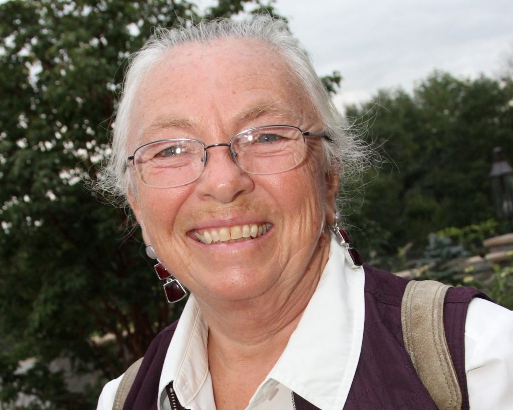
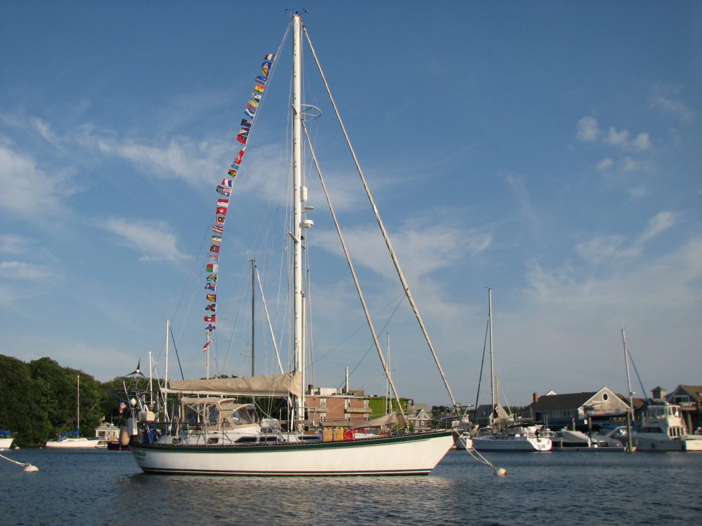
After almost 6 years of traveling, we sailed into Woods Hole on Cape Cod. We continued living aboard for the next five years and I wrote about that, adding ‘and Beyond’ to the title of the blog. Then shortly before Mark’s death in 2016, we sold our beloved Windbird and my travel logs became land logs. At this point, I had written a daily account for each and every day for 11 years. I fully intended to end the blog at that point, but when I wrote that news in a log, I got many responses saying that I really needed to keep posting. At the same time, I realized that I couldn’t stop writing. Summarizing each day had become a permanent part of my life and I will probably continue writing until I can no longer. These postings reflect the ordinary, and sometimes the extraordinary, days in my life and I would like to invite you to join me on my journey.
Day 170, Year 2: Pirogue Sail Across Upi Bay
Day 170, Year 2: Pirogue Sail Across Upi Bay
Date: Thursday, October 11, 2007
Weather: New Caledonia Has Only Beautiful, Sunny Days!
Location: Kuto Bay, Isle of Pines, New Caledonia
Today we played tourist. We rode the hotel van to the pirogue landing in Vao and got aboard for our sail up the shallow Bay of St. Joseph and through the narrow entry into the Bay of Upi. Sailing on a pirogue was so much fun. These outrigger canoes are basically a hollowed out log with a smaller log pontoon out to one side to steady it. There is a platform on top of the log canoe, and that is where you sit. The triangular sail is attached to a rustic mast. That is about it. We were amazed
at how smoothly they sailed in basically no wind. We didn’t move fast, but we continually moved forward to the head of Baie de Upi. Once there we were dropped off so that we could walk for about an hour through the forest to get to La Priscine Naturelle, the natural pool where we swam yesterday. We left Kuto Bay at 8 AM and landed at the head of Upi Bay at 10 AM. By 11 AM we were in the water at the natural pool, and we basically snorkeled and walked the reef for the next three hours. Our ride
back to Kuto was the hotel van that was going to pick us up at 3:00, so we spent our last hour at the homestay where we were to be picked up having a beer and talking to a couple from Paris. Donna of Scot Free and Mark were also looking through the underwater pictures they had taken during day.
When we first arrived at the pool today, there were other tourists standing on rocks in the pool feeding the fish. I got into the water and evidently got myself under one of the areas where the fish were being fed. All of a sudden, I had fish of all sorts nibbling on me! They were gentle, even though some of the fish were quite large, and it was just so much fun to be enveloped by so many fish. I swam around the natural pool a number of times and discovered creatures I had not seen before. I
loved watching the batfish swim beneath me and was thrilled that a huge school of goat fish allowed me to swim along with them for quite some time. On our walk to the pool, we saw lots of Reticulate Brittle Stars and fiesty little crabs, and in the pool I found a very long creature that looked a little like a sea snake, but it seemed to have no head. Later in the day, we found one of these in a shallow area and played with it a bit. It was probably about three feet long, but when you picked it
up with a stick, it totally collapsed and looked like loose skin. Instead of a head, it had short tentacles, and when you approached the tentacle end with a stick, it shrunk and became only a foot and a half long. We have no idea what this was, but it entertained us for some time. We then climbed up onto the coral wall that separates the pool from the ocean and had even more surprises. We were walking on a reef with lots of shallow pools containing small fish, colorful clams, urchins, and sponges.
By this time, almost all of the other tourists had left and we had the place all to ourselves to explore. After finishing our exploration of the top of the wall, Mark and I made one last underwater visit. I went back to see a family of anemonefish living in a hole in the side of a large coral rock. When I came face to face with the little guys, one of them actually attacked me. I knew I had come too close to her home, so I backed off just a bit and Mark got a video of the two anemonefish coming
toward by dive mask, backing off, and coming back again and again. La Priscine Naturelle is one of the most magical places we have visited and we enjoyed it to its fullest today.
Our ride home in a van was not nearly as beautiful as our ride up Upi Bay in a pirogue, but the driver went home via the only road we had not already traveled on the island. We cut across on the airport road and at one point we had a fantastic view of the bays on the west side of the island. Tomorrow morning we are hoping to climb Pic N’ga, the tallest mountain on the island, and from there we should be able to have a 360 degree view of the Isle of Pines and all of her bays. Here’s hoping we can
make it to the top.
Day 169, Year 2: Road Trip Around The Isle of Pines
Day 169, Year 2: Road Trip Around The Isle of Pines
Date: Wednesday, October 10, 2007
Weather: Ditto–Another New Caledonia Beauty
Location: Kuto Bay, Isle of Pines, New Caledonia
Today was another great island tour day. Every time we rent a car and travel around a new island, we are so overwhelmed with everything we see. One of the highlights for me today was seeing the gardens, newly tilled, and ready to plant. The soil here is Georgia red. It almost looks unreal, but plot after plot looked ready for planting. But the real main attraction of the day was swimming in La Priscine Naturelle. This is a clear pool cut off from the ocean by a coral wall and it is teeming
with fish that are totally oblivious to your presence. They don’t swim away, they simply continue doing what they are doing as you swim through them. It is like swimming in an aquarium, and it was great fun. We saw so many varieties of fish, and like yesterday, we saw some new players. The Great Barrier Reef anemonefish is new to us, as well as the Silver Pompano. It looks like a Pompano dolphinfish except that it is round like a saucer instead of long. We saw Sunset Wrasse and Moon Wrasse,
pencil urchins, small clams, fish grouped together in what I called a tower of fish, and on and on. In fact, we enjoyed our time in La Priscine Naturelle so much that we are returning tomorrow by pirogue. Pirogues are the sailing outrigger canoes in this part of the world and we will sail on one up through Baie de Upi and then walk about an hour across to La Priscine Naturelle. We will snorkel there, eat a picnic lunch, and return to Kuto by bus. We are really looking forward to the day.
But back to today. We drove 62.3 kilometers, or somewhere around 40 miles. We went in a car with Marie and Paul on Ranger. Galaxie and Incognita took another car, and Scot Free went in a car of their own. Our whirlwind tour took in all the sights on the island. We started by driving from Kuto to Vao, going to the Wednesday market, visiting the information center, and then driving to the shore of the Baie de St. Maurice to se the Statue du Sacre coeur. This is a fence of carved totems along
the beach and a circle of totems surrounding a statue of Jesus. This is commemorating the arrival of missionaries to the Isle of Pines. The silver-gray totems make a pretty picture set against the blues of St. Maurice Bay. From there we visited the Catholic church and photographed its red steeple. We then walked up the mountain behind the church to a chapel with a wonderful view of the area. We drove out to Baie de St. Joseph to the pirogue landing, tried to gather information about the pirogue
trips but found that difficult without being able to speak French, and then headed north to Baie de Upi. This is where we walked to the natural pool and snorkeled. As we walked to the pool, Marie and I stopped and played with the little black crabs with one very large red pincer. Strange looking little creatures. We went snorkeling in the natural pool and would have stayed much longer, but we only had the car until 1 PM, so we had to keep on truckin’. The next stop was the Grotte de La Reine
Hortense. As you walk from the road toward the cave you pass through a lush tropical forest. There were giant ferns, plants of all varieties, and very tall hardwood trees. When we reached the cave it was like a huge opening in the mountainside side. We followed the stream in and could see the other end of the cave where light was flooding in a large opening. We didn’t have flashlights so we couldn’t see the rock ledge where Queen Hortense, wife of a local chief, sought refuge for months in 1855
during a time of tribal fighting. The stalactites hanging from the ceiling were huge. It was an easy and interesting cave experience. From there we drove to the top of the island and visited Gadji Bay, drove down the west side of the island and visited Baie de Ouameo, and found our way back to Kuto to meet our 1 PM deadline. It was great to see the entire island, and tomorrow we look forward to a more leisurely day of exploration.
We spent the late afternoon and early evening hours on Ranger with Scot Free II doing a little strategic planning on where to from here. There are some wonderful islands we could visit between here and Noumea, but the weather once again is showing its supremacy. West winds are predicted and very few of the islands have protection from that direction. We will stay here at least two more days and hope the weather reports become more favorable. If not, we have the “West Wind” plan as a back-up.
Day 168, Year 2: Exploring Kuto
Day 168, Year 2: Exploring Kuto
Date: Tuesday, October 9, 2007
Weather: Another New Caledonia Beauty
Location: Kuto Bay, Isle of Pines, New Caledonia
Early this morning we went to shore to check out the possibility of renting cars tomorrow for a group of us to tour the island. The Hotel Kou-Bugny is right on the beach and it rents cars. We made the arrangements for tomorrow and then kept walking. Just past the hotel there is a path leading to Baie de Kanumera. Baie de Kuto is on one side of a peninsula and Baie de Kanumera is on the other side. Kuto is the best anchorage, but most definitely Kanamera is the most beautiful. At the head of
the bay there is a huge rock, Le Rocher, totally covered with vegetation and it is linked to the mainland by a white sand walkway. There are only two things that are forbidden on Isle of Pines. One is topless bathing and the other is climbing the wooden stairs that lead to the top of Le Rocher. It is most tempting, but absolutely tabu. We took lots of pictures of the bay and then walked out on Presqu’lle Isle or the Kuto Peninsula. In the 1800’s France built a prison on the Isle of Pines to
the north of Kuto. On this peninsula, they built a home for the Governor and surrounded it with a tall stone wall as a precaution in case any prisoners should escape. Today there is modern wharf on the peninsula and the old Governor’s home is now the gendarmerie. There is also the Boutique Creations Ile des Pins. Naturally we had to check this out as we had read about the boutique’s owner, Hilary Roots, her selection of books for sale, and the hand-painted clothing done by Albert. We had not
read about a young woman named Marian who has a separate shop selling jewelry she makes from shells, seeds, and coral, and some small wood carvings. Marian was a wealth of of information about places to snorkel and about the names of trees that are the source of seeds for her jewelry and the wood for the carvings.
After visiting the boutique and the wharf, we walked back to the main road and headed north to the prison ruins. The prison was built around 1870 and was used until 1913. It is now just rock walls and buildings overgrown with vines. Nature is doing a great job of reclaiming the land, but we really enjoyed walking through the structures. Mark became my guide as he explained what he thought each building must have been used for based on evidence I didn’t notice. Some of the buildings had small,
single cells, but then another building had very large rooms. Mark pointed out how the holes in the wall appeared to once hold the supports for bunks for inmates who were allowed to be housed together. He also noticed metal supports over every window that looked like they once held some sort of sun awning. As we were leaving, he also noticed the shards of glass that were imbedded in the top of the rock wall to deter prisoners from escaping over the top. I thanked him for the guided tour and suggested
a new career for him–prison guide! We also visited a building that houses a water reservoir. It was built at the same time as the prison and has been restored and is still used today.
I forgot to mention that just across the road from the prison ruins there was a rotisserie, a source of lunch. We ordered what we thought was going to be sausage and french fries. We got the fries, but the “sausage” was foot-long American-style hotdogs sans bread. Each order was enough for two people, so next time we will order only one for the both of us. After eating lunch and visiting the ruins, we walked another kilometer north to the Cimetiere des Deportes. In France in 1871, just after
the prison was built, there was an uprising in Paris and 3,000 people were deported to the new prison in New Caledonia. Over 240 of these people died on the island and were buried in this cemetary. The graves are very simple, small rectangles surrounded by stone. The political prisoners still living were given amnesty in 1879, and after that true convicts from France populated the island prison.
We hitched a ride from a local back to Kuto, went back to Windbird to regroup, and then headed back to shore to snorkel around Le Rocher, the rock in Baie de Kanumera. Marian at the boutique had told us that it was good snorkeling, and she didn’t mislead us. After getting over being greeted by a poisonous water snake, Mark, Marie of Ranger, and myself slid into the water. Obviously the fish here are fed. We have never snorkled where the fish were so friendly. Marie discovered a little alcove
in the rock where Gorgonian sea fans were in abundance. We need to go back during the morning to get good pictures of the sea fans and to enjoy the friendly fish once again.
Tomorrow at 7:30 we meet Ranger, Galaxy, Incognita, and Scot Free on shore to go rent the cars and start our day of island exploration. Ten of us are going to squeeze into two small cars, so it should be a most interesting day.
Day 167, Year 2: Arrival in Isle of Pines
Day 167, Year 2: Arrival in Isle of Pines
Date: Monday, October 8, 2007
Weather: Sunny Day, Winds NE 10-12, Turning SE 10 in Anchorage
Latitude: S 22 degrees 39.477 minutes
Longitude: E 167 degrees 26.403 minutes
Location: Kuto Bay, Isle of Pines, New Caledonia
Interesting day. The waxing moon, just barely a crescent, came up just before the sun. It was a glorious morning. We had spent the night slowing ourselves down so we would reach the Passe de la Sarcelle at 10:40 AM, our best estimate of low tide. We had used local tide charts to reach this conclusion, but we now think our information was just not correct. At 7:30 AM, Scot Free II, Ranger, and Incognita arrived at the pass and decided to enter. They reported back that it was calm and that they
had only a half knot current against them. Since we had not planned to enter until 10:40, we noted the information, took the reef out of our headsail, and sailed as fast as we could. We had only turned the motor on twice during the trip at this point, and only then to motor to the east into the wind to slow ourselves down. In the end, that was a bad decision, but based on the information we had it seemed best at the time.
We arrived at the pass at 9:40, an hour before mean low according to our information. But it was not a pretty sight. The sea was a seething froth of white and there was no way to tell what was reef and what was not. We entered the seething water and found ourselves surfing down six to nine foot waves that were coming from directly behind us. Mark was having to wrestle with the helm to keep Windbird on course so I rolled in the headsail giving him a little more control and then went out on the
bow to watch out for shallow water. At this point we were totally relying on the electronic charts and hoping that they were correct. In some places they are a few hundred feet off, sometimes more, sometimes less, so when you first arrive in a new location you have to watch carefully until the offset can be established. Once in the middle of the pass, we could see the reef on each side and a small islet ahead. Using those as points of reference, we deemed that the charts looked roughly correct,
so we relaxed a little and surfed our way through. Galaxy was behind us and they chose to sail up close to the reef on the northern side of the pass and follow the reef in. Theirs turned out to be a much better choice as they had much calmer waters had only three knots of current against them at their worst point. We had three, then four, then finally back to two the further in we got. We were running the motor at 2800 RPM’s and still going only three to four knots. Once we got through the pass,
we continued to motor through the lagoon. We had talked to Bruce on Incognita and he had taken a shortcut through the reef-laden lagoon and reported that the path was very wide and easy, so we went that way. We arrived in the Baie de Kuto anchorage not far behind Ranger, so the shortcut clipped off almost two hours of motoring through the lagoon. Galaxy came in shortly after us, along with two other boats. There were already about ten boats in the anchorage, so we have lots of company here in
beautiful Isle of Pines.
We set the anchor and almost immediately a beautiful green turtle came to the surface of the turquoise water to greet us. She surfaced four more times before swimming away, and we felt warmly welcomed to New Caledonia’s southern lagoon. The colors of the water here are not quite as stunning as in Ouvea, but the tall pines and volcanic peak of Pic N’ga hovering over the anchorage give it a very different look. There are white sand beaches here, plenty of them, but not one that is 25 kilometers
long. The Lonely Planet says you can walk to the top of the 262 meter summit of Pic N’ga in only 45 minutes. Bet it takes us two to three hours!
We want to spend time in this anchorage exploring the nearby sights, but we also want to go around to another anchorage near Vao. From there, you can explore the Baie de Upi, one of New Caledonia’s gems. It is very shallow so you can only explore in a dinghy or you can rent a sailing pirogue, a traditional outrigger with a triangular sail. Pictures of this bay are so beautiful and I really want to go there. From the upper reaches of that bay, you can walk to a beautiful blue hole, a clear blue
pool cut off from the ocean by a reef, where they say the snorkeling is delightful.
As soon as we got here, we got the dinghy in the water and we going to shore to explore. But then we found out that there was a late afternoon 60th birthday party on shore for Maree on Galaxie. We met a few new cruisers and had fun celebrating with Maree. Tomorrow we will explore.
Day 166, Year 2: Overnight Passage to Isle of Pines
Day 166, Year 2: Overnight Passage to Isle of Pines
Date: Sunday, October 7, 2007
Weather: Mostly Cloudy, Winds ESE 15
Latitude: S 21 degrees 19.262 minutes
Longitude: E 166 degrees 33.600 minutes
Location: On Passage from Loyalty Islands to Isle of Pines, New Caledonia
So far we are having a rather uneventful passage to the Isle of Pines. New Caledonia is comprised of the main island of Grande Terre, the Loyalty Islands of Ouvea, Lifou, and Mare, and the Isle of Pines. Grande Terre is long and thin and lies northwest to southeast. The Loyalties lie in a row in the same direction to the east of Grande Terre. And if you think of New Caledonia as an exclamation mark, the Isle of Pines is the dot at the bottom of the mark. It is an island that is surrounded by
many small islets and is renowned for its beautiful waters and tall Araucaria pines. We are looking forward to our arrival tomorrow afternoon, but for now southeast is the theme. We are headed basically in that direction and the winds are coming from that direction. The winds are less than yesterday and the seas seemed to have calmed, so even though we are sailing as directly into the wind as possible, it is not a bad ride. The winds have steadily declined since this morning, however, so at some
point we will probably have to motor sail. For now, however. we are enjoying a nice day of sailing.
On passage, reading is a favorite activity. The last three books I have read had to do with sailing, but now I am reading a novel by Mark Mills, Amagansett. It is a mystery set on the eastern end of Long Island. The book I just finished was “Over the Edge of the World” by Laurence Bergreen. This was about Magellan’s circumnavigation of the globe. Before that I read Tania Aebi’s “I’ve Been Around.” Tania circumnavigated the globe back in the 1980’s as a teenager. Her book about the circumnavigation,
“Maiden Voyage”, was spell-binding, but I must say this recent book was not as interesting. The book before that was Beth Leonard’s “Following Seas” outlining her circumnavigation with her partner Erik Starzinger in the 1990’s. Magellan’s circumnavigation was in the 1500’s. I have been struck with the differences in sailing around the world then and now. Magellan had a compass of sorts, but used celestial navigation and dead reckoning to find his way. In the 1980’s Tania Aebi did exactly the
same. Even though she had a brand new boat, she had no GPS as it was not available, and no auto pilot. Even in the early 1990’s, Beth Leonard had no GPS, but she did have an auto pilot. As I mentioned in a log a couple of days ago, a few of us were together for the evening and we had a discussion on what is essential for sailing around the world today. The answer to that question all depends on your requirements. It is totally possible to circumnavigate single-handed with just a compass using
celestial navigation and a windvane for self-steering. This is what Tania did, but we have not met one boat out here today without a GPS. We made the decision early on that we were not heading out here to camp out or do a bare bones circumnavigation. So what is essential for us? A boat you can trust with good sails, rigging, and ground tackle is essential–not even on the list because you can’t begin without this level. From there . . .
Number 1: A Reliable Engine
Number 2: Auto Pilot
Number 3: GPS and Navigation Instruments for Wind, Depth, and Speed
Number 4: Ham Radio for Communication
Number 5: Multiple Computers–One for navigation and storage of photos, one for general use, and one for back-up. Most people have only one computer, but we seemed to be more plugged in than most.
Number 6: Reliable Dinghy and Dinghy Motor–This is your transportation to and from land and is very important. There are some hard core sailors out here that have only a rowing dinghy, no motor, but that is not for us.
Number 7: Refrigeration and Freezer–Unlike in Magellan’s time, we no longer need to depend on just hardtack and wine for our provisions. We could do without the freezer, but definitely not without the refrigerator. And the freezer just makes life so much easier.
Number 8: A cockpit enclosure to keep dry (and warm when it is chilly)
Number 9: Watermaker–We could do without, but we like the convenience.
Number 10: A Sense of Adventure!
I’ve written this list very quickly and might find that I need to adjust it, but I just wanted to get it down before I forgot what is important and what is not for Windbird.
while I’m at it, there is one thing we have that is not very important to us – radar. We almost never use it.
If you have questions or thoughts on the matter, please send us a comment. We will try to get back to you when we reach Noumea late next week.
Day 165, Year 2: Still Here . . .
Day 165, Year 2: Still Here . . .
Date: Saturday, October 6, 2007
Weather: Nice Day with Some Clouds
Location: Mouli, Island of Ouvea in the Loyalties, New Caledonia
I hardly stuck my head outside the cabin today, so I’m not really sure what the weather was like. But every time I looked out, I didn’t see that beautiful blue sky I have been seeing for the past week. Scot Free left the anchorage just after 6 AM this morning, but they were back by 8 AM. Gerry knew he would be heading into the wind, but he had hoped to be able to sail tight to the wind and keep close to the rhumb line. That was not the case and the seas were higher than expected, so he decided
to turn around and try again tomorrow. Based on his experience and our weather information, we decided to stay put until tomorrow as well. Actually, I voted to leave, but Mark was being a prudent captain and thought we should wait based on the sea state. So we are still here.
We will leave tomorrow morning and one way or another (sailing or motoring), and we will arrive in Isle of Pines on Monday. Scot Free, Ranger, Galaxie, and Incognita are also planning on heading out in the morning. Today Mark spent his day trying to figure out a problem he has been having with GRIB file data the past week and I spent the day researching the Isle of Pines anchorages and naming photos to be posted on the web once we arrive in Noumea. About a week ago Mark started getting GRIBS that
include Australia so he could start watching the weather patterns. But as he discovered today, somehow the larger GRIBS caused a problem with the program that reads the data. So know he thinks he knows how to fix the problem.
We will leave here at 8:30 in the morning and arrive at the pass that will lead us into the Isle of Pines about 24 hours later. Sometime Monday afternoon we will arrive in Kuto Bay on the Ile des Pins or Isle of Pines. Captain Cook was the first European explorer to sight these islands. He didn’t actually land on the Isle of Pines as the surrounding reefs made that too difficult. He did land on a nearby islet and stayed just long enough to have the signature tall pines of this area, the Araucaria
cookii, named after him.
Day 164, Year 2: Silver Bells and Cockle Shells
Day 164, Year 2: Silver Bells and Cockle Shells
Date: Friday, October 5, 2007
Weather: Same Old, Same Old–Another Perfect Day
Location: Mouli, Island of Ouvea in the Loyalties, New Caledonia
There is a shell here that is abundant on the beach. It is a bivalve, basically white, sometimes with some pink to orange spots, and it has one flat side. I picked some up the other day, brought them back to the boat, and washed and dried them. What seemed like a nondescript shell on the beach began to look beautiful to me, so I looked in our only shell book and identified the shells as half-heart cockles. According to our book this is an uncommon Indo-Pacific shell. Whether or not uncommon,
I decided that I wanted to collect as many as possible today. Low-tide was at 7:30 AM, so just after we ate breakfast, we headed to shore to walk the incredibly beautiful white sand beach and pick up cockle shells. We tried to remember the nursery rhyme with “cockle shells” in it, but it didn’t come to us right away. All we could remember is “silver bells and cockle shells” and quickly the conversation went in another direction. When we finished our early morning collection we went back out
to Windbird and saw that Donna and Gerry of Scot Free II were visiting with Ranger. We had talked on the radio earlier about getting together to discuss the weather, so we dropped off our shells on Windbird and went over to Ranger. When I announced that we had been collecting cockle shells, Paul immediately started reciting, “Mary, Mary, quite contrary, how does your garden grow?” Of course, Mary’s garden grows with “silver bells and cockle shells and pretty maidens in a row.”
We spent a great deal of the morning on Ranger visiting and discussing the various possibilities for getting from here to the Isles of Pines that are south-southeast of here with winds that are blowing from the east-southeast. We have been watching the weather everyday and Mark has produced new spreadsheets based on the latest information. Whether to leave tomorrow or Sunday is one of the questions, but Gerry decided that he is leaving tomorrow morning around 6 AM. Ranger and Windbird are going
to wait to hear from him once he is out there and then decide whether or not we are leaving tomorrow or the next day. This is one passage where we might have to tack back and forth to get to our destination. Usually we just run a straight rhumb line, but that might not be possible this time.
We went back to shore in the afternoon with Scot Free and Ranger. While walking up the road, a family came out to say bon jour. Gerry could talk with them and he was asking if there is a craft market here on Tuesdays. I read that in a publication, but we have seen no evidence of anything like that. The family said that there is not, but they produced a backpack with some beautiful cowrie shells that they would sell to us. We all ended up with one or more beautiful cowrie shells and then we walked
on to the Cocotier homestay to visit the boutique there. They have some beautiful wood carvings there, but they are quite pricey. So we enjoyed “window” shopping. We ended up staying there and having a couple of beers and just enjoying the afternoon together. We had a discussion about what is essential and what is not for each of us sailing around the world, and I am planning on writing about that in tomorrow’s log.
Last night I posed a question in my log, and our daughter Heather got back to us right away with her thoughts on the subject. “IF the paper napkins are thrown overboard far enough from land that they won’t litter the beaches, and IF the paper napkins are fully exposed to the water (i.e. not in a trash bag), then they probably don’t pose a big problem. They are definitely easily broken down. However, depending on what your detergent is, it may not be a big problem either (phosphates and nitrates
are discouraged, as they are nutrients that can cause algal blooms). So the question comes down to which requires more fossil fuel energy and creates more pollution in production … paper napkins or detergent? And I really don’t know the answer to that.” When we get to Noumea and high speed internet, we will see if anyone else decided to weigh-in on this question and report those thoughts then.
The stop here in Ouvea has been unbelievably relaxing. Mark and I don’t usually enjoy just doing nothing, but we have enjoyed doing just that here in Ouvea. Being anchored here in Ouvea off the tribu de Mouli has been one of our most memorable anchorages of this cruising season. Now on to the Isle of Pines.
Day 163, Year 2: Hanging Out in Ouvea
Day 163, Year 2: Hanging Out in Ouvea
Date: Thursday, October 4, 2007
Weather: Another Perfect Day
Location: Mouli, Island of ouvea in the Loyalties, New Caledonia
If you were going to pick a spot to just “hang out” and wait for the weather, this is great choice. The scenery doesn’t get much better and the weather is beautiful. I just wish there were more underwater possibilities. We have now seen the island and explored the tribu of Mouli where we are anchored. Mark and I rode our bikes to the end of the island today and went snorkeling. The point of the island was beautiful and the water was clear and warm, but we saw very little coral and only a few
fish. I did succeed in finding at least one anemonefish family, my goal for every snorkel, and there were some pretty parrotfish. But it was not a snorkeler’s delight.
We explored some side roads on our way back to Mouli. One led us out into an undeveloped area and the other led us to a wharf built in 2005 to accommodate cruise ship transports when they come to Ouvea. We headed back to Mouli and we saw Paul and Marie and Donna and Gerry walking up the road. We caught up with them and chatted. Donna, Marie, and I spotted some beautiful beetles. They unfortunately look like Japanese beetle relatives, but their colors were bright and beautiful, so we spent time
taking some photos. The guys headed on to the little store. They were looking for the man we rented cars from. Ranger and Scot Free still owe him for some fuel, but the store was closed and no one was around. We talked and waited, but even by 3:45 PM the store was still not open. We gave up for today and they will try again tomorrow.
We have a least one or two more days here before we can take off for the the Iles of Pines. When we do leave, we will have to travel for a day, a night, and arrive in the late afternoon of the next day. Mark and I have been looking at the latest weather information trying to figure out if there is any way to leave here sooner and still have a good ride south, but it doesn’t look promising. If we do have to wait another day or two, I will work on naming photos and studying our next location.
Now I have a question for those of you reading this log. We have been using cloth napkins thinking that choice is better for the ocean environment than throwing paper napkins overboard. But in a conversation with Gerry on Scot Free II, he pointed out to me that washing cloth napkins and throwing laundry detergent water overboard is actually worse for the environment than the paper. But then I am going to have laundry detergent water anyway when I wash our clothes, and I just include the napkins
in that wash. So is it really worse for the environment to use cloth napkins? If you have thoughts on this, please send them as a comment. We won’t be able to read those until we reach Noumea in another week and half or so, but I will be interested in what you think.
Day 162, Year 2: Tour of Ouvea
Day 162, Year 2: Tour of Ouvea
Date: Wednesday, October 3, 2007
Weather: Another Absolutely Gorgeous Day
Location: Mouli, Island of ouvea in the Loyalties, New Caledonia
Villages here are called tribus, and today we visited most every tribu on the island. We rented a car for half a day and left Mouli around 11 AM. There is one main road on the island that runs north to south. And in fact, at times the island is so narrow that there is little more than the width for a two-lane road. We headed north and made a stop on the north side of the Mouli bridge. We had been here with our bikes yesterday, and the view was so spectacular that we wanted to take it in one
more time. Yesterday there was a heron standing on the beach and he acted as if he owned it. I wanted to see if he was still there today. He was not in his spot, but soon after we arrived he came walking out on the beach to the exact same spot where we saw him yesterday. Maybe he does own the beach! We then went to Camping de Lekine to drop off a packet for Ranger. They had met a man yesterday and taken some pictures of him. He wanted copies and they had arranged for him to pick them at Camping
de Lekine. With that done, our next stop was just a little north where we turned right off the main road to go back to see the cliffs at a spot where you can walk across the bay at low tide. Valerie at Camping de Lekine had told us about this spot and it was special. The bay is narrow and shallow and even though it was not low tide, it looked like we could walk across anyway. We opted not to, but we got some great pictures of the cliffs with stalactites and stalagmites hanging from the sides.
We also saw a couple of little green birds in the trees that we thought might be the green parakeet (Eunymphicus Uvaeensis) that is endemic to the island. It is also endangered and hard to find, so maybe we were seeing something else. I tried to get photos, but they were very elusive little things.
The next stop was in Fayaoue which serves as the business center for the island. There are grocery stores, gas stations, a couple of restaurants, and an airport. We wanted to visit the caves out near the airport, the Grotte de Kong Houloup, so we followed the directions for getting there that we had read in the Lonely Planet. The directions led us to the end of a road where we got out and walked and sure enough, the trail led us to the caves. The openings were small, but when we looked inside,
it looked like you could crawl around and explore for quite some time. We just took pictures and enjoyed the area. There were more butterflies flitting around than we have seen anywhere across the Pacific. There was an orange and black butterfly that looked very much like a Monarch, and a beautiful little white and black butterfly. There were others, but these two were the most abundant. There was lots of pink and orange lantana, so it was butterfly heaven.
It was time for lunch, so we stopped at a place by the lagoon named Snack Champagne. No one spoke English and we surely don’t speak French, so ordering was a bit challenging. We decided to have what the person before us had been served. It ended up to be a raw fish salad with coconut milk and it was delicious. But it was served with french fries and rice and was more than either of us could eat. Everything else in the area was closed for lunch, so we decided to head on north and return to Fayaoue
on the way home to check out the grocery store. The gas station was open and we had our dinghy gas tanks with us to fill, but we also decided to do that on the way home. So on north we went.
Wadrilla was the next town. We stopped to see the large white memorial to those who died in the hostage crisis of 1988. A group of Kanak freedom fighters captured sixteen gendarmes and held them hostage in a cave in the northern tribu of Gossanah. After about two weeks, 300 gendarmes stormed the cave and killed nineteen of the freedom fighters. There is way more to this story, but basically Ouvea has become a symbol of martyrdom in the resistance of the native people to French colonialism and
the memorial in Wadrilla is physical evidence of this. The main wharf for Ouvea is just a little north of Wadrilla, so we stopped to view the northern islets of Pleaides de Nord from there and then we visited the coconut oil soap making factory, Aiia. The business only has about twelve employees, but we were so impressed with their simple, yet efficient operation. A young man named Edward showed us the process. He could speak very good English which was greatly appreciated.
>From the wharf, the road north winds around to the Col de Casse-Cou, the narrowest point on the island (45 m). From there we went to St. Joseph’s district. We visited the Catholic church and then followed directions we had copied from the Moon Handbook of the South Pacific to find Trou Aux Tortues. This is a sinkhole near the ocean where the Grand Chief of Wenaki supposedly keeps turtles until he is ready to eat them. The water is brackish and it is said that no one has ever found the bottom
of the sink hole. When we arrived we immediately saw one turtle, but we sat and waited for what seemed like an eternity and only one other turtle surfaced momentarily. We started walking a track around the sinkhole, but somehow we ended up on another road headed to what we think was a little village. We went back the way we came and just before we were about to give up and go back to the car, one turtle surfaced and put on quite show for us. We had our turtle fix for the day, and headed on to
tribu de Ognat at the end of the road. From one viewpoint, we could see the island of Lifou and look back to see all of the east coast of Ouvea.
On our way back, we stopped at Trou Bleu d’Anawa. This is another sinkhole. You are supposed to ask permission to visit, but when we got to the location, no one was there. Evidently someone is building a beautiful homestay on the edge of the sinkhole. There were many cases, some built of white stone. When this place is finished, it is going to be fabulous. It is right on the lagoon and has the Trou Bleu in it’s backyard.
Our last stop was in Fayaoue to get fuel and stop at Chez Fella, supposedly the best grocery store on Ouvea. It was a little like the Chinese stores in Nukalofa in Tonga. The shelves were stocked, but you have to stand behind a counter and have someone get things for you. Not a very easy way to shop, but I was only after onions and potatoes, and that was easy. It was then back to Mouli and out to Scot Free II for a delicious spaghetti dinner. The number of boats in the anchorage increased while
we were gone today. New Dawn out of Alaska and Cool Bananas (love the name), a US catamaran, had come in while we were gone today. Tomorrow was supposed to be a snorkeling day, but the news of a tourist that was killed by a shark on the neighboring island of Lifou has everyone a little timid about getting in the water. Maybe we will just swim in the crystal clear waters here in the anchorage and not venture out to the reef.
Day 161, Year 2: Bicycle Trip to Baie de Lekine
Day 161, Year 2: Bicycle Trip to Baie de Lekine
Date: Tuesday, October 2, 2007
Weather: Absolutely Gorgeous Day
Location: Mouli, Island of ouvea in the Loyalties, New Caledonia
All across the Pacific I have been looking for the perfect anchorage–long white sand beach, azure water that is crystal clear, great snorkeling right under the boat. Our anchorage here at Mouli definitely fits two of the categories, the white sand beach and the crystal clear azure water, but unfortunately the great snorkeling is not right here under my boat. Nevertheless, this is one of the most amazing places we have seen. Just sitting here and looking out over the water is mesmerizing. People tell us that the Iles of Pines are even more beautiful and might fit all three of my qualifying categories. I’m anxious to find out, but I am not anxious to leave here. It is just too beautiful for words.
Early this morning we put our folding bicycles in the dinghy and took them to shore. We haven’t used them since New Zealand, so unfolding them took a little force. A family that swam out to our boat when we first anchored is still at the homestay, Mowague, where we come ashore, and when the children saw what we were carrying they were eager to see how they would turn into bicycles. Mark and I really had difficulty with one bicycle, and another guest at Mowague came to help us. He was from the Marlborough Sound on the South Island of New Zealand and was very interested in our voyage. Once he took my place and put his muscle into the process, the bike opened easily. The children who were watching the process were satisfied and went back to have their breakfast. Mark and I got on the road and it felt great. The skies were perfectly clear and bright blue and the waters of the lagoon glistened as we headed north. We were on an information finding mission, and we couldn’t think of a better way to explore a flat island with paved roads–not something we have seen much of on our voyage. We traveled north the way we had walked yesterday and then went beyond that point. We came to a hill and when we started the descent we could see the Baie de Lekine on our right. The view was breathtaking. The shades of green to blue of the crystal clear water and the bright blue sky was overwhelming. We stopped at the Hotel Paradis d’Ouvea and we were overwhelmed with it as well. What a lovely
spot with view of the lagoon and the white sand beach out front and the Baie de Lekine out back. We found a young man who could speak English and we started asking our many questions. Can we take our dinghies into the bay? Can we snorkel in the bay? Where can we make a reservation for going out on the bay in a glass-bottomed boat? Where can we make a reservation for walking across the mouth of the bay at low tide? And on and on. The young man was very helpful, but he said that the definitive answers to our questions could be found at the Camp de Lekine across the Mouli bridge. so on we rode. We came to a little restaurant, the Snack Chez Fassy and stopped for a cold drink. Again the views of the lagoon and the bay were fantastic from this location, but little did we know that things just got better and better. After leaving Snack Chez Fassy we came to the Mouli bridge that goes across an entrance from the lagoon to the bay. We walked our bikes across just so we could take in the sights below us. We didn’t see a lot of big fish, but we did see hundreds of small fish and one very satisfied heron. Just beyond the bridge, we found Camp de Lekine, a homestay, and hopefully the place where we would find the definitive answers to our questions. Valerie, a young woman who left France to become a dive instructor in Egypt in the Red Sea and then moved to Ouvea was the right person. She told us that bringing our dinghies into the bay or snorkeling there is forbidden. The glass-bottomed
boat is out of commission right now, and the tides are not low enough during daylight hours for us to do the cliff walk right now. So we struck out on all fronts, but she did give us directions for seeing the same sights we would see on the cliff walk so we could go on our own.
We rode back towards Mouli and once again took in all of the beautiful views of the bay and the lagoon. We looked for the Corderie de Fibre de Coco rope-making factory, but we didn’t find it. When we got closer to Mouli we stopped at a place that looks like it sells cars and trucks and tried to ask about the rope-making factory. No one could understand us, and about that time, a little green car pulled up with Paul and Marie of Ranger and Donna and Gerry of Scot Free II inside. They had found a car to rent and were headed north up island. Gerry got out to help interpret for Mark as he was inquiring about the rope factory and what we found out is that the factory is no longer. Our friends headed north in their rental car and we headed back to Mouli. We stopped to inquire about renting a car for tomorrow and had a very interesting “conversation” with a gentleman that spoke only French while we speak no French at all. With lots of charades and writing on paper, we found out that we could get a car tomorrow for half a day. We signed up for that and continued on our way home. We visited the Catholic church, rode around on roads behind tribu de Mouli and ended up south of the tribu on the main road headed south to the end of the island. We rode on, but then realized that we were probably getting sunburned and that was lunch time. So we headed back to Mowague to where we had left our dinghy.
We sought permission to leave our bikes at the homestay, talked with Laurent and family once again, invited them out to Windbird later in the afternoon, and then headed out to the boat. After we had lunch and Mark had a little siesta, he went back to shore to get Laurent, his wife Viviane, and the their three children. Only Laurent and the children came out. Viviane opted for some quiet time. We enjoyed our visit with the kids and Laurent. The oldest child is Ludovic, age 7, and the two little girls are 5 and 3 years-old. I was mystified by the boy-girl differences. Ludovic wanted to see books about sharks while the little girls each found a little stuffed animal, a pillow, and a little kava bowl. They used the bowls to feed their babies and carried them around on the pillows. Ludovic had no interest in playing dolls. when the girls tried to rearrange my laundry on the line, Ludovic was only interested in how the clothes pins worked. Mark and I were both amazed at the stark differences in the girl-boy interests. When Mark took them home he was going to bring back our bicycles, but he forgot the keys to the locks. I heard him coming back because I could the screams of delight of young children. Mark had only Ludovic and the oldest girl and he was flying across the anchorage to their delight. All I could think is that children will play.
We had sundowners on Ranger once they returned from their island tour and we got some tips for our trip tomorrow. The weather looks like we will stay here another two to three days and then head to the Iles of Pines. I can’t wait to get there to see if it is actually my dream anchorage.
 |
| 071002 Day161 Loyalty Islands, New Cal–Bicycle Trip to Baie de Lekiny |