
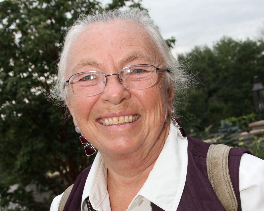
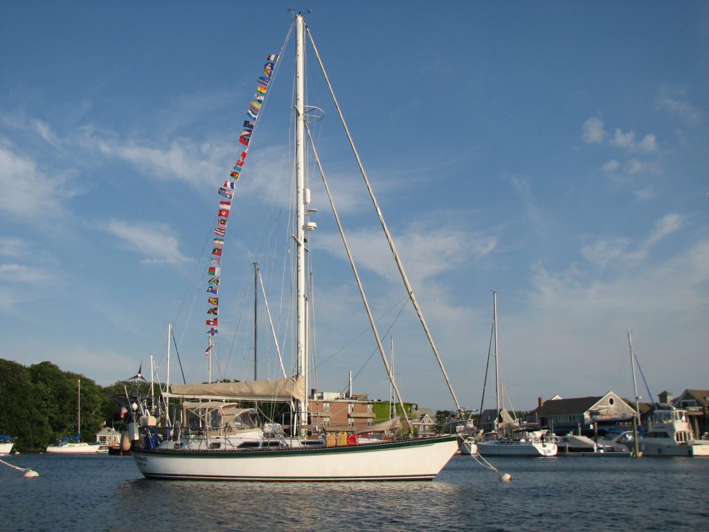
After almost 6 years of traveling, we sailed into Woods Hole on Cape Cod. We continued living aboard for the next five years and I wrote about that, adding ‘and Beyond’ to the title of the blog. Then shortly before Mark’s death in 2016, we sold our beloved Windbird and my travel logs became land logs. At this point, I had written a daily account for each and every day for 11 years. I fully intended to end the blog at that point, but when I wrote that news in a log, I got many responses saying that I really needed to keep posting. At the same time, I realized that I couldn’t stop writing. Summarizing each day had become a permanent part of my life and I will probably continue writing until I can no longer. These postings reflect the ordinary, and sometimes the extraordinary, days in my life and I would like to invite you to join me on my journey.
Day 19, Year 3: Orpheus Island to Hinchinbrook Island
Day 19, Year 3: Orpheus Island to Hinchinbrook Island
Date: Wednesday, May 28, 2008
Weather: Partly Cloudy Morning, Sunny Afternoon; Winds ESE 15-20
Temperature: Air 72 degrees F; Water 73 degrees F
Latitude: 18 degrees 14.013 minutes S
Longitude: 146 degrees 15.104 minutes E
Location: Shepherd Bay, Hinchinbrook Island, Queensland, Australia
It was another fantastic day as we slowly work our way up the Australian coast. Hinchinbrook Island is one of Queensland’s treasures. It sits just off the coast but remains “one of the last untouched tropical wilderness island left in Australia.” I take that quote from a guide book we are using called “Going Troppo.” The island was made a World Heritage Area in 1981. There are wonderful walks on the island, but you must register with the National Park Office and gain their permission to be on
the island. There is one eco-friendly resort on the northern tip of the island, but that is it. There are no roads and no one lives here except at the low-key resort. We left Orpheus early this morning when Hinchinbrook was still veiled in clouds. We motored across from Orpheus to the southern end of the island and then sailed wing and wing up the eastern coast. We got a good look at the very long jetty at Hinchinbrook’s southern end. The next sight was what looked like a very big waterfall.
As the clouds began to disperse, the beauty of Hinchinbrook became apparent. It has jagged peaks draped in lush greenery that reminded us of islands in the Marquesas. We sailed by Zoe Bay with its white sand beaches and sand dunes and then by Little Ramsey Bay. We could then see Cape Richards at the top of the island and Shepherd Bay that was our intended destination for the day. We were here just after noon and spent our afternoon onshore walking the beautiful beach with Donna and Gerry on
Scot Free II.. The southern end of the beach was lush rainforest and the remainder of the beach was backed dunes covered with a green grass that looked sun-bleached. The color was a grayish-green.
The big attraction of the afternoon was a pair of Beach Stone Curlews. They did not appear to be very happy that we were walking on their beach, but we were delighted to watch them and listen to their call. These birds are also called Beach Thick Knees and they do have knobby little knees on their long legs. They are very distinctively marked with white stripes on the head and shoulder and they have very stout, longish beaks. Mark called them “roadrunners” as they did run up and down the beach
making sure we didn’t wander back into the bush. They seemed to be protecting a nest, but maybe this is just their behavior. As we watched, we realized that they stop and bow as they call out. We felt privileged to share their beach with them today. While I was video-taping the strange bowing behavior, I head the call of a Sulphur-crested Cockatoo. By the time I spotted him, he has flying away, so I have no photo of him, but we also saw a pair of Azure Kingfishers sitting on the top branches
of an old dead tree and I did get pictures of them.. Their yellowish-orangish breasts were shone off in the sunlight and their azure blue backs were just beautiful. Another beach attraction was the tiny little sand-colored burrowing crabs. They are so camouflaged that they are hard to see, but the little balls of sand that they produce when burrowing covered the entire beach. It is very obvious that they keep very busy from tide to tide. We arrived about halfway between low and high tide, and
it was hard for us to believe that all of those millions of sand balls had been made in only three hours. These little guys really do keep busy. By the time we got in Scot Free II’s dinghy to head back to the boats, high tide was coming in and the wind had picked up. We had a wet ride back to Windbird and Donna and Gerry had difficulty getting back to Scot Free. We thought we were going to have to launch our dinghy and go rescue them, but they finally made it back. Their outboard engine was
overheating, so Gerry will have to check this out when we are in a calmer anchorage. In the meantime, they can hitch a ride with us.
Scot Free II and Windbird are rocking from side to side this evening as this anchorage does have swell from the southeast, but it was such a special day that we will endure the inconvenience. Aqua Magic couldn’t get their anchor to set here, so they went on around Cape Richards to the west side and anchored in Macushla Bay. Tomorrow morning at 6:30 am we will all head forty miles further north to the little sugar cane port of Mourilyan. Winds should be stronger tomorrow, so we might have another
short sailing day.
 |
| 080528 Day 19 Orpheus Island to Hinchinbro |
Day 18, Year 3: Magnetic Island to Orpheus Island
Day 18, Year 3: Magnetic Island to Orpheus Island
Date: Tuesday, May 27, 2008
Weather: Overcast; SE Winds 10-15
Temperature: Air 75 degrees F; Water 73 degrees F
Latitude: 18 degrees 35.989 minutes S
Longitude: 146 degrees 29.326 minutes E
Location: Little Pioneer Bay, Orpheus Island, Queensland, Australia
It was yet another motor sailing day. We keep getting reports for 20 knot winds, but we seem to be getting only 10 to 15 from directly behind us and that is not enough to push Windbird forward without a little boost from the engine. We would move forward without the engine, but not fast enough to get us to our nighttime anchorage. So we motor on. I think Australia is definitely a country of extremes. We either have too much or too little wind. Or maybe that is the definition of sailing most
everywhere!
We moved north about forty miles today up through the Palm Islands to the little island of Orpheus. We picked up a public mooring in Little Pioneer Bay and then put our dinghy in the water to travel to larger Pioneer Bay and the James Cook University Research Station. Since we only had to travel forty miles today, we got in around 2:30, did some planning for tomorrow, and listened to the weather on the radio before heading to the research station. At low tide, there is an extensive drying fringe
reef that keeps you from going ashore, but we were lucky that high tide was at 3:30 this afternoon. When we neared the shore, a young woman and her eighteen month old daughter came to meet us. Louise is a research assistant at the station and lives there with her husband, Lachim, and her daughter Siara. It was a quiet afternoon so Louise had time to show us around. There was a big round coral reef tank with examples of various fish and reef life, the temperature controlled research labs, a classroom
that accommodates about fifty students, a dry lab with all the microscopes and camera equipment, and then the housing units for staff and for students and researchers. Louise didn’t say, but in terms of staff it seemed that there was just housing for the director and his family and Louise and her family. We thoroughly enjoyed the visit and especially enjoyed meeting little Siara. Louise and Lachim have just purchased a 40 foot sailboat which was sitting out in the harbor. In a couple of years
they plan on doing a circumnavigation, so we had lots to talk to about. Unfortunately, the tide goes out quickly here, so we had to get going. We had to paddle out for a little way as it was, but we were certainly glad that we made the visit.
Tomorrow it is on to Hinchinbrook Island. It is only about twenty-two miles and we can see it easily from here. In fact, tonight we can see the long jetty that protrudes out of the east side of the island. Louise told us it is the longest jetty in Australia and it is for loading sugar cane on ships. Tomorrow we should get a closer look as we sail up to Shepherd Bay at the top of Hinchinbrook. Orchard Beach in this bay was the location for the recent Jodi Foster film, “Nim’s Island.” We will
stay in Shepherd Bay, weather permitting, or if it gets a little too windy, we will move around Cape Richards into Missionary Bay and walk over to Orchard Beach from there. Either way, it should be an enjoyable visit to another beautiful island in Australia.
 |
| 080527 Day 18 Magnetic Island to Orpheus Island |
Day 17, Year 3: Day Trip to Townsville
Day 17, Year 3: Day Trip to Townsville
Date: Monday, May 26, 2008
Weather: Another Lovely, Partly Cloudy Day
Location: Horseshoe Bay, Magnetic Island, Queensland, Australia
What a wonderful day! We really enjoyed our trip to Townsville on the mainland. We were up early and on the bus to Nelly Bay by 7:20 am. Our bus driver asked us if we were taking the ferry to Townsville and we said we were. He then said, “Oh, you’re going to Australia. Then you’ll have to be ‘De-Magnetized.'” Obviously Magnetic Islanders think of themselves independently of the mainland.
Townsville is Queensland’s largest city in the tropics, but it definitely has a small town feel to it. Mark and I remembered it as a nice little town, and we were so pleasantly surprised to find that it is really much, much nicer than we remembered. It is the first place we have been that made us both think that we could actually live here. The people are so very, very friendly and helpful, the weather is great, and the town is really special. The old-style Australian buildings in the downtown
area have been kept in beautiful condition and The Strand is just fantastic. This is a park along the water’s edge that runs the entire length of the city waterfront. We are amazed that the town governments here have huge gas grills in every park so people can enjoy cook-outs in the park, and everything is so clean. We did read a sign today that said vandalism/graffiti would result in a seven year prison sentence. So maybe this is how they keep everything so nice. Whatever . . . we walked almost
the entire length of The Strand and we found the neighborhood where our daughter Heather lived while attending university here. Her street was one block from the ocean and the apartment building she lived in hasn’t changed one bit in the last twelve years. Our next goal was to take the bus out to James Cook University (JCU) to go to the bookstore and try to get some JCU bumper stickers for Heather. This was a little request of hers that we were only too glad to try and fulfill. The university
is way out of town and it was a forty minute bus ride from downtown, but we were so glad we went out there and revisited the campus. On the way back into town, we stopped at a huge shopping area called Stockland and picked up a computer video cable. We hope to put a flat screen monitor that our son Justin gave us in our cockpit and connect it with the cable we bought today to our computer down in the main cabin. That way we can take full advantage of our navigation software without having to put
our computer in the cockpit. We’ll let you know if this all works out.
It was almost two in the afternoon by the time we got back from our university/shopping trip, so we had to head immediately back to the ferry. The day went so quickly and we could have spent much more time just enjoying Townsville-but it is time to move on. So we headed back to Magnetic Island and Windbird and started getting ready for an early morning departure. Tomorrow’s sail is about forty miles to Orpheus Island.
I regress just a bit to our Skype call with our grandson Sam late last night. We had a great wireless connection on the boat that allowed us both to use video. So instead of talking with him in his late evening, we were able to call in our late evening and watch him getting wound up for another day of activity. He watched us and jabbered away excitedly. He now throws kisses to us and actually tries to kiss the computer screen. He is just too cute. By next weekend we will be in Cairns which
is the last outpost of civilization in northern Queensland. We’ll probably be able to make one more Skype call from there and then no more until we reach Darwin. We will definitely have Sam withdrawal symptoms from Cairns to Darwin, so that will give us the incentive to move north quickly.
 |
| 080526 Day 17 Day Trip to Townsville |
Day 16, Year 3: Magnetic Island–Horseshoe Bay Lagoon Walk
Day 16, Year 3: Magnetic Island–Horseshoe Bay Lagoon Walk
Date: Sunday, May 25, 2008
Weather: Partly Cloudy
Location: Horseshoe Bay, Magnetic Island, Queensland, Australia
It was a lazy Sunday on Windbird. We started our day by calling our son Justin and his wife Jo and we will end our day by calling our daughter Heather and her husband Jed-and of course, our grand baby Sam. Sam is really no longer a baby. He is a full-fledged toddler and just a delight to watch when we call using our Skype video web cam. We are hoping that the signal is strong enough her to make for a successful video Skype call. We are waiting until 10 pm to call which is 8 am Sunday morning
for Sam. We always call him late in the evening just before he goes to bed, so we are looking forward to seeing him early in the morning this time. We called Justin and Jo this morning at 9 am, which was 5 pm their time yesterday. While talking with Justin and Jo we found out that Jo is opening a gallery showcasing her art on June 7. That is exciting news and we wish her the best in this endeavor. We called Justin and Jo from in town this morning, but we will make the call to Heather, Jed, and
Sam later tonight from the boat. We do have wireless internet in the anchorage here through Marinanet which is fantastic. Unfortunately, Townsville is as far north as this service goes. Somehow I feel that we will find ways to get internet in even the most remote places as we travel further north although that is not what we are told. I guess we shall see about that soon.
In the afternoon, we went for a walk on the beach with Patrick and Margaret of Aqua Magic and Donna and Gerry of Scot Free II. I had read that water birds and wallabies hang out at the lagoon. We did see a wallaby and maybe even a kangaroo (or a very large wallaby), but water birds were few and far between. On the way back from the lagoon we saw lots of Rainbow Lorikeets-so colorful and delightful to watch as they flit from tree to tree.
Early tomorrow morning Patrick and Margaret and Mark and I will hop on an early bus to Nelly Bay and there we will catch the fast ferry to Townsville. We go seeking information about places from here north, getting some needed supplies, and revisiting some of our favorite spots from when we were in Townsville twelve years ago. It will be interesting to see how things have changed.
On Tuesday morning, we leave here and head 40 miles north to Orpheus Island. By next weekend we will be in the town of Cairns. Slowly but surely we are making our way north. We are still on target to be in Darwin by July 7, and maybe even sooner. Sail Indonesia here we come!
 |
| 080525 Day 16 Magnetic Island–Horseshoe Bay Lagoon Walk |
Day 15, Year 3: Magnetic Island
Day 15, Year 3: Magnetic Island
Date: Saturday, May 24, 2008
Weather: Another Beautiful Day
Location: Horseshoe Bay, Magnetic Island, Queensland, Australia
We received an email this morning from our friends Felix and Monika aboard Makani. They made it through the Red Sea and are now in Irakleion Harbor, Greece, where they began their circumnavigation seven years ago. We were so excited to hear from them as they are the first people that we have met on our circumnavigation who have made it “home.” Home for Felix and Monika is actually Germany but it sounds like they are staying in the Mediterranean for another year as they said they would see us there
in 2009. Of course, that depends upon whether or not we go around South Africa or through the Red Sea to the Med. We’re not ready to make that decision yet and we have many miles to go before then. We have only traveled some 20,000 to date, but Felix and Monika reported traveling 49,000 miles, visiting 52 countries. We first met Felix and Monika on way from the Galapagos Islands to the Marqueses. We had been sailing for days and had not seen another boat. One morning we saw a boat on the horizon
behind us. By noon that boat was beside us and called us on the VHF radio. It was Makani and they asked us if they could email us their position each day and have us relay that to the radio net as their SSB radio was not working. We said we would be glad to do that and then they were on their way, fading into the sunset in front of us by evening. Makani is a FAST boat and she has served Felix and Monika well in their travels around the world. So congratulations to Felix and Monika and to Makani.
We also reconnected with some good friends today that we first met in Panama. Patrick and Margaret of Aqua Magic sailed into Horseshoe Bay this morning. We went right over to say hello and then invited them over for sundowners this evening. It was great to catch up on news of family and friends. They are doing the Sail Indonesia Rally, as we are, so we will probably be crossing paths many times in the next few months. After greeting Patrick and Margaret this morning, we went to shore with Donna
and Gerry of Scot Free II and caught the bus heading across the island. We were only taking the bus for a short way to the start of something called the “Fort Walk.” We followed a ridge overlooking some of the beautiful bays of Magnetic Island to the ruins of the forts complex that was operated here during World War II. We were also on the lookout for koalas, but none were to be seen on the walk today. The views from the fort were spectacular on this very clear day. When we walked back down,
we caught the bus again and took it to Nelly Bay. This is where the ferries leave for Townsville and it is also the only place on the island with an IGA grocery store. We are planning to buy groceries in Townsville when we go over on the ferry on Monday, but one could skip the Townsville trip and stock up at this store. It had most everything you would want and the prices weren’t all that much more than in the larger towns. Donna and Gerry might do that, but we just have to revisit Townsville.
That is where is daughter went to college and where we visited her twelve years ago. So we will take a trip down memory lane on Monday in Townsville and do our shopping at the same time.
Our citing of the Woobegong two days ago generated a comment from a one of our faithful log readers that was quite informative to us. We saw signs in Airlie Beach for “flake and chips” and wondered if that was any different from “fish and chips.” Evidently shark meat is referred to as “flake” in Australia. So thanks, Rich, for sending along that information. There’s one other bit of information that cruisers visiting here might find helpful. In the latest edition of Lonely Planet’s “Australia”
it says that there are no internet cafes on the island other than in backpackers and hotels. That is no longer true. There is Marinanet wireless here in Horseshoe Bay, as well as internet availability in Noodies Bar and Cafe. We also saw a huge sign for an internet cafe in the little borough of Arcadia today, so the internet is alive and well here.
 |
| 080524 Day 15 Magnetic Island–Fo |
Day 14, Year 3: Cape Upstart to Magnetic Island
Day 14, Year 3: Cape Upstart to Magnetic Island
Date: Friday, May 23, 2008
Weather: No Change–Sunny Skies and Fair Winds, SE 15-20
Temperature: Air 72 degrees F; Water 72 degrees F
Latitude: 19 degrees 06.666 minutes S
Longitude: 146 degrees 51.536 minutes E
Location: Magnetic Island, Queensland, Australia
“The East point I named Cape Cleveland, and the West, Magnetical Head or Island, as it had much the appearance of an Island; and the Compass did not traverse well when near it.” (James Cook’s Journal, 6th June, 1770)
Evidently Captain Cook’s Endeavor was the only ship to ever record the strange magnetic occurrence, but the name stuck. And although Captain Cook named the island, he did not visit here. The first European visitors were probably the crew of the HMS Beagle some seventy years later in 1841. The traditional people of Yunbenun or Magnetic Island were the Wulgurukaba or canoe people who lived on the mainland and visited the island by canoe or walked over at low tide. The oldest aboriginal remains
found on this island date back some 12,000 years, but there is evidence that the Wulurukaba people lived on the low mainland for some 40,000 years before the first Europeans came here. Today much of Magnetic Island is national park mixed with a few seaside tourist communities. The wildlife on the island seems to have learned to coexist with the thousands of tourists who visit here. Just after we arrived today we headed to the island to the little community in Horseshoe Bay. There are a few small
cafes and restaurants, a tourist trinket store, a convenience food store, and a place that sells wireless internet time. Yea! Then there are the many little backpackers and a hotel or two hidden in the bush somewhere. We only walked on the main street that has a cul-de-sac at both ends, but on this street we saw the most beautiful blue headed parrots and some cheeky Laughing Kookaburras. I’d never seen a Kookaburra in the wild before, if you can call main street “wild”, but this one was definitely
an Aussie all the way. He flew from a tree on the beach to the open air bar and just sat there on the back of a chair. Only in Australia.
We did indeed leave Cape Upstart at 2 am this morning and had a lovely sixty-eight mile sail arriving here twelve and a half hours later. As always, the wind was more behind us than we had hoped. We first sailed with just a headsail, and then with a headsail and the main, then we poled out the headsail, and ended the day with just the main. The wind sure keeps us busy these days.
One of the main reasons for visiting Magnetic Island is so we can take advantage of the wonderful walking tracks here. When we were here twelve years ago, we saw koalas as we walked up to the remains of old World War II fortifications. Koalas are not native to the island but were introduced in the 1930’s. We are hoping for a repeat performance.
 |
| 080523 Day 14 Cape Upstart to Magnetic Island |
Day 13, Year 3: Greys Bay to Cape Upstart
Day 13, Year 3: Greys Bay to Cape Upstart
Date: Thursday, May 22, 2008
Weather: Clear Skies and Fair Winds, SE 15-20
Temperature: Air 73 degrees F; Water 73 degrees F
Latitude: 19 degrees 42.726 minutes S
Longitude: 147 degrees 45.171 minutes E
Location: Cape Upstart, Queensland, Australia
The sailing day today was shorter than normal, with Windbird going about forty miles in about seven hours. The southeast winds were behind us, which seems to be the only case here on the coast of Australia, and they pushed us at a gentle but steady five knots and better to the northwest. We arrived in Sharks Bay tucked behind Cape Upstart before two o’clock and have just enjoyed the sunny afternoon aboard Windbird at anchor. From where we were anchored in Greys Bay this morning, we sailed across
Queens Bay, past the very long jetty at Abbot Point which is a coal loading facility, across Abbot Bay, and finally rounded Cape Upstart. There is a little rock just off the cape and it is known as “The Bun” to locals. Just as we were going around it, we saw a very different looking animal in the water beside us. It looked like a small ray with a very fat tail and it looked yellow with reddish-orangish-brownish spots. Before we could get a picture, it disappeared. As we have perused our guides
this afternoon we think it was actually a small shark called a Wobbegong. It might have been an Ornate Wobbegong or a Spotted. At least that’s our best guess. Whatever, it was an exciting find.
There are two more capes before we reach our destination of Magnetic Island, Cape Bowling Green and Cape Cleveland. Our destination for tomorrow was to be Cape Bowling Green, but we have decided to get up at 2 am and head directly for Magnetic Island. We should be there no later than 4 pm tomorrow afternoon and we will avoid another night out in a somewhat dicey anchorage. Cape Bowling Green is shallow and has shifting sand banks that you have to watch. The bottom is also covered in grass that
makes it hard to anchor securely. None of that sounded like much fun and with such good winds predicted, we have chosen for the early start arriving at Magnetic Island a day early. Magnetic is about three and half miles from Townsville on the mainland and it has wonderful walking tracks as well as a ferry to the mainland. We should have no trouble spending three days there before heading further north.
Mark’s continued project ended successfully this morning with a water maker that is now happily making fresh water for us. I spent my day reading cruising guides, and reading cruising guides, and then reading cruising guides and planning. The major thing I discovered is that we are still sailing in the path of Captain James Cook’s Endeavor. He sailed past here on June 5th, 1770 and chose the name Cape Upstart as the headland rises prominently above the surrounding low lands. He named Cape Bowling
Green, Cape Cleveland, Magnetic Island, and almost every point of land from here north. He was one busy guy! I was also able to semi-finalize our sailing plan from here to the tip of Cape York. At that point, we turn to the west and head almost directly to Darwin. I have to run my plan by the captain and share it with Scot Free II to see what they think, but if all goes as planned, we will be at the northern tip of Cape York by the middle of June.
 |
| 080522 Day 13 Greys Bay to Cape Upstart |
Day 12, Year 3: Back to the Mainland-Greys Bay
Day 12, Year 3: Back to the Mainland-Greys Bay
Date: Wednesday, May 21, 2008
Weather: Sunny Day; Winds SE 8-10
Temperature: Air 72 degrees F; Water 73 degrees F
Latitude: 19 degrees 58.550 minutes S
Longitude: 148 degrees 15.222 minutes E
Location: Greys Bay, Queensland, Australia
There’s not a lot to report today. We left the Whitsunday Islands early this morning and headed 40 miles to the northwest to Greys Bay. This is a little bay in the larger Queens Bay tucked in under the protection of Cape Edgecumbe. This is on the north side of a peninsula and the little port of Bowen is on the south side. Many cruisers headed north go into Bowen to provision, but we are going to do that just a little further north in Townsville and Cairns. So since we didn’t need to provision,
we just pulled into this little bay and we can quickly be on our way in the morning. Our trip here was uneventful and unfortunately we had to motor sail all the way. Those strong winds we had the first couple of days out have disappeared. There is a huge high pressure system sitting over Australia and until it moves, the southeast trades will not get a change to build up speed. So it was a calm, relaxing day, but we are using up that precious diesel duel that will cost us a pretty penny to replace
here in Australia. Once we are in Indonesia, the price of fuel goes way down, but for now the cost is high.
We talked to our friends Margaret and Patrick of Aqua Magic on the radio this morning. They will arrive in the Whitsundays today and spend a few days playing there. I’m not sure when we will meet up, but we will probably see them somewhere along the line before reaching Darwin. I’m going to take time here to explain the trip to Darwin in a little more detail. Darwin is on the north side of Australia and about 1500 miles from here. Since we are traveling inside the Great Barrier Reef, this is
not prime territory for passage sailing, so most people go from point to point. At our current rate, we will reach Darwin sometime before mid-July. The Sail Indonesia Rally that we are joining there leaves on July 26 and there are two weeks of meetings and activities once we get there that will better prepare us for our trip through Indonesia to Singapore. Right now there are 113 boats signed up for the rally, so we are going to have plenty of company. But for now, we head north one day at a
time. We have two more days before we reach Magnetic Island, just off the Townsville. Townsville is the second largest city on the Queensland Coast, Brisbane being the largest. We will take the ferry from Magnetic Island into Townsville and we will spend a couple of days walking the trails on Magnetic. From there we make a few stops on our way to Cairns. That is the last “city” stop. From then on, we are in upcountry Queensland, home of crocodiles! Once we get all the way to the top of Cape
York, we will then do two major passages that will take us most of the way to Darwin. So, yes, our final destination is Darwin, but we intend to enjoy the trip.
Mark’s project today has been the continued work on the watermaker. He is cleaning the membrane with an alkaline solution and it is a long process. You do one cleaning and then wait five to ten hours and do it again. Then you wait overnight. So we won’t know the results until tomorrow morning. A new membrane costs somewhere between $800 and $1,000 dollars, so I sure hope that is not what we need.
 |
| 080521 Day 12 Hook Island to Cape Upstart |
Day 11, Year 3: The Whitsundays-North Hook Island
Day 11, Year 3: The Whitsundays-North Hook Island
Date: Tuesday, May 20, 2008
Weather: Couldn’t Be Finer
Location: Butterfly Bay, Hook Island, Queensland, Australia
We’re starting to feel like a beach ball. We started today in Maureen’s Cove, moved next door to Luncheon Bay, took the dinghy to Manta Ray Bay to snorkel, had lunch back in Luncheon Bay, moved back to Maureen’s Cove where we had started the day so that we could snorkel at low tide, and then ended up back where we first moored on Sunday in Butterfly Bay. Whew! Just keeping track of ourselves wears me out. But it was a good day, and actually very relaxed. Being able to pick up a mooring everywhere
we go is so much easier than anchoring. The good news today was that we saw some great fish, but the bad news is that our underwater camera is once again not working. We sent it back to the factory while in the US and we thought they replaced it with a new camera, but this one is giving us the same screwy readings that we were getting with the old one, so something is surely not right. I can’t believe we missed the picture of the Giant Humphead Wrasse that came to greet us in Manta Ray Bay. He
was right beside the dinghy the minute we tied up to the mooring ball and he didn’t scare away easily even after we were in the water. In fact there were so many fish around us that we think the tourist boats must feed the fish. There were abundant Sergeant Majors and Blue and Yellow Fusiliers and the instant the dinghy stopped, the fish dove toward us. That happened to us in Bora Bora, but the fish there were fed as well. We also saw such beautiful, big parrotfish today, but unfortunately we
won’t be able to share photos of those things with you. But no matter where we went to snorkel and no matter what time of day in terms of high and low tide, the water here is just not as crystal clear as many of the places we visited last year. I guess we are really spoiled. We not only want to see beautiful coral and unusual fish, but we also want clear, warm water free of any dangerous creatures.
Mark continues to work on his list of projects. Today’s Project of the Day was to get the watermaker back up and running. Easier said than done. After trying all his tricks to no avail, he consulted the manual. Evidently, we need to do a special cleaning process for the membrane, so that work will continue tomorrow. We spent our evening onshore watching Sulphur-Crested Cockatoos come in for the night. These magnificent white birds with their yellow tops can surely make quite a raucous. They
look prettier than they sound and I think maybe they were especially loud tonight because of the full moon rising. As that full moon sets in the morning, we will be on our way further north. We could spend many more days here, but Darwin calls us. We have to keep moving if we are going to get there by early July.
 |
| 080520 Day 11 AU Hook Island, Whitsundays–Anchorage to Anchorage |
 |
| 080520 Day 11 Underwater in Maureen's Bay |
Day 10, Year 3: The Whitsundays-Butterfly Bay & Maureen’s Cove, Hook Island
Day 10, Year 3: The Whitsundays-Butterfly Bay & Maureen’s Cove, Hook Island
Date: Monday, May 19, 2008
Weather: Gorgeous, But Cool
Latitude: 20 degrees 04.098 minutes S
Longitude: 148 degrees 56.233 minutes E
Location: Maureen’s Cove, Hook Island, Queensland, Australia
We finally made it into the water today and had no problem with jellyfish of any sort. We snorkeled in Butterfly Bay where we were moored this morning. It is not marked in the guide we are using as a snorkel spot, but there were lots of fish and coral. This is a marine park and there is absolutely no fishing allowed, so the fish we saw were larger than average. We saw many of the same varieties we have seen throughout the western Pacific, just bigger. I saw one three to four foot grouper and
a couple of Napoleon Humphead Wrasse that were about four feet in length. There were parrotfishes and wrasses of all kinds and butterflyfish, some familiar, some new. The coral was not particularly colorful, but there was a great variety. There were even a few large clams. The one thing that was missing was the little anemonefish. I didn’t find my obligatory anemonefish family, so I will have to continue that hunt tomorrow. Mark got cold and got out early but Gerry and Donna and I continued
to swim across the bay to a rocky outcropping separating our wing of Butterfly Bay from the other wing. The trip back to Windbird was a long one and all three of us struggled a bit with the current. We are obviously not in sailing or snorkeling shape yet, so we had to forego the afternoon snorkel. We did, however, move the boat to the bay next door, Maureen’s Cove. The move happened late in the afternoon as we were waiting for some of the large sailing boats that bring tourists out from Airlie
to leave the mooring balls. We can anchor here, but we are trying to use the mooring balls to keep from accidentally tearing up any of the coral. You are really only supposed to stay on the balls for two hours during the daytime, but if there is not high a demand, it seems you can get by with staying a little longer. We moved today at 3 pm so our two hours are up at 5 o’clock. But after 5:00, you can stay the night and not have to move until mid-morning. We will snorkel in this cove in the morning
and then move on to the next bay for the afternoon. If the snorkeling in this cove is really good, we might try to come back late tomorrow afternoon and spend another day here. Since this cove is where all the tourist boats come, I’m figuring there must be something special to look at underwater. Right now there is big sailboat named Boomerang anchored next to us. The deck was littered with young people when she came in and now they are all in the water. We’ve watched carefully where they snorkel and will trace their path in the morning to see what is there.
I had a strange incident today. Mark and I had both bought new dive masks while home and today was they first time we used them. Mark’s works great, but I struggled the whole time we were out today with water gushing in the mask. When I finally got back to the boat after being in the water for almost two hours, I took the mask off and looked at it. The entire rim around the goggles was cracked and crazed with parts of it missing entirely. It looks like someone took a hammer to it. Very strange.
It was wrapped in plastic and in the plastic case it came in until this morning. Neither Mark or I can figure out what happened to it, but I guess I’ll have to find a new one when we get to Cairns. I’ll definitely want a good mask when we get to Lizard Island in a couple of weeks.
I’m writing this log in the late afternoon and plan to send it as soon as the sun sets. Last night we waited until later in the evening to send the log and we could not get the email to go. We had to wait and send the log early this morning. I got up at 4 am to send the log, but still had radio trouble. So when Mark got up at 6 am, he discovered a couple of problems. There were some settings that had been accidentally changed on the radio and when he started the engine to boost power for sending the log, he discovered that we had a charging problem again. This time it was loose connections, but poor Mark worked all morning on one problem after another. We think we have the radio issue under control now, but we will be sending the logs earlier in the evening for a while just to make sure. We are now headed to the beach to watch the sun go down and do some bird watching. We will then have dinner on Scot Free II, so I’ll have to report on those things in tomorrow’s log.
 |
| 080519 Day 10 AU Hook Island, Whitsundays–Butterfly Bay & Maureen’s Cove |
 |
| 080519 Day 10 Underwater in Butterfly Bay |