
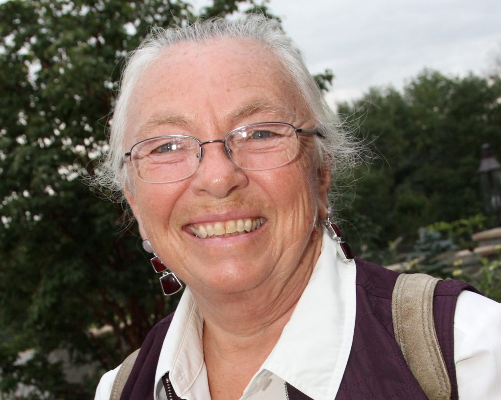
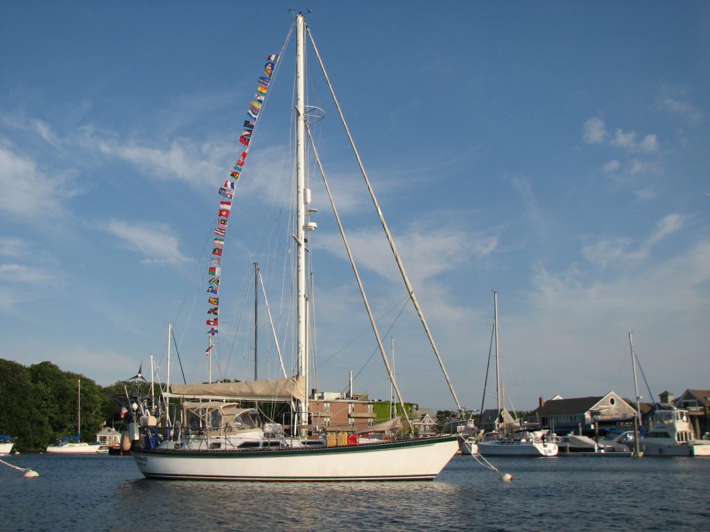
After almost 6 years of traveling, we sailed into Woods Hole on Cape Cod. We continued living aboard for the next five years and I wrote about that, adding ‘and Beyond’ to the title of the blog. Then shortly before Mark’s death in 2016, we sold our beloved Windbird and my travel logs became land logs. At this point, I had written a daily account for each and every day for 11 years. I fully intended to end the blog at that point, but when I wrote that news in a log, I got many responses saying that I really needed to keep posting. At the same time, I realized that I couldn’t stop writing. Summarizing each day had become a permanent part of my life and I will probably continue writing until I can no longer. These postings reflect the ordinary, and sometimes the extraordinary, days in my life and I would like to invite you to join me on my journey.
Day 153, Year 10: On the ‘Road’ Again
Day 153, Year 10: On the ‘Road’ Again
Date: Thursday, March 12, 2015
Weather: Sunny and Windy, Winds E to ESE 18-20
Latitude: 24 05.886 N
Longitude: 076 24.257 W
Location: Anchored at Black Point, Great Guana Cay, Exumas
What a difference a day makes. Yesterday was literally the sailing day from hell, but today we were on the ‘road’ again by 11 am. A little time and a man who can fix almost anything helped out. Mark got the engine running this morning and we headed south nine miles to Black Point on Great Guana Cay to meet up with our good friends Ed and Lynne of Contance. Lee and Lynda followed behind us. We both motored all the way and the conditions were so calm compared to yesterday. Life is good.
We got up at 6:30 am to listen to the weather (a daily must here in the Bahamas). After the weather, Mark went back to bed for a bit. He was still exhausted from yesterday’s fiasco. But I stayed up and wrote a couple of emails. When Mark got up the second time, he dove right into the engine fuel line issue. It was a lot easier to work on this when we weren’t heeling over so far that the toe rail was in the water. The fuel filter was blocked because it was filthy with all the gunk sucked into it from the churned up almost empty fuel tank. He got that problem fixed, but then the fuel coming from the tank we had switched to yesterday was also blocked. When I finally turned the key and the engine actually started, we were elated. The wind was still blowing almost 20 knots today from the direction we wanted to go, but we decided to go for it. As it turns out, it was a walk in the park compared to yesterday. By mid-afternoon we were anchored right next to Constance and sitting in Constance’s cockpit talking to Ed and Lynne. The last time we were anchored together like this was in 2010 in Madagascar. It was a great feeling to be reunited in this way. Ed and Lynne filled us in on what we will find here in Black Point. This community is the second largest in the Exumas and the people here are very welcoming to cruisers. There is a top-of-the-line laundromat with its own dinghy dock and free internet, a good little supermarket, Lorraine’s Café where everyone meets for lunch and more free internet, and there is free water and garbage disposal. It is a lovely little place and feels very comfortable. What it doesn’t offer is good snorkeling opportunities. So we will spend tomorrow and part of Saturday here and then, weather permitting, we will sail about five miles back towards Staniel Cay for an overnight stop at little Bitter Iguana Cay. This is a protected iguana preserve that should provide lots of photo opportunities. On Sunday morning we will return to the Staniel Cay area where we were last night, but this time we hope to be able to actually make it into the anchorage. There are lots of fun things to do there, so we will make that our base until mid-week when we will go a little further north into the Exuma Cays Land and Sea Park where there are tons of great snorkeling opportunities.
Happy Hour was enjoyed on Windbird with both Constance and Sea Turtle in attendance. Lee keeps insisting that he sees the infamous “green flash” at sundown, but Lynda and I think that is just a result of too many sundowners! After everyone headed back to their boats, Mark and I had dinner and then checked out the internet possibilities here in the anchorage. We are anchored very close to Ida’s Laundromat and the free internet is available out here in the anchorage for those with a wifi booster. Thankfully, we have one. Mark spent the evening catching up on email and Facebook contacts. We saw some wonderful photos of our grandkids which made us VERY happy and also some great photos from Bali where our good friends Jane and Bruce Woodin from back home in Falmouth are vacationing. Justin had posted a photo of Ziggy where he had fallen through the couch. Ouch!
 |
| 150312 Day 153 Photos from Puerto Rico–Ziggy |
And Heather had posted photos of the boys playing in the snow and ice on the beach. But there is hope. She also posted a photo of crocuses peeking their colorful heads out. So spring must be on the way to snow and ice-laden Cape Cod.
 |
| 150312 Day 153 Photos from Cape Cod–The Goldpebbles |
Day 152, Year 10: Windbird’s Terrible, Horrible, No Good, Very Bad Day
Day 152, Year 10: Windbird’s Terrible, Horrible, No Good, Very Bad Day
Date: Wednesday, March 11, 2015
Weather: Sunny and Windy, Winds SE 20-25
Latitude: 24 10.828 N
Longitude: 076 28.353 W
Location: Anchored Near Staniel Cay, Exumas
From the subject line of this log, I think it is pretty clear that this was not a good day on Windbird. It started out just fine, windier than our weather guru predicted, but the ride wasn’t terribly rough. We were motor sailing with the main and staysail and were able to fight our way forward. Without the motor, we would not have made any headway, but with it, we were able to maintain a speed of three to five knots. Then, as our English friends would say, things went pear-shaped. Mark decided to go a little off-course so that we weren’t motor sailing directly into 20 to 25 knots of wind. He turned away from land to avoid shallow areas, but this put us out on the Exuma Bank with absolutely no protection. The seas went from one foot to two to three to four to five. When I started seeing seven foot seas, I suggested that we tack back toward land. The captain differed, so we continued on. Finally at about 2:30 pm, he agreed that turning back toward land might be a good idea. So we tacked, and almost immediately the engine stopped running. We assumed we were out of fuel in one tank, so Mark went down to switch tanks. We tried and tried to start the engine with no success. Mark stayed below working on the problem and I stayed at the helm going nowhere. Mark did all of the things that you are supposed to do when you run out of fuel and in doing so, he discovered that our fuel filter was really gunked up. Since there was not much fuel left in the tank, the gunk that settles to the bottom of the tank was getting mixed in thoroughly with the fuel in rough sea conditions. Long story short, we had to change our destination for tonight to someplace closer and we had to sail for five and a half hours to get there. In order to reach an anchorage by dark, we had to sail with all sails up full and that heeled us right over. We were running with the toe rail almost in the water and since we had to tack back and forth, everything in the boat went flying from one side to the other. Normally we would have been reefed down in these conditions, but we needed the speed today. By the time we were close to an anchorage it was after 8 pm and very dark. So we picked a place close by to the western anchorage on Big Majors Spot island and hope that we will get the engine started tomorrow so we can go on into the anchorage. Big Majors Spot is the easy go-to anchorage close to Staniel Cay. There are other anchorages just off Staniel, but none are known to have the good holding that Big Majors has. With the winds that we are predicted to get over the next couple of days, good holding is very important. Thus, Big Majors is probably packed and that’s why we anchored way off. We didn’t want to try sailing into a crowded anchorage in the dark. Thankfully we made it where we did safely. Mark is exhausted and my nerves are on edge, but hopefully a good night’s sleep will fix things.
We are disappointed that we couldn’t make it to our original destination at Black Point on Great Guana Cay. We were really looking forward to seeing our friends Ed and Lynne of Constance. But we are close enough to be able to talk to them on the VHF radio, so at least we were able to tell them that we weren’t going to make it. But we weren’t able to talk to Lee and Lynda on Sea Turtle for most of today. At the start of the day, a boat named Pearl was hailing Sea Turtle on the radio. Sea Turtle didn’t answer, so we called them to tell them they were being called. They never could hear the other boat and this is when we discovered their radio issue. Then as the day progressed and we got further apart, they couldn’t hear us either. They can transmit just fine, but they have a very limited distance for receiving. Since we were having so many issues, we wanted to be able to tell them not to expect us in the anchorage, but it just wasn’t possible. We had talked to them off and on enough during the day to know that they were changing their destination to Big Majors Spot, so we headed there as well. Once we got close to where we were going to anchor, we finally re-established contact. They made it in one piece but they also have some repairs that have to happen tomorrow. So I suppose we will be here for at least one day. We would still love to make it down to Black Point to see Ed and Lynne, but that will depend on how successful we are in getting our motor running again. And, of course, it depends on the weather.
Day 151, Year 10: Normans Cay to Shroud Cay
Day 151, Year 10: Normans Cay to Shroud Cay
Date: Tuesday, March 10, 2015
Weather: Another Gorgeous Day-Sunny, Temp 80’s F, Wind ESE 15-20
Latitude: 24 31.966 N
Longitude: 076 47.834 W
Location: Anchored on the Exuma Bank Side of Shroud Cay, Exumas
The Exumas are a thin chain of small islands to the east and south of Nassau running to the southeast. As we did two days ago, you have to cross a shallow bank, either the Yellow or the White, from Nassau before you reach the first cay in the chain. You can then work your way down the chain on the inside or Exuma Bank side of the cays or on the outside in the Exuma Sound. The Exuma Sound is on the east side of the cays and it is referred to as the ocean side. Here on the inside on the Exuma Bank, we are a ‘bit’ more protected, but just a bit. This morning we motored about five miles south of Normans Cay to Shroud Cay directly into the SE winds. It is slow, but the seas weren’t too bad, so it was actually just fine. Shroud Cay is a lot of little cays that surround a shallow mangrove interior with a whole network of creeks winding their way from the Bank side to the Sound side. Only the northernmost creek goes all the way from west to east and it is the only one that you can navigate with a motor. So as soon as we arrived, we headed out to explore. Sea Turtle is anchored almost two miles north of us in catamaran country. Sea Turtle is not a cat, but her draft is only four feet, so Lee and Lynda can go where Windbird dare not tread. We are further south in the lovely Exuma Cays Land and Sea Park mooring field where most of the moorings are in ten to twelve feet of water. In order to reach the northernmost creek, we had to pass right by Sea Turtle. Lee and Lynda were ready to head out in their dinghy, Hatchling, so off we went. Navigating the creek was delightful. It was nearing high tide, so even though the creek is shallow, we had plenty of water under us. On the banks of the creek in very shallow water is where the mangroves grow. They were short and stubby growing in white sand in crystal clear water. The variation in the colors of the water went from clear with a white sand bottom to various shades of aquamarine. But then as we approached the Exuma Sound, we had a color burst going from white, white sand beaches with gray rocks topped with green palm trees to deeper and deeper shades of aquamarine reaching out in to the Sound. And the darker blue sky rose up from the water. The surf was rolling in, so the crashing waves separated the water from the sky. It was beautiful. We were in search of Camp Driftwood and it was not clear if it was on the beach to the left or to the right of us. We guessed left and I hopped ashore to check it out. I couldn’t find the path that was supposed to take us up the hill, so I went back and Lee and Mark went out scouting. They found the path and Mark came back to tell Lynda and I to follow him. Camp Driftwood was once the haven of a reclusive sailor who built all manner of creations from driftwood atop his hill. During the drug lord years, the “feds” used Camp Driftwood as their base for spying on the activity on Normans Cay. From the top of the little hill where Camp Driftwood sits, you can see in all directions making it possible to use high powered cameras to document the activity on Normans Cay. Today it is managed by the Exuma Cays Land Sea and Park and there is a sign at the top announcing that you have reached Camp Driftwood but asking you to please not leave things to ‘decorate’ the camp. Older cruising guides say that you must bring scavenged items from the beach to please the ‘guardians’ of the camp. The Park now says otherwise, so we had to throw our shells and driftwood over the hill. We enjoyed the views and then descended back down to the beautiful little beach. A large boat had arrived with a boatload of young people who were frolicking in the surf. We should have joined them, but we sat on the rocks in the shade of the hill and ate our picnic lunches. I think we could have stayed all day just to watch the waves roll in, but after we ate, we went back to the dinghies and made our way back across the island. It was a wonderful little explore.
Tomorrow we have about 35 miles to motor straight into strong headwinds. Thursday, Friday, and Saturday are all windier than tomorrow, so we are opting to go even though it won’t be particularly comfortable. The winds are supposed to settle a bit in the afternoon when we will have only 15-17 knots on the nose. We’ll look forward to that afternoon reprieve and in the meantime travel very slowly on our way to Black Point on Great Guana Cay. That is as far south as we plan to go, so once the winds settle down over the weekend, we will start the trek back to the north to Staniel Cay. The adventure continues. And next week it is going to get even better. Our friends Kevin and Claire are going to fly into Staniel Cay to spend a few days with us. It was a last minute decision and they were able to get great flights right to Staniel. Kevin and Claire are our friends even though they are the age of our kids. We lived aboard our respective boats in Boston from 2003 to 2005. Claire was completing her doctorate work at Harvard Medical and found buying a boat and living aboard a cheaper way to live in Boston. We sailed to Maine together one summer and on our trek around the world, they flew to Thailand to sail with us for two weeks. They have visited us often on the Cape and in Little River, and we are delighted that they will be now be joining us in the Bahamas.
 |
| 150310 Day 151 Bahamas–Exploring Shroud Cay |
Day 150, Year 10: Cruising Again . . . Feels Fantastic
Day 150, Year 10: Cruising Again . . . Feels Fantastic
Date: Monday, March 9, 2015
Weather: Gorgeous Day-Sunny, Windy, and 80 degrees F
Location: Anchored on West Side of Normans Cay, Exumas
It feels fantastic to be cruising again. I know we live on a boat, but living on a boat and cruising in a boat in the islands are two different things. Mark just said, “This is the way you are supposed to feel at the end of a day-a little exhausted after a day filled with fun activities.” So what is that we did today that we love so much? We took a long walk on land, most of it along the beach with beautiful views. We explored some old ruins, watched the construction crews busy cleaning up and building who knows what, went back to our boats for lunch and rest, set off on a dinghy exploration of the north end of the island, and then came back to our boats to jump in the water and cool off. Perfect day. But this is the short story. Of course, I have a longer version for those of you interested.
Windbird and Sea Turtle both started the day with a dinghy ride to the beach. We drug our dinghies above the high tide line, tied them to trees on the far side of the beach, and then walked down to Normans Cay Beach Club. From the water all we could see were two white houses on the beach, two boats on moorings, and a dinghy on land to get to the boats out in the water. There’s a little more to it than that, but not much more. There is a restaurant called MacDuff’s Bar & Grill that is part of the ‘club’. We had read that a hamburger, great as it is supposed to be, costs $25. So we skipped that. Behind the Beach Club there is a paved airstrip completely surrounded by high chain link fence. We’ve seen lots of little island air strips and this is one of the nicest we have ever seen. We had asked at the Beach Club how to get to the far side of the island and a young man told us to walk to the end of air strip and follow the beach. So we did. The views were beautiful and it was interesting to see all of the construction going on. Normans Cay has very few people living here, no villages or settlements, no stores. It is basically an uninhabited island except for a couple of resorts and a sprinkling of private homes. But with all of the construction going on, something new is obviously coming. On the other side of the island, we marveled at the colors of the waters and explored the ruins of the once prosperous domain of Colombian drug runner, Carols Leder. In the late 1970’s and early 1980’s, Leder ran a cocaine smuggling operation from Normans Cay. Since the island was basically uninhabited except for the cruisers who anchored offshore, Normans made a great place for the smuggling operation. But then there were supposedly a number of murders involving cruising boaters who came too close the operation and eventually it was shut down by the “feds”. But what a beautiful location Leder chose for his operation called the Normans Cay Club. After walking back to our dinghies, we headed out to Sea Turtle and Windbird for lunch and a little rest time. Then Mark and I picked up Lynda and Lee and took them in our dinghy about three miles north of the anchorage to Galleon Point at the northern end of the island. I had read that the colors of the water between the point and Saddle Cay were quite remarkable, and we weren’t disappointed. It was truly breathtakingly beautiful reflecting shades of blue that that look almost surreal. It was a bit of a wet dinghy ride home, so we all decided to go to our respective boats and jump into this crystal clear water. We put our snorkel gear on so we could check the bottom of the boat and just generally enjoyed the warm water. Then it was off to Sea Turtle for happy hour with a couple from another boat anchored next to Lee and Lynda. We arrived at 5:30, but the other couple didn’t get there until 6:30. Philip and Johanne of Majestic Phoenix are from Montreal and they had no idea that the time had changed here on Sunday. It was a full day filled with fun. I think we’ll see if we can replicate the fun tomorrow. We will sail six miles south to the next little island, Shroud Cay, and continue our explorations there.
 |
| 150309 Day 150 Bahamas–Exploring Normans Cay |
Day 149, Year 10: The Exumas . . . At Last
Day 149, Year 10: The Exumas . . . At Last
Date: Sunday, March 8, 2015
Weather: Partly Sunny, Winds NE 15-20, Great Beam Reach Sailing
Latitude: 24 36.040 N
Longitude: 076 49.418 W
Location: Anchored on West Side of Normans Cay, Exumas
For Mark and me, it has been more than two years of waiting to finally reach the Exuma Islands in the Bahamas. In the fall of 2012 we left Cape Cod thinking we were headed to either Puerto Rico or to the Exumas in the Bahamas. We got as far as Little River in South Carolina and Mark made the decision that he wanted to stay there for the winter. It is a comfortable place to stay and we really enjoyed a winter of visiting with my sister Patsy and her husband Joe. But we didn’t make it to the Bahamas. We went back to Cape Cod for the summer and thought we would be headed to the Bahamas in the fall of 2013. But just a few days before we left, we found out that Mark’s cancer had returned and that we needed to stay in Massachusetts for the winter so he could undergo treatment. So once again, we didn’t make it to the Bahamas. Fast forward to September of 2014. Mark had undergone a second surgery and the doctors were convinced that he was cancer free. But then, just a few days before departure for the Bahamas, we found out that the cancer had returned. But this time, Dr. Kwak, his oncologist, insisted that we go ahead and sail south. She was determined to find a way that Mark could get the necessary cancer treatments and still make it to the Bahamas. And so she did make that happen, and now we are here. Surely we can find a post card somewhere here in the Exumas to send to Dr. Kwak. Better yet, I need to figure out how to send an electronic post card with a picture of Mark on Windbird in these beautiful turquoise waters. It feels wonderful to be here and we have nothing but thanks and praises for a doctor who helps patients make dreams come true.
We had a great day. From the Nassau area, you can get here by going the short way across the Yellow Bank (lots of coral heads to negotiate) or the longer way across the White Bank (fewer coral heads). We chose the longer route with few coral heads. It was only about 30 minutes of careful watching, but as I stood on the bow looking for those dreaded ‘heads’, it seemed like an eternity. But we made it and we were able to sail all the way from Rose Island. We were on a beam reach with 15 to 20 knots most of the day. It was lively, but not really rough. And now we are here!!! Tomorrow we will explore around Normans Cay before heading further south.
 |
| 150308 Day 149 Bahamas–Arrival in the Exumas at Normans Cay |
Day 148, Year 10: Chub Cay to Rose Island (East of Nassau)
Day 148, Year 10: Chub Cay to Rose Island (East of Nassau)
Date: Saturday, March 7, 2015
Weather: Beautiful Weather for Motoring, Winds E 5, Flat Seas
Latitude: 25 04.997 N
Longitude: 077 12.681W
Location: Anchored on the South Side of Rose Island, Just East of Nassau
It was a beautiful day . . . for motoring, but not for sailing. But still it was a beautiful day. Lee has a theory about sail boats. I’m not sure I have the theory exactly right, but I think it is basically that sailboats have a magnet in the bow that attracts wind. Therefore, you are always sailing directly into the wind. And it seems that we either have winds on the nose or we have winds directly behind us. I guess that would be the opposite theory that states there is a magnet on the stern of the boat attracting wind to it. We haven’t had a lot of great sailing days since leaving South Carolina in late December, but we are still having fun.
Windbird and Sea Turtle left the anchorage at Chub Cay just before 8 am this morning and motored the 44 miles due east to Rose Island. This is a small island to the east of New Providence Island, home of Nassau. We had no desire to get this close to Nassau, but there is really no other anchorage between Chub Cay and the Exumas. And tomorrow we will be entering waters where there are coral heads making an overnight impossible. So Rose Island is our home for one night. Tomorrow night we will be in the Exumas, hopefully anchored off Normans Cay. We won’t get there until very late in the afternoon, so we hope to do a little exploring on Monday morning before heading further south to Shroud Cay. The reason we will get there late in the day is because we have to time our departure here to reach the area between the Yellow and White Banks where there are scattered coral heads when the sun is high in the sky. That area is only two hours from here, so we can’t leave too early. And this brings up a time question. Chris Parker, our weather guru, announced this week that the time changes tonight to Eastern Daylight Time, at least the time for his broadcasts. What we don’t know for sure is whether or not the Bahamas go to Eastern Daylight or stay on Eastern Standard. The tide charts we have indicate that they do. So until we find out for sure (not easy without internet), we will spring forward and go with Eastern Daylight. And that brings up the internet issue. Phone and internet issue here is tricky. Our provider is AT&T and we could have paid to have limited service. But it was very limited. Or we could purchase a SIM card here and buy time for Bahamian phone and internet service, but this comes at a greater cost than we are willing to pay. Our solution was to simply turn off our phones. We use our HAM radio for email communication and we will buy wifi time when it is available. That means that photos will be posted only when we have wifi available and it also means that we can’t look up the answers to simple questions. How did we ever function without the internet?
When we got to Rose Island it was almost 6 pm. It took us longer to get here than expected as we had adverse current most of the day. We launched our dinghy and Mark went over to pick up Lynda and Lee. We invited them to come over so we could have a planning meeting. We spent an hour discussing our schedule for the next couple of weeks. We have a basic plan, but the details have to be decided each morning after we hear the latest weather report. This week we will be heading south and the winds will be coming from the SE, stronger on some days than others. So we’ll try to match our travel days to the days with least wind. It looks like we could have really strong winds on Friday, so we’ll want to tuck into a good anchorage before then to ride out the winds. It seems that you have to be on constant weather watch in these parts.
 |
| 150307 Day 148 Bahamas–Chub Cay to Rose Island |
Day 147, Year 10: Checked-in and Ready to Explore
Day 147, Year 10: Checked-in and Ready to Explore
Date: Friday, March 6, 2015
Weather: Sunny and Hot, Light Winds SE to ESE
Latitude: 25 24.629 N
Longitude: 077 54.610 W
Location: Anchored at Chub Cay, Berry Islands, Bahamas
We made it! Windbird and Sea Turtle are checked-in and ready to explore. The decision was made to sail through the night and it was a great decision. Once we were on the Grand Bahama Bank the winds and seas calmed down and the full moon rose to give us light . . . and a light show on the water. The light of the moon danced on the water and looked like phosphorescent fairy dust laying a path for us to follow. Magical. Otherwise, the night was uneventful and we reached Chub Cay around noon. The Chub Cay Club dominates this small island. There is a marina with great docks but almost no boats, a fuel dock, the Club with a restaurant and rental homes, a small village where the workers live, a little store and laundry in the village, and the airport for private planes. The Chub Cay Club serves sport fishermen as the fishing in this area is fantastic. There are a few big fishing boats, but most fishermen must fly in. The Club charges a $100 to allow sailors to become guests for a day and check into the country. But they let you apply the $100 toward diesel fuel ($4.90 a gallon) and water ($ .40 a gallon), so basically we filled up our fuel and water tanks, checked in, and then headed out to the anchorage. Lee and Lynda stayed inside long enough to do laundry, but tonight we are both anchored out and will continue on tomorrow. It is too far to get to the islands of the northern Exumas in one day, so we will stop tomorrow night at a small island to the east of Nassau, making landfall in the Exumas on Sunday. The weather today was gorgeous, but with light winds, it was hot. We dare not complain, however.
The weather reports we are getting from friends and family all along the eastern seaboard from South Carolina to Massachusetts say that they are still having colder than normal weather. And as of yesterday morning, it was still snowing on the Cape. Sure wish we could send some of this sunshine and hot weather up north. But spring will come. Our weather guru, Chris Parker, announced this morning that Daylight Savings Time begins on Sunday morning. He also said that a huge weather front coming through on Friday the 13th of next week looks like it will be the beginning of a different weather pattern. Here as well as up north in the US, the same pattern has been cycling for weeks bringing colder than normal weather and lots of precipitation. Chris predicts that is going to change and warmer weather will ‘surely’ follow.
 |
| 150306 Day 147 Bahamas–Arrival at Chub Cay, Berry Islands |
Day 146, Year 10: Almost There
Day 146, Year 10: Almost There
Date: Thursday, March 5, 2015 @ 5:45 pm
Weather: Sunny and Hot, Winds SE 15-20 AM, SSW 8-10 PM
Latitude: 25 54.217 N
Longitude: 079 20.626 W
Location: 5 Miles from Entering the Grand Bahama Bank; 52 miles from Key Biscayne
After listening to the morning weather report, we decided to go for it. It is now early evening and we are still not quite on the Grand Bahama Bank, but we will be there just after sunset and continue on until around midnight. At that point, we (Sea Turtle and Windbird) will simply drop our anchors and sleep for about six hours before continuing on. At least that is the current plan. We could just motor sail on overnight, but not sure everyone is up for that. The goal is to reach Chub Cay in the Berry Islands tomorrow, check in, and then continue on to Rose Island just west of New Providence Island (Nassau) for Saturday night. On Sunday we will start the trek south through the Exumas, weather permitting.
If you are not familiar with the Bahamas, this probably all sounds like a bit like Greek. So here are my quick notes to help you better understand the territory. The Abacos and Grand Bahama Island (Freeport) are on the Little Bahama Bank. These places are in the northern Bahamas and at the closest point are about 50 miles due east of West Palm Beach in Florida. Bimini and Cat and Gun Cay are further south and are about 50 miles due east of Miami and are on the Grand Bahama Bank. Mark’s definition for the ‘bank’ is simply, “A shallow place.” So we left Miami heading across to Bimini BUT the Gulf Stream runs rapidly north in the waters between Florida and the Bahamas. If you want to go east, you have to sail south. And since we left with strong SE winds, we were carried further north than we would have liked, but we knew the wind was going to die mid-afternoon and that we could then make our way back south. Of course, the wind went further south as well, so we are still motor sailing into the wind, but it is now only 7-8 knots with 1-2 foot seas. That’s a whole lot better than 15-20 with 6-7 foot seas. We could have waited until tomorrow and motored the whole way, and in retrospect, maybe that would have been smarter because this morning was rough. Mark and Lee talked on the VHF radio a number of times today about navigation issues, but we had really not heard how they are doing. So I just called and Lee said his butt is sore from sitting behind the wheel all day and that Lynda spent most of the day below sleeping. So she should have lots of energy tonight! The seas and winds are calming down nicely, so hopefully it will be a relaxing night on the water, whether we anchor around midnight or keep on motor sailing.
Now back to the notes about the geography of the Bahamas. We have the Abacos and Grand Bahama Island to the north of us and Bimini and Cat and Gun Cay to the south. Just a couple of minutes ago Mark yelled out, “Land Ho.” We can see Bimini, but we are not going to stop there. We are headed right on to the Grand Bahama Bank and will end up in the Berry Islands tomorrow (Chub Cay). From there we will sail about 35 nautical miles to Rose Island just east of New Providence Island (Nassau). To the east of there is Eleuthera and to the south is the chain of small islets (called cays, pronounced keys) of the northern Exuma chain. This is where we will be spending all of our time. Further south is Great Exuma and Little Exuma Island and the cruising mecca of Georgetown. To the east of there is Long Island and Conception and to the south the Bahamas continue to the southeast all the way to the Turks and Caicos. South of there you in the British and US Virgins.
So, yeah, we are here. I got my birthday wish. The one thing I didn’t want for my birthday, however, was a website that is not working. But I got that, too. For some reason, when I tried to get on handleysail.com this morning, I got an error message. It is like the website is just no longer there. I sent an email to Justin and hopefully he will be able to get this fixed. But the timing was horrible. I am sending this log directly to a number of you and hopefully Justin will be able to get the website back up and running soon. Patience, patience . . . not one of my virtues!
 |
| 150305 Day 146 Bahamas–Judy's Birthday Full Moon on the Grand Bahama Bank |
Day 145, Year 10: Birthday Wish
Day 145, Year 10: Birthday Wish
Date: Wednesday, March 4, 2015
Weather: Mostly Sunny, Winds SE 15, Temp in the 70’s F
Location: No Name Harbor, Bill Baggs Cape Florida State Park, Key Biscayne, FL
My wish for my birthday tomorrow is that we would be in the Bahamas. And if things go as planned, we will definitely be in Bahamian waters sometime tomorrow afternoon. Where we land to check in will depend on the wind, but our strategy is to check in and then get as far south in the Exuma chain of islands as we can before the strong SE trade winds start blowing again. We will get a break in the trades starting tomorrow afternoon, but how long that break lasts depends on many factors. So we’re taking this trip one baby step at a time.
This morning we got up at 6:30 am to listen to Chris Parker’s weather and then discussed various strategies for reaching the Bahamas. We didn’t settle on one strategy as we want to wait and hear tomorrow morning’s weather before doing so, but we did definitely decide that we would be leaving. So we headed to shore to do the last minute provisioning. We needed some things from CVS which required a long walk into town and then we returned to The Fresh Market on the waterfront to do the food shopping, mostly fresh veggies, bread, and yogurt. Once we got back to Windbird, we ate lunch and prepared for take-off. We motored about five miles across Biscayne Bay to little No Name Harbor in the Cape Florida State Park. Lee and Lynda sailed up from the Keys to join us here, so we planned to have dinner at the Boater’s Grill in the harbor and discuss sailing plans. But first, we had Skype calls with our kids and grandkids. We had planned to talk to them separately, but Justin called while we were on with Heather and Skype automatically connected all of us as a conference call. What fun! It was wonderful being able to see all of the grandchildren at one time, but the absolute highlight was when they all sang happy birthday to me. I was one happy Oma.
Note: Once we leave here tomorrow morning, we will no longer have internet or cell service. We should be able to send the logs and receive email via Ham radio, but don’t be alarmed if tomorrow night’s log is not posted. It won’t mean there is a problem. It would be because of a technical difficult. But if that should happen, we’ll get it worked out as soon as possible. I say “we” but it is really our son Justin that deals with the techie problems.
 |
| 150304 Day 145 Florida, USA–Windbird in No Name Harbor, Key Biscayne |
Day 144, Year 10: Ready, Set, Go . . . or Not
Day 144, Year 10: Ready, Set, Go . . . or Not
Date: Tuesday, March 3, 2015
Weather: Mostly Sunny, Winds ESE 15-20, Temp in the 70’s F
Location: Dinner Key Marina Anchorage, Coconut Grove, FL
We are poising ourselves for a Thursday departure to cross the Gulf Stream to the Bahamas, but we could still back out depending on the weather updates tomorrow and early Thursday morning. If the wind should go a bit more south we would feel better about crossing on Thursday, so we shall wait and see. In the meantime, we spent our day getting ready to go. We spent the morning taking a close look at the weather forecasts from various sources and in the early afternoon we headed to shore. We filled our water jerry jugs and put them in the dinghy (something we have been doing every time we go to shore) and then we headed for the bus stop. The Coconut Grove Circulator bus ends its route near West Marine, so we made the mandatory stop there before catching the next bus on to Coral Gables. We went to Coral Gables because the only TD Bank and Barnes & Nobles in this area are there, right next door to each other. TD Bank is our bank and we needed to get cash for the trip and to let them know that we will be traveling. If we don’t let them know, they invariably cut off our ATM/credit card—not a good thing to have happen just when you arrive in a foreign country. One of my birthday wishes was to go to Barnes & Nobles to get a few books that Detta recommended. So after visiting the bank, we did that. We then went to the post office to send a few items and hurried on to the bus stop to get back to Scotty’s Landing for a 6 pm meeting of cruisers interested in going to the Bahamas. We don’t actually know who the couple was that ran the meeting, but we did meet another couple, Deb and Drew from Exeter, New Hampshire, who are planning on heading to the Bahamas next week. It really is a small world. The meeting was very informative and we so appreciate the cruisers’ radio net here that comes on at 9 am every morning to let us know about things like this meeting. It was well after dark when we walked back to the dinghy dock and we had a rough ride out to Windbird. The dinghy dock is a LONG way from the anchorage and tonight it was rougher than usual. The only really calm weather we have had since we arrived here was last Monday, Tuesday, and Wednesday while Tom and Detta were here. We might have to ask them to come back if this wild, crazy, windy weather doesn’t stop!
 |
| 150303 Day 144 Florida, USA–Bahamas Cruiser Forum at Scotty's Landing |