by Judy Handley | Oct 15, 2014 | Passage to SC, Sailing Logs Year 10 |
Day 5, Year 10: Intracoastal Waterway—Chesapeake, VA to Coinjock, NC
Date: Wednesday, October 15, 2014
Weather: Overcast, Periods of Torrential Rain, Winds S 15-20, Sometimes 25-35
Latitude: 36 20.906 N
Longitude: 075 56.944 W
Total Miles Traveled: 419 Nautical Miles
Miles Traveled Today: 29.5 Nautical Miles
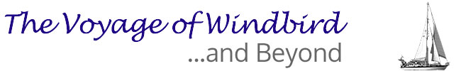
Location: Coinjock, NC, Mile 49.5 on the Intracoastal Waterway
This afternoon we arrived at the dock in Coinjock with a big CRUNCH—literally. The marina staff asked us to dock in a 60 foot space between two huge sport fishing boats. I gave the wheel to Mark because I knew I couldn’t do it. He tried, but neither of us understood just how strong the current was here. Mark gave it his best shot, but the current pushed us against the first sport fishing boat and there was nothing I could do to fend us off. The current was pushing onto the boat. The stanchion by our exit gate was rubbing against the other boat’s rub rail so hard it was bending our stanchion backwards. The guys onboard came out and helped push us off and we pulled up to the dock at a different spot where we didn’t have to ‘parallel’ park. I really didn’t think we had damaged the sport fishing boat at all as I was standing there watching the whole thing happen while trying to push us off. Their rub rail was metal and it didn’t look damaged by our encounter. But there was a scrape in their gel coat just under the same place where our stanchion got into a battle with their rub rail. They were insistent that our rub rail scraped their hull. They said they would rather settle for cash rather than go through the insurance process and they wanted $200. Our rub rail had no white paint on it and because their rub rail was almost like a wing sticking out from their boat, I honestly don’t think we caused the scrape in their gel coat. But what to do? We paid the $200 and then went out to dinner in the marina restaurant. It has been an expensive day!
In addition to being expensive, there were also some challenging moments. At 8:30 am Mark was sitting in the cockpit and I was downstairs getting breakfast together. We knew the bridge didn’t open until 9 am, so we had time to relax. Wrong. All of a sudden Mark yelled down to tell me the bridge was opening. He started the engine and jumped off the boat and onto the dock to untie the lines. I got behind the wheel and took off. He jumped onboard and we made it through the bridge before they closed it. Phew! A couple of workmen in hardhats were in a small rowboat going from the marina over to the bridge. I think the opening was for them to do some work, but it gave us a chance to get away before the crowd of boats that we knew would be there at 9 am. It was a challenging moment, but we made it. Things then went along smoothly all morning. We had periods of rain, but each time the rain passed quickly. Then in the afternoon we had torrential downpours with 25 to 35 knot winds. You could see absolutely nothing. This was another challenge. Thank goodness for electronic navigation. We had to navigate just by looking at the screen and hoping it was right on. I don’t mind being out in the ocean in blinding rain, but in the small quarters of the Intracoastal Waterway, it is a bit scary. Once, just as one of the torrential storms ended, I looked beside us to see a beautiful motor cruiser passing us. As I was admiring its beauty, I saw it was from Woods Hole. I had never seen this boat before, so Mark called to inquire. The captain explained that indeed the boat is from Woods Hole, but that they keep it at ‘the big house’ on Penzance Point, not in the harbor. Ahhh. Penzance Point is a small gated community in Woods Hole where the very wealthy, mostly from New York, have summer homes. People often laugh about the fact that the small peninsula might sink from all the money out there. Next summer we’ll look for the Eagle in Woods Hole.
The weather has settled some this evening and it is supposed to be sunny tomorrow with very little wind. We are jammed in like sardines on this dock tonight, so we will have to wait for either the boat in front or in back of us to leave in the morning before we attempt a get away. But at some point, we will continue on and hope to have a calmer day tomorrow.
by Judy Handley | Oct 14, 2014 | Passage to SC, Sailing Logs Year 10 |
Day 4, Year 10: Made It to Norfolk and Beyond
Date: Tuesday, October 14, 2014
Weather: Mostly Sunny with Temps in the 70’s (felt HOT), Winds SE 20
Latitude: 36 43.435 N
Longitude: 076 11.247 W
Miles Traveled: 419 Nautical Miles
Location: Chesapeake, VA, Mile 15.2 on the Intracoastal Waterway
We made it! We arrived in the ship’s channel leading into Norfolk at daybreak and tonight we are side-tied to a dock at the Centerville Waterway Marina in Chesapeake, Virginia at Mile 15.2 on the Intracoastal Waterway. Last night our beautiful sailing came to an end when the winds turned further to the S and we had to motor into them in order to reach Norfolk this morning. It was like riding a bucking bronco. But when the sun came up and the skies were bright blue, the bad memories from the rough night faded. Later in the day we had a bit of problem when we reached our final destination for the day, but we worked our way around that problem as well. We had hoped to make it through the Great Bridge lock and bridge, and then tie to a free dock for the night. But as we exited the locks, one of the workers called out to us that the free dock was under construction and no one could tie to it. What to do? There was a catamaran, two motor yachts, and three sailboats that went through the locks with us and none of us had a place to go. The marina across from the free docks was full except for very expensive slips “out back”. I was not willing to pay the price, but you really can’t anchor in the waterway. In a very tight space with lots of boats jockeying about, we looked in our books and on Mark’s tablet and found that there was one more marina just a couple of miles away. But while we were looking we were evidently slowing down the sailboat behind us and he was yelling at us to get a move on. But we still took time to call the other marina and to find out they had room for us for half the price of the other one, so we moved on. We are side-tied to a dock right next to the very busy and the very noisy Centerville Turnpike Bridge. And there is constant air traffic noise above us from the Naval Auxiliary Landing Field in Fentress, a part of the city of Chesapeake. According to Wikipedia, this landing field supports day and night Field Carrier Landing Practice operations by US Navy and Marine Corps. We are hearing Hornets, and Super Hornets, Hawkeyes and Greyhounds overhead. Sam and Jonah would love this. The sounds could be annoying, but we are just so happy to have a place to stay that didn’t cost an arm and a leg that we have no complaints. Once we settled in, we checked Active Captain to see if there was any place interesting to walk to, but we found nothing. The woman in the marina office, however, told us there was a sushi restaurant just a little walk over the bridge. She didn’t mention that you take your life in your hands walking across that narrow bridge with the constant traffic and that you then have to walk about a mile with the busy highway on one side of you and a swamp on the other side to get there. But we made it and the little sushi place in a strip mall was fantastic! And I forgot to mention that the price for diesel fuel here was the lowest we’ve seen for quite some time. So as they say, all is well that ends well. It was a day with ups and downs, but the end made it all worth it. And now we are sitting in the cockpit, me on my computer and Mark reading, listening to the deafening sounds of the bridge and the aircraft overhead . . . but there is lovely breeze and it is very warm. And we are in the Dismal Swamp and there are no mosquitoes. Once again, life is good.
by Judy Handley | Oct 13, 2014 | Passage to SC, Sailing Logs Year 10 |
Day 3, Year 10: Passage to Norfolk, Virginia, Day 3
Date: Monday, October 13, 2014
Weather: Overcast, Clearing in PM, Temp in the 70’s, Winds SE to S 15 to 20
Latitude: 37 46.404 N
Longitude: 075 15.399 W
Miles Traveled: 318 Nautical Miles
Location: Offshore SE of Chincoteague Inlet, Delmarva Peninsula
Our decision to head directly to Norfolk was a good one. We are beating into SSE winds but the seas are fairly calm and it is a good ride. The wind was SE overnight and earlier in the day putting us on a beam reach. The sailing has been great. And the forecast for strong southerly winds in the Chesapeake Bay over the next couple of days would have made getting down the Bay difficult. We will be in Norfolk sometime tomorrow morning and try to make it to our first stop on the Intracoastal, Great Bridge, for the night.
I know Mark is loving being out here. He always loves being at sea. But I am continually surprised at how much I love it. From the beginning, I have been a reluctant sailor with no real desire to sail. But once you get me out here, I love, love, love it. I complain when it is really rough, but I never want to go back. On this trip, Mark and I both have found ourselves just staring out at the water for long periods of time. I know both of us are thinking that we would just like to sail on offshore to South Carolina, but then we would have to go around Cape Hatteras with the Gulf Stream coming up from the south and stronger south winds on the way. Not a good idea. But it is tempting. Mark and I seem to immediately adjust to our three hours on, three hours off overnight schedule, and we nap during the day. So we are never really tired on passage. It is a special time for us. And this trip has been blessed by the light of moon every night. Love that moon light.
This morning Mark made radio contact with Lee Kaufman in Little River. They have been trying for three days to get a good radio connection and this morning’s was the best. But just about the time Mark got off the radio I heard his phone and tablet dinging letting us know he had email. We were evidently close enough to Ocean City, Maryland to have a good phone signal. I was able to use the hot spot to connect my computer to the internet and check the website. It is back up and running and I posted the logs from the past two days. We had sent them to the site through Ham email, but somehow they were not posted. Once we are in the waterway, we will probably have cell service again and will once again be able to post daily logs via the internet. At least I hope that is the case.
Hope everyone enjoyed Columbus Day. We all know the little ditty, “In fourteen hundred and ninety-two, Columbus sailed the ocean blue.” I want to write a new ditty, something like, “In twenty hundred and ten plus four, Mark and Judy sailed over the ocean floor.” Help me. My ditty sounds awful.
by Judy Handley | Oct 12, 2014 | Passage to SC, Sailing Logs Year 10 |
Day 2, Year 10: Passage to Norfolk, Virginia, Day 2
Date: Sunday, October 12, 2014
Weather: Glorious, Sunny Day, Temp in the mid-60’s, Winds NNE 5
Latitude: 39 21.428 N
Longitude: 073 46.848 W
Miles Traveled: 200 Nautical Miles
Location: 30 Miles Due East of Atlantic City, New Jersey, Sailing SW
We got an email from our friend Lee Kaufman who has been out on an Intracoastal Waterway excursion the past few days with his wife Lynda in their boat Sea Turtle. The email just said that for various reasons, they were heading home a day or so early. Lee just said, “Plans change, don’t they?” Yep, they do. Yesterday we were headed to Cape May to duck into the Delaware Bay and on through to the Chesapeake to avoid winds from the south. But this afternoon we rerouted and our heading directly to Norfolk. According to the GRIB files the winds will not be strong, just 10-15 from the SE and that should be fine since our course takes us SW. And who knows, we could get into the night and decide differently, but at this point, I think we are going for it as the weather forecast for the Chesapeake in the coming days doesn’t look great. This change means we will arrive at the entrance to the Chesapeake early on Tuesday morning and head directly to Norfolk and down the Intracoastal. We would have loved to have taken a leisurely trip down the Chesapeake visiting with friends, but we need to get to South Carolina so Mark can get his next cancer treatment as soon as possible. We figure we should go as far as we can as fast as we can while the weather is settled. And the weather report for the Chesapeake this week doesn’t look great. Right now it is a little too settled as we are motoring with just 5 knots of wind, but we had a great night and morning of sailing. The night was busy at times with brightly lit casino boats and fishing boats and even a few sailboats. This morning I could see three sailboats, but they were all in front of us and moving faster. We talked to one of the boats on the VHF radio and they said they were headed to Norfolk. I have a feeling we’re going to have some company in the inland waterway with sailboats headed south for the winter. We are obviously not the only snowbirds out here.
Mark and I are getting our sea legs. We still roll a bit with the wind behind us, but it is much calmer than yesterday. Last night I fixed Shepard’s Pie for dinner. I took the Pyrex baking dish out of the oven and put it on the stove top to cool a bit. I thought it was calm enough that I could leave it there while I went to the bathroom, but I returned to find the glass baking dish in the floor of the galley. It had hit so hard that part of the pie was on the floor and all over the louvered door under the sink. But at least the baking dish didn’t break. We were able to save most of the pie that was thrown out, but what a mess to clean up. Yuck! A hard reminder that you never, ever leave anything sitting on the counter while underway. So that was the low point of yesterday. The high point was the wonderful moonlight that we had overnight. The overcast skies cleared after sunset and the moon guided us. It was beautiful.
by Judy Handley | Oct 11, 2014 | Passage to SC, Sailing Logs Year 10 |
Day 1, Year 10: Passage to Cape May, New Jersey, Day 1
Date: Saturday, October 11, 2014
Weather: Overcast and Rainy, Temp in the low-50’s, Winds NE 15-20
Latitude: 40 51.648 N
Longitude: 071 30.998 W
Location: 17 Miles Due South of Block Island, Sailing WSW
Miles Traveled: 60 Nautical Miles
Here we are rolling our way south. We had wind from ESE all morning which put us on a port tack with seas on the port quarter. We were rolling, sometimes very violently. That plus the rain and the cold were making for a fairly miserable day. But mid-afternoon the winds went to the NE putting both the wind and seas directly behind us. We poled the headsail out to port and we are still rolling but it is much gentler. And we can now sail the rhumb line. Downwind sailing is not my favorite as something about the rolling motion affects me more than other movements. I find it hard to stay below for more than a few minutes unless I’m sleeping. But I’ll settle in. It just takes a few hours to get back into the passage mode. The rain has stopped and it actually feels a bit warmer. And we’ll hope for a sunny day tomorrow.
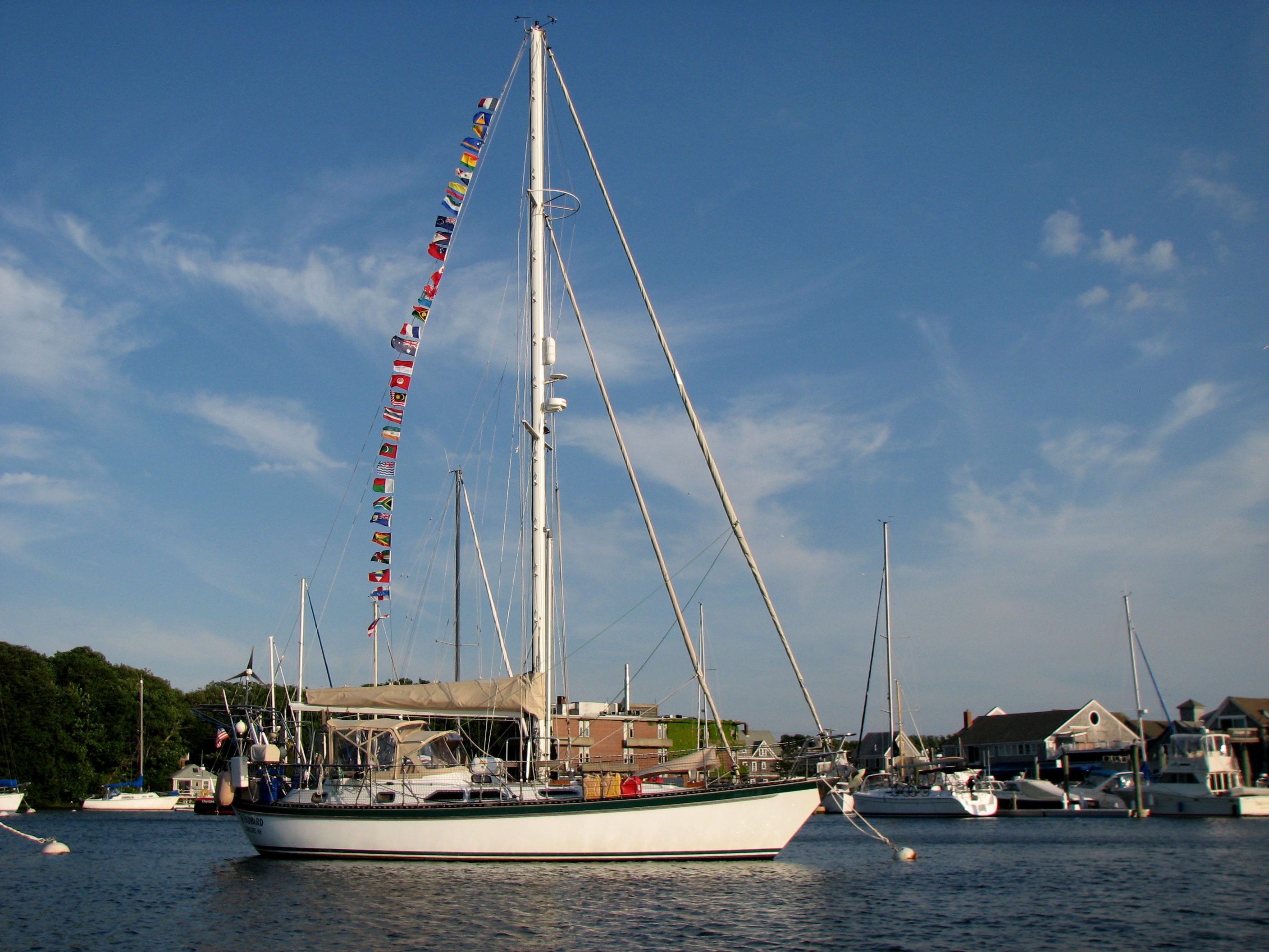
We are back to Day 1, this time for Year 10 of the Voyage of Windbird. Years 1-6 were spent circumnavigating the globe. Year 7 was land-based in New England. Year 8 started just like this new year with a sail to South Carolina for the winter. Year 9 was again land-based in New England. And who knows where Year 10 will take us. But wherever, we’ll enjoy our time once again cruising on Windbird.