by Judy Handley | Oct 20, 2014 | Passage to SC, Sailing Logs Year 10 |
Day 10, Year 10: ICW–Camp Lejeune, NC to Carolina Beach, NC
Date: Monday, October 20, 2014
Weather: Sunny, Warmer Again (70’s F daytime), Winds NE to SE 5-10
Latitude: 34 02.990 N
Longitude: 077 53.347 W
Total Miles Traveled: 666 Nautical Miles
Miles Traveled Today: 44 Nautical Miles
Location: Anchored in Carolina Beach, NC, ~Mile 295 on the ICW
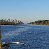
Lovely day! The sun was shining, the skies were blue, and the temperature was a bit warmer than yesterday. It looks like it will be warm again tomorrow and then on Wednesday we will get a bit of a drop for a few days. That New England weather is bound and determined to follow us, but as long as the sun is shining, we’ll be happy. We were on constant watch today for shallow shoaling areas, but thankfully we had no more bottom ‘bumps’. And we traveled through absolutely beautiful country. I think this is definitely the most beautiful part of the Intracoastal between here and Norfolk. In most areas, the salt marsh goes on forever without a lot of development in sight. There are lots of inlets with sand dunes and the salt marshes are punctuated by little white sand beaches. In other areas, particularly around Wrightsville Beach, the homes lining the waterway are also quite a sight—lots of people with lots of money. The homes are huge and the landscaping is beautiful. But my favorite home on the ICW is one we passed today that is painted a flamingo pink. It has palm trees and its own flamingo pink lighthouse. It even has a half sunken crab boat out back. When I see this house, I know it is a definite sign that we are moving south.
But travel today was really all about bridges. We timed our departure time to arrive at the first bridge at 11 am. This was the Surf City swing bridge that opens only on the hour. But the current was with us and gave us an unexpected boost and by pushing the RPM’s a bit, we made it for the 10 am opening. But things went downhill from there. We just missed the 12 noon opening of the Figure Eight swing bridge and turned circles waiting for the 12:30 opening. We then had only 5 miles to go to the Wrightsville Beach bascule bridge, but it opens only on the hour. So we turned the RPM’s way down and very s-l-o-w-l-y made it there for the 2 pm opening. There are no bridges on our travels from here to Little River tomorrow, and our friend Lee Kaufman wrote to tell us that the shallow areas in the ICW between here and there have been dredged are no longer a threat. So we will stay inside the waterway. The winds outside tomorrow will be light and from the wrong direction, so there is no advantage to going outside. We should arrive in Little River at Lightkeepers Marina sometime between 3 and 5 pm, depending on current and boat speed. We are excited to see my sister Patsy and brother-in-law Joe and our friends Lee and Lynda Kaufman. We called them this evening and proposed that we meet on the dock and then all go out to dinner together tomorrow night to celebrate. Can’t wait.
And I totally forgot to mention one of the more ‘interesting’ experiences we had today. We were crossing the Masonboro Inlet, which is one of those places you need to watch for shoaling. And all of a sudden we were in the middle of group of boats that were shooting scenes for a video, movie, something. There was one boat with a camera on a crane focused on another boat, and then other small boats all around. From a distance, we assumed they were just boats traveling in our direction on the waterway, but once we were in their midst, we saw that they were moving VERY slowly and other boats were coming at us, looking at the camera boat and not at us, and they almost hit us. Phew! We were sure glad as we moved on and they stayed behind shooting their movie or whatever. And when I looked up the Masonboro Inlet on Google, I found out that it was used as a hideout by Confederate blockade runner during the Civil War. You just never know.
by Judy Handley | Oct 19, 2014 | Passage to SC, Sailing Logs Year 10 |
Day 9, Year 10: ICW—Morehead City, NC to Camp Lejeune, NC
Date: Sunday, October 19, 2014
Weather: Sunny, but Cooler (60’s F daytime), Winds NNW 10-15
Latitude: 34 33.065 N
Longitude: 077 19.484 W
Total Miles Traveled: 622 Nautical Miles
Miles Traveled Today: 35.9 Nautical Miles
Location: Anchored in Mile Hammock Bay, Camp Lejeune, NC, ~Mile 244.5 on the ICW
Cool New England weather seems to have followed us here. The days have been so beautiful with not a cloud in the sky, but the temp today was only in the mid-60’s and tonight it will be in the low-50’s or possibly only the upper-40’s. During the day the sun warms up the cockpit so that we don’t need to wear jackets, but people on boats that pass us that don’t have a cockpit enclosure are all wearing heavy jackets. When we got to Norfolk we put the down comforter away, but tonight we will get it out again. Hopefully this cool weather is going to be short-lived.
Today was a short one as the next possible anchorage was just too far for one day. We pulled into Mile Hammock Bay here in the 246 square-mile Camp Lejeune Marine Base. As you come down the waterway, it seems to go on forever. I read that the base has 14 miles of beaches and on the land side of the waterway, those 14 miles are salt marsh with danger signs posted everywhere to let you know that there are unexploded ordinances—so no going ashore here. The Intracoastal from Morehead City to here (and a little beyond) is challenging in that there are shoaling areas that constantly move and are there now always marked. We bumped the bottom twice today, but Windbird just kept on going. Tomorrow morning there will be another stretch of tense navigation. This boat is as big as you would want to transit the Intracoastal. The fixed bridges are just barely tall enough to accommodate our mast height and our depth of 6’3” is just a little too deep for comfort. We made it just fine, but you really can’t just sit back and relax. We are contemplating going outside for the last leg on Tuesday from Southport to Little River Inlet. If we stay inside, there are two more places where we could go aground. So winds and seas permitting, we’ll go outside and sail.
A quick wildlife report . . . Yesterday we saw our first porpoises and today we saw the first pelicans. So despite the cool temps, the bird life indicates that we are really moving south. We talked on the phone to our friends Linda and Mike Stuart who are biking south and they are now in alligator territory. I prefer pelicans!
by Judy Handley | Oct 18, 2014 | Passage to SC, Sailing Logs Year 10 |
Day 8, Year 10: ICW—Bay River, NC to Morehead City, NC
Date: Saturday, October 18, 2014
Weather: Sunny and Warm (70’s F daytime), Winds SW 10
Latitude: 34 43.097 N
Longitude: 076 42.835 W
Total Miles Traveled: 587 Nautical Miles
Miles Traveled Today: 40 Nautical Miles
Location: Anchored Behind Sugar Loaf Island, Morehead City, NC, ~Mile 205 on the ICW
Exactly nine years ago today we pulled out of our slip at Shipyard Quarters Marina in Boston and headed around the world. We called our adventure the Voyage of Windbird (VOW) and what an adventure it has been. The last three years have been spent back home here in the United States. We haven’t been sailing to faraway ports, but we have spent wonderful times with family watching grandchildren grow. And that in itself is quite an adventure. When I did a quick review of where we were on October 18th of each year, this is what I found.
2005 . . . our friends Kevin and Claire were on the dock before sunrise to hand us our lines as we set sail for Quissett Harbor on Cape Cod, our first stop in our ‘round the world adventure. In 2006 . . . we were on Ano Beach on the island of Neiafu in Tonga enjoying a traditional Tongan feast. 2007 . . . we were off on a walking tour of the city of Noumea in New Caledonia and a year later in 2008 . . . we were on the first day of a passage from Belitung in Indonesia to Singapore. The next day we would cross the equator from south to north. 2009 . . . home from Southeast Asia for the birth of two grandsons, Ziggy Milo and Jonah Biggs and on October 18 we were walking on the beach in South Carolina with friends Kevin and Claire (they keep popping up on this date). 2010 . . . the third day of passage from Madagascar to South Africa with afternoon squalls. We completed our circumnavigation in 2011when we returned to Cape Cod and on October 18 of that year we made a visit to our upcoming winter home, Fiddler’s Cove Marina in North Falmouth, Massachusetts. 2012 . . . on a blustery October 18th we were moving Windbird from a mooring to the dock in Eel Pond to get ready for our impending departure south for the winter. Heather, Jed, Ollie, Jonah, and Jed’s parents Marti and Donald were on the dock to catch our lines. 2013 . . . a plan to sail south was thwarted due to a return of Mark’s cancer. So we decided to spend the winter hanging out with Ollie. On October 18th of 2013 he was putting on a show for us by dressing in mommy’s top and daddy’s shoes. And that brings us to tonight, here at anchor just off the Intracoastal Waterway. 2014 . . . Kevin and Claire showed up again. This time it was a phone call. They called from their boat Merganser in the Rappahannock River to say hello. And we also had Skype video calls with Heather and Jed, Justin and Jo, and got to see and talk to all five grandchildren. What a perfect ‘Voyage of Windbird’ celebration.
Mark and I struggled with where to spend this night in the Intracoastal. Today we left the swamps and headed out to the coast to the salt marshes. Anchorages in this part of the Intracoastal are often too shallow for Windbird. It was almost 85 miles from last night’s anchorage to the next deep water anchorage, and we weren’t interested in trying to make that many miles in one day. So we opted for a shorter day with a few possibilities for anchorages. We read about the first one on Active Captain, but when we got to the spot, we looked at each other and said, “No.” It was just out in an open area on the backside of Morehead City with its sprawling industrial complex for a view. I told Mark that life is just too short to put up with ugly anchorages, so we traveled on. The next possibility was a spot just right next to the waterway that runs between the waterfront in Morehead City and a little undeveloped island called Sugar Loaf. Again, we read about this on Active Captain, and when we got to the spot, we were unsure. There was a huge amount of boat traffic and not a very big spot in which to anchor. But we went for it and so far, so good. The tidal current runs fast here and Windbird heads one way for a couple of hours and then changes direction. And we have the music coming from the bars on the waterfront to entertain us. Now what more can one ask for?
by Judy Handley | Oct 17, 2014 | Passage to SC, Sailing Logs Year 10 |
Day 7, Year 10: ICW—Alligator River, NC to Bay River, NC
Date: Friday, October 17, 2014
Weather: Sunny and Warm (70’s F daytime), Winds SW 2-12
Latitude: 35 11.761 N
Longitude: 076 35.523 W
Total Miles Traveled: 547 Nautical Miles
Miles Traveled Today: 50 Nautical Miles
Location: Gale Creek Point, Bonner Bay off Bay River, NC, ~Mile 160 on the ICW
Evidently Tropical Storm Gonzalo turned into Hurricane Gonzalo and gave Bermuda a bit of a pounding. That system is keeping a high pressure system stationary which is giving the mid-Atlantic area (where we are) dry, absolutely beautiful, sunny weather with almost no wind. Normally having very little wind is not a good thing for a sailboat, but when you are motoring on the ICW (Intracoastal Waterway), it is great. Tomorrow we will travel to the Beaufort-Morehead City area where only a thin strip of land will separate us from the ocean that will be pounding the outer shores due to Gonzalo. But we should feel no effect from that at all—just continued lovely weather for transiting the ‘ditch’.
Today I felt like I was in a parade. We slept in and didn’t get started until after 7:30 am. There were no boats left in our anchorage, but there were three boats right in front of us as we entered the canal and four boats right behind us. And it continued that way all day. But some boats went faster and some went slower and tonight we are in a lovely anchorage with only one other boat. This anchorage is totally exposed and wouldn’t be so lovely with stronger winds, but we are enjoying the settled conditions and the last of swamp land scenery. We spent this evening trying to figure out the best way to proceed from here. The places with good anchorages are few and far between, so we are going to think about the choices overnight and make a decision once we get started in the morning. Wouldn’t want to plan too far in advance!
by Judy Handley | Oct 16, 2014 | Passage to SC, Sailing Logs Year 10 |
Day 6, Year 10: ICW-Coinjock, NC to Alligator River, NC
Date: Thursday, October 16, 2014
Weather: Sunny and Warm, Winds SW 10 to 15
Latitude: 35 40.373 N
Longitude: 076 05.580 W
Total Miles Traveled: 497 Nautical Miles
Miles Traveled Today: 48 Nautical Miles
Location: Tuckaho Point, Alligator River, NC, Mile 104 on the Intracoastal Waterway
The weather today was just perfect making for a most enjoyable day. Tonight’s anchorage is a new one to us. It is only a mile or so from another anchorage we have used, but it has a character all its own. When you are in swamp country, you have to look at the details to see any differences, but they are there. We had a good day crossing the Albemarle Sound, but we didn’t get to sail as the wind was on the nose all day. We left the dock at the Coinjock Marina at 7:15 am, but we were just about the only boat left on the dock. I guess everyone else was in a bigger hurry than us. But then, the other boats were all motor boats except for one sailboat (named Coco) and they get going early, go fast, and put many miles under their belts each day.
We left Coinjock and wound our way through swamp country for a about three hours before entering the Albemarle Sound. It took another three hours to cross the Sound. We had to wait a very short time to get through the Alligator River Swing Bridge and then it was another three plus hours of motoring to transit the Alligator River. Our anchorage tonight is within sight of the entrance to the Alligator River-Pungo River Canal, a very narrow 20 mile long canal that we will transit tomorrow morning and then on into the Pungo and Pamlico Rivers. This will mean more motoring. In fact, we don’t expect to get to sail for the entire ICW trip to Little River. But we take turns being on watch and just enjoy the days. There are about ten sailboats anchored within two miles of us tonight. And there are quite a few motor yachts headed south. But the anchorages are not too crowded, so that is good.
We have been very pleased with the performance of the new heading sensor that Mark installed before we left. We have been able to use the auto pilot for the entire trip so far. In the past, when we were in the narrow confines of some of the canals, we had to hand steer because the auto pilot had us swinging from side to side. The heading sensor, at least so far, keeps us nicely on the straight and narrow. The other new addition, using a tablet for navigation with Plan2Nav software and C-Map charts is also working nicely. The one problem is that the tablet needs to be recharged every four hours. We don’t have a power source for it in the cockpit, so when it comes below to be charged we fall back on our old C-Map and NOAA charts on Open CPN. That is not nearly as satisfactory, so we have to get power to the pedestal for the tablet. In the meantime, we will just switch back and forth and make do.
by Judy Handley | Oct 15, 2014 | Passage to SC, Sailing Logs Year 10 |
Day 5, Year 10: Intracoastal Waterway—Chesapeake, VA to Coinjock, NC
Date: Wednesday, October 15, 2014
Weather: Overcast, Periods of Torrential Rain, Winds S 15-20, Sometimes 25-35
Latitude: 36 20.906 N
Longitude: 075 56.944 W
Total Miles Traveled: 419 Nautical Miles
Miles Traveled Today: 29.5 Nautical Miles
Location: Coinjock, NC, Mile 49.5 on the Intracoastal Waterway
This afternoon we arrived at the dock in Coinjock with a big CRUNCH—literally. The marina staff asked us to dock in a 60 foot space between two huge sport fishing boats. I gave the wheel to Mark because I knew I couldn’t do it. He tried, but neither of us understood just how strong the current was here. Mark gave it his best shot, but the current pushed us against the first sport fishing boat and there was nothing I could do to fend us off. The current was pushing onto the boat. The stanchion by our exit gate was rubbing against the other boat’s rub rail so hard it was bending our stanchion backwards. The guys onboard came out and helped push us off and we pulled up to the dock at a different spot where we didn’t have to ‘parallel’ park. I really didn’t think we had damaged the sport fishing boat at all as I was standing there watching the whole thing happen while trying to push us off. Their rub rail was metal and it didn’t look damaged by our encounter. But there was a scrape in their gel coat just under the same place where our stanchion got into a battle with their rub rail. They were insistent that our rub rail scraped their hull. They said they would rather settle for cash rather than go through the insurance process and they wanted $200. Our rub rail had no white paint on it and because their rub rail was almost like a wing sticking out from their boat, I honestly don’t think we caused the scrape in their gel coat. But what to do? We paid the $200 and then went out to dinner in the marina restaurant. It has been an expensive day!
In addition to being expensive, there were also some challenging moments. At 8:30 am Mark was sitting in the cockpit and I was downstairs getting breakfast together. We knew the bridge didn’t open until 9 am, so we had time to relax. Wrong. All of a sudden Mark yelled down to tell me the bridge was opening. He started the engine and jumped off the boat and onto the dock to untie the lines. I got behind the wheel and took off. He jumped onboard and we made it through the bridge before they closed it. Phew! A couple of workmen in hardhats were in a small rowboat going from the marina over to the bridge. I think the opening was for them to do some work, but it gave us a chance to get away before the crowd of boats that we knew would be there at 9 am. It was a challenging moment, but we made it. Things then went along smoothly all morning. We had periods of rain, but each time the rain passed quickly. Then in the afternoon we had torrential downpours with 25 to 35 knot winds. You could see absolutely nothing. This was another challenge. Thank goodness for electronic navigation. We had to navigate just by looking at the screen and hoping it was right on. I don’t mind being out in the ocean in blinding rain, but in the small quarters of the Intracoastal Waterway, it is a bit scary. Once, just as one of the torrential storms ended, I looked beside us to see a beautiful motor cruiser passing us. As I was admiring its beauty, I saw it was from Woods Hole. I had never seen this boat before, so Mark called to inquire. The captain explained that indeed the boat is from Woods Hole, but that they keep it at ‘the big house’ on Penzance Point, not in the harbor. Ahhh. Penzance Point is a small gated community in Woods Hole where the very wealthy, mostly from New York, have summer homes. People often laugh about the fact that the small peninsula might sink from all the money out there. Next summer we’ll look for the Eagle in Woods Hole.
The weather has settled some this evening and it is supposed to be sunny tomorrow with very little wind. We are jammed in like sardines on this dock tonight, so we will have to wait for either the boat in front or in back of us to leave in the morning before we attempt a get away. But at some point, we will continue on and hope to have a calmer day tomorrow.