by Judy Handley | Nov 20, 2012 | Passage to South Carolina, Sailing Logs Year 8 |
Day 17, Year 8: ICW Mile 311 to Mile 346, Southport to Little River
Date: Tuesday, November 20, 2012
Weather: Partly Sunny, N Winds 10-15
Latitude: 33 51.753 N
Longitude: 078 38.325 W
Location: Lightkeeper’s Marina in Coquina Harbor, Little River, SC
We made it! In 17 days we covered 888 miles-one day at a time. We could
have made this in five to seven days if we could have gone offshore, but
with the weather we had, we’re just thankful we made it safely and in time
for Thanksgiving. Our friends Lee and Lynda arrived at the boat early this
morning and Lee and I switched places. I drove to Little River with Lynda
and Lee helped Mark with the last leg of the trip. Lynda dropped me off at
my sister’s house and we launched into doing some of the prep work for
Thanksgiving dinner. It was great to see Lee and Lynda and my sister and
brother-in-law. Mark and I are really looking forward to our visit here
over the next few weeks. Mark called when he and Lee were about an hour
from the marina in Little River so that Lynda and I could go to the marina
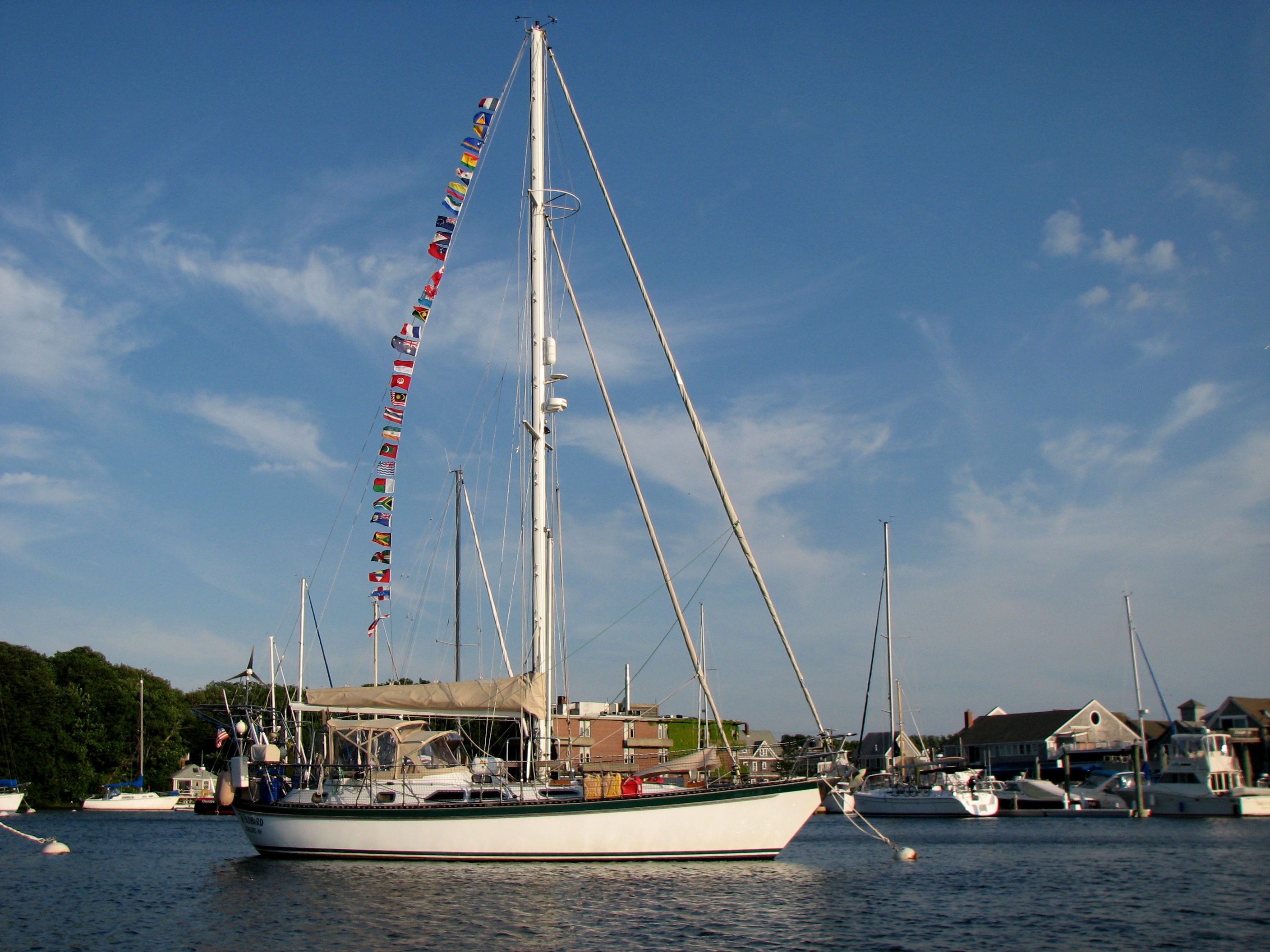
to catch lines when they arrived. Windbird looks happy in her new home and
now Mark and I will turn our full attention to getting the big Thanksgiving
dinner ready. Some family arrived today and more family and friends will
arrive tomorrow. The next three days will be filled with family, friends,
food, and fun. It should be a Happy Thanksgiving.
by Judy Handley | Nov 19, 2012 | Passage to South Carolina, Sailing Logs Year 8 |
Day 16, Year 8: ICW Mile 283 to Mile 311, Wrightsville Beach to Southport
Date: Monday, November 19, 2012
Weather: Overcast and Windy, but NO Rain; Winds N 20 with Higher Gusts
Latitude: 33 55.263 N
Longitude: 078 03.683 W
Location: Intracoastal Waterway, Mile 311, Southport, NC
Our day was shorter than usual. We left Wrightsville Beach and 7 am and
were tied up to a T-dock in the South Harbor Village Marina in Southport by
11:30 am. We decided to play it safe and transit the next two inlets on a
rising tide tomorrow morning as recommended in the cruising guide. So we
stopped at the last marina. It was an easy stop after a rowdy ride through
the Cape Fear River. We had wind against current and it was a bit like I
think it would be in a washing machine. But at least getting into the
marina was easy. All we had to do was make a right turn off the ICW, enter
the marina, turn the boat around, and tie to a T-dock. The marina manager
was on the dock to catch our lines, so even with the wind and current we
made a smooth landing. I washed down the outside of the boat and then we
spent our afternoon doing laundry, taking showers, and taking a nice walk.
I needed to cut Mark’s hair, so we took a chair from the marina complex and
put it out on the lawn between the marina and a restaurant and bar next
door. I’m sure we provided great entertainment for the people in the
restaurant, but cutting hair on the lawn and letting it fly away sure beats
cutting it on the boat and having to vacuum up hair for days. We are now
ready for our final day in this transit from Cape Cod to South Carolina.
Tomorrow night we hope to be tied to a dock in Lightkeeper’s Marina in
Little River that will be our home for the next two months.
Traveling through the Intracoastal Waterway has been an interesting
experience. We did this same trip in the late 1990’s in our previous boat,
Sky Breaker, but it was early summer and the weather was quite different.
But there are certain things that are the same. In the past few days, we
have left the quiet solitude of the North Carolina marshlands and have
entered vacation land. We are now seeing shrimp boats, palm trees, low sand
dunes fringed with little sandy beaches, vacation homes in pastels and vivid
colors associated with the tropics, and more pelicans and porpoises. We
have also met positive and then negative currents that change direction with
every inlet from the sea. So you go slow with the negative current and then
fast with the positive. It is a little disconcerting not to know when the
current will change, but in the end, it all evens out. We have seen boats
with the most interesting names and met some fellow adventurers. While
doing laundry this afternoon we met a young man with three crew members
headed to Panama to go surfing. This adventure trip has been six years in
the making and they are so excited to be on their way. For just a moment,
Mark and I both thought, “Wouldn’t it just be easier to fly to Panama to go
surfing?” But then we looked at each other and knew that if it were us with
the surfing dream, we would be sailing there as well.
We still have the wind, but today we didn’t have to deal with the rain. For
that we are thankful. Still, it takes the full attention of both of us to
keep on course. I regret that I have not been able to be out on deck to
take photos and video of the pelicans, dolphins, and porpoises. But we have
enjoyed seeing them nonetheless. The pelicans are particularly fun to
watch. They seem to fly in pairs just above the surface of the water. They
remind me of fighter jets doing a reconnaissance mission. Sometimes they
land right beside or in front of the boat. Today I was sure I was going to
hit one, but she escaped by paddling her feet just a little harder. And I
love watching them on take-off. They slowly flap their wings, rise out of
the water with their feet still lingering below them, stretch out their
necks, and then rise into the air. Mark calls them Pterodactyls and I have
to agree that they look like something from prehistoric times.
We are going to dinner at a little Italian restaurant here at the marina
complex tonight. We were told that it gets quite crowded by 7 pm, so I will
stop here and go to dinner.
by Judy Handley | Nov 18, 2012 | Passage to South Carolina, Sailing Logs Year 8 |
Day 15, Year 8: ICW Mile 244 to Mile 283, Camp Lejeune to Wrightsville
Beach
Date: Sunday, November 18, 2012
Weather: Overcast and VERY Rainy and Windy; NE 20-30, Gusts Higher
Latitude: 34 12.431 N
Longitude: 077 47.963 W
Location: Intracoastal Waterway, Mile 283, Wrightsville Beach, NC
Oh, the best laid plans. They can go awry and the weather can make that
happen, and that did happen to us today. We couldn’t leave Camp Lejeune
until we had good light because the wind was howling and we didn’t want to
have an ‘incident’ while bringing up the anchor. Then we had difficulty
getting the anchor up and got delayed by 15 minutes. That 15 minutes cost
us an hour and a half of time over the course of the day due to the bridge
opening times. We missed the first opening by 10 minutes and had to wait 50
minutes for the next opening. The day then went downhill from there. We
have had pouring rain and winds in the 20 to 30 knot range with gusts to 35.
There were periods when the wind was only 10-15, but those periods were
short and far between. We got to Wrightsville Beach and got through the
last bridge at 2 o’clock. We made the decision to head on to Carolina Beach
which we would reach at 5 o’clock with favorable tide. We got a couple of
miles south and realized that with the negative current and driving rain
that we were not going to make Carolina Beach before dark. At that point we
turned around and headed back to Wrightsville Beach. We called all of the
marinas that we could afford and they were full, so we had to go through
Motts Channel to an anchorage between the town and the actual beach. We had
read that Motts Channel has lots of shoaling and we were a bit nervous, but
we made it just fine. We are in an anchorage with a number of other boats,
but we feel like we are securely anchored. We thought that last night and
yet we dragged a bit, but we have had high winds since we arrived with gusts
to 35 and we haven’t moved. Mark had to get up very early this morning to
do anchor watch, so hopefully he won’t have to do that tonight.
Our other ‘event’ of the day was our little bump-bump-bump-bump across
shallows in the New River Inlet just after leaving Camp Lejeune this
morning. We followed what we thought we should be doing according to the
markings, but at 2.1 meters we hit the bottom. We then bounced a few times
while still moving slightly and then turned and got into deeper water.
Thankfully we avoided a call to Tow Boat US, but we did get online last
night and renewed our towing insurance.
Today’s delay probably means we will not reach Little River until Tuesday.
If the tide was with us all the way, we might be able to make it in 10 hours
tomorrow, but that would be leaving here at 6:30 am at dead low tide. We
are not sure we can get out of here at low tide, so we will just have to see
what the morning brings. In the meantime, we will sit here and listen to
the wind literally roaring all around us.
by Judy Handley | Nov 17, 2012 | Passage to South Carolina, Sailing Logs Year 8 |
Day 14, Year 8: ICW Mile 180 to Mile 244, Neuse River to Camp Lejeune
Date: Saturday, November 17, 2012
Weather: Partly Sunny and Windy; N 15-20, Gusts to 30
Latitude: 34 33.055 N
Longitude: 077 19.529 W
Location: Intracoastal Waterway, Mile 244, Mile Hammock Bay, Camp Lejeune,
NC
The transit of this ‘ditch’ just gets tougher. Today we headed out toward
the sea to Beaufort and Morehead City and then headed down the ICW with the
ocean sometimes visible far to our port across miles of marshlands. It is
beautiful country but we didn’t have time to enjoy it as one of us was
always at the helm and the other was constantly watching the paper and
electronic charts to make sure we were exactly on course. There is very
little margin of error here. So the dolphins and pelicans and other birds
didn’t get photographed today. And when we came to places where there are
inlets from the sea, the going got really tough. The sailboat in front of
us, Spunky, went aground in the Bogue Inlet. We were right behind them when
we saw them keep a floating red to the right and then return to an ICW green
on a pole and immediately go aground. The floating red was a marker for
those coming in from the sea and should have been ignored, but it was very
confusing. We had to go on past them but were relieved to see that they
were able to free themselves and continue on. About that time, I head a
boat named Sanderling calling someone asking for clarification on how to
negotiate a floating red and green in Brown’s Inlet ahead of us. The person
who answered the call told him to go ‘outside’ both marks. Sanderling
interpreted that to mean that he should go around the marks on the sea side.
Wrong. He was aground and had to call Tow Boat US. When we got to this
spot, Sanderling was no longer aground, but the three boats in front of us
slowed down and one called the dredge boat ahead for further clarification.
This time the man said to keep both the red and green to port and favor the
green. His directions were much clearer this time and we all made it
through just fine. We made it to our anchorage for the night but not before
we heard another call for Tow Boat US from a boat aground at the next inlet
at New River. That will be our first inlet tomorrow so we will just have to
hope that we make it through there. Our Tow Boat US insurance expired while
we have been on this trip. I remember getting the email when we were in
Chesapeake City. We took care of that as soon as we got into our anchorage
for the night. We got online and upped our level of insurance. We might
need it tomorrow morning.
Our new friends Bill and Cathy of New Wave got underway early this morning
and almost caught up with us. They are spending the night in Morehead City
and when we called them to tell them about the upcoming shallow spots, they
said they are laying over tomorrow and not moving again until Monday due to
the ugly weather forecast. Right now the winds are roaring and the forecast
for tomorrow is for a 70 per cent chance of rain and winds 25-30 with gusts
to 35. If it was just wind or rain it wouldn’t be so bad, but the
combination sounds really yucky. We’ll wait until in the morning to make a
decision, but we might have to lay over as well. The other option is that
we will leave but just not get quite as far as we had hoped. In any case,
the weather on Monday should be much better, so we will be able to get to
Little River-just maybe not until Tuesday. We shall see.
I talked with my sister today and made plans for our big Thanksgiving
dinner. And I also talked to Heather and Oliver. Jed, Sam, and Jonah were
in Boston for the Yale-Harvard football game, but Heather and Oliver stayed
home as Oliver now has the cold that Jonah had earlier in the week. It was
so much fun to hear Oliver babbling in the background. I just know I heard
him say, “Hello, Oma. I love you.” Sure miss that little guy.
by Judy Handley | Nov 16, 2012 | Passage to South Carolina, Sailing Logs Year 8 |
Day 13, Year 8: ICW Mile 102 to Mile 175+4, Alligator River to Neuse River
Date: Friday, November 16, 2012
Weather: Lovely Sailing Day–Partly Sunny and Windy; N 15-20
Latitude: 34 58.228 N
Longitude: 076 34.720 W
Location: Intracoastal Waterway, Mile 175+4, South River Off the Neuse
River, NC
Sunrise . . . sunset . . . has become our routine. We get up at 5:45 am
and have the anchor up by 6:15. The sun doesn’t pop up until 6:40, but
there is enough light to get underway. Then we tuck into some little
anchorage near the ICW by 5 pm. The sun sets right then but there is still
enough light for about 30 minutes to get things settled and go below for the
evening. If, with Windbird’s help, we can continue this for the next three
days, we will be in Little River on Monday (well before sunset). Tomorrow
we will make it to the Beaufort-Morehead City area and then head south down
the ICW to Camp Lejeune. This is a US Marine Corps reservation that borders
on the ICW and there is a dredged anchorage where they allow cruisers to
spend the night. The next night might have to be spent at a dock in
Southport as there are no anchorages listed in our guidebook, and then on
Monday we will head to Little River. This ICW travel is tough. There are
uncharted trees barely poking their nasty little heads above water and
shoals encroaching on the channel trying to ground you. And we continue to
have difficulty hand steering Windbird. Auto pilots don’t love downwind
sailing with strong winds so we switch off being at the wheel. But at least
Windbird is still chugging ahead. Our new friends Bill and Cathy weren’t as
lucky today with New Wave. Bill called saying they had a massive oil leak
and had to be towed back to the closest town of Belhaven. We passed by them
and felt terrible leaving them behind. But we did see the bright red tow
boat arrive to take them back to Belhaven. Bill called late this afternoon
at one of those moments when we had cell service and said that the mechanic
took the head off the engine and hoped to be able to make the repairs in
time for them to get underway tomorrow morning. Whew! The report of “lots
of oil” is never a good thing and can sometimes require major work, so we
are ecstatic that New Wave’s problem was on the minor side.
We’ve decided that North Carolina along the ICW is like a third world
country. All we have seen is marsh land and cell phone signals are VERY
spotty to non-existent. We did see a number of hawks today and were
welcomed to the Pamlico with a couple of bottle-nosed dolphins. But we are
once again without a cell signal, so tonight’s log will be sent via HAM
radio. If we take the phone up to the cockpit we have one bar and might be
able to make phone calls, but that is certainly not enough to allow us to
get on the internet. By tomorrow night we will back in civilization with
all the good and bad that brings, but that will allow us to internet service
once again and I will be able to post photos once again.
by Judy Handley | Nov 15, 2012 | Passage to South Carolina, Sailing Logs Year 8 |
Day 12, Year 8: ICW Mile 50 to Mile 102, Coinjock to Alligator River
Date: Thursday, November 15, 2012
Weather: Overcast, Breezy, and Cool; Winds NE 16-22, Calming to NE 14
Latitude: 35 40.535 N
Longitude: 076 04.732 W
Location: Intracoastal Waterway, Mile 102, Bear Point, Alligator River, NC
Today we were part of a parade of sailboats negotiating our way from Coinjock, across Albermarle Sound, through the Alligator River Swing Bridge, and into anchorages in the headwaters of the Alligator River just before the entrance to the Alligator River-Pungo River Canal. We are just off the waterway, and I mean JUST off, but we dare not go further in toward shore as it gets super shallow. We have had weather issues since leaving Cape Cod and now the tedium of negotiating the ICW where you dare not get even a few feet out of the channel without going aground in many places has made this a trip of tense days. And Windbird has not been liking the conditions either. We have been pushing the RPM’s to make bridge openings and going at the faster speeds just doesn’t agree with Windbird. She takes off to starboard and we have to steer with all our might to keep her on track. The auto pilot just can’t handle it. And then there is the problem of finding suitable anchorages. We had to do a short day yesterday and again today because the next possible stopping place would have brought us in well after dark. Let’s just say this is not the most relaxing trip we have ever embarked upon.
Meeting Bill and Cathy yesterday has proven to be a very good thing for us. Bill came knocking on Windbird at 6:15 am this morning with updates on today’s route that we needed to copy before taking off. Just before the Alligator River Swing Bridge, there is a very confusing spot where the charts are just wrong and many boats go aground. With Bill’s help, we made it through just fine. Then he helped us get off the dock which had worried both Mark and I all night long. We were wedged in between two trawlers and the wind was blowing us onto the dock. But with Bill’s help, getting off was easy. And then he found tonight’s anchorage for us. We have Dozier’s Waterway Guide which I am finding difficult to use. Bill and Cathy have something they call Captain Bobs’ guide and it seems to have much more information. The anchorage that we had chosen for tonight based on our guide has all kinds of things on the bottom to snag anchors according to Captain Bob. So Bill called with the recommendation of Bear Point. Thank you, Bill. He has also done his homework on where we might stop to overnight in the next few days. Right now Mark is working on the same thing and I have been reading the guide trying to digest all of the information. There are so many places along the ICW where you have to be very careful to not go aground and so few places deep enough for us to anchor. I think we are getting close to a plan that might get us into Little River on Monday afternoon, but the Captain needs more time to work on this. It would be helpful if we could talk easily with Bill and Cathy, but there is no phone service here, thus no internet. So we can’t share proposed routes by email. Talking on the radio is just too confusing, but hopefully sometime tomorrow we will be out of the swamp and back into phone range and will be able to confirm a plan. And since there is no internet, I had better stop here and see if we can get this log sent via HAM radio.