by Judy Handley | Jul 4, 2008 | Australia Seisa to Darwin, Sailing Logs Year 3 |
Day 56, Year 3: Port Essington to Alcaro Bay
Date: Friday, July 4, 2008
Weather: Another Beautiful Day; Winds 15-20 ESE
Latitude: 11 degrees 17.37 minutes S
Longitude: 131 degrees 47.80 minutes E
Location: Alcaro Bay, Cape Don, Northern Territory, Australia
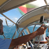
What a lot of fun we have had today. We left the anchorage at Black Point, Port Essington at 7:30 am and we arrived here in Alcaro Bay just after three in the afternoon. We sailed and motor sailed and made great time getting here. Once here, Mark went to shore with Scot Free II and I stayed on Windbird preparing dinner for Scot Free II, Rendezvous Cay, and ourselves. Rendezvous Cay is a US boat, although it is documented in Road Harbor in the British Virgin Isles. But we both proudly flew our American flags today and enjoyed a great July 4th dinner on Windbird. Tim is the captain on Rendezvous Cay, and his 25 year-old son Joe and Olivia from Sydney are his crew. Joe and Olivia met in Sydney and have been a twosome ever since. We had a great time sharing war stories of our sailing adventures across the Pacific. Once of the best stories was told by Joe. Evidently they had a damaged spinnaker in French Polynesia and had to have another one made. Once the new one rrived, Joe wanted to cut the clue and tack ends of the old one to use as a decoration. What he didn’t know is that his dad had stored the new sail with the old one, and he ended up cutting out two tacks and two clues. This meant that he had cut up the brand new sail. Yikes! This was an expensive mistake, but it makes a great story. Obviously father and son had some words over this one!
Tomorrow morning at 3 am we are leaving here and making our passage to Darwin. By this time tomorrow night, we hope to be anchored in Darwin. That is our hope, so we shall see what the winds and tides allow us to do. If we don’t arrive by sunset, we will come into Darwin at night. This should be fine as it is well lighted and our destination of Fannie Bay should have lots of sailboats on call on the radio to give us advice upon entry. It will be great to arrive and begin our plans for our sail through Indonesia. We also hope to have some time to explore the Northern Territory. But for now, we will be very happy to just arrive safely in Darwin.
by Judy Handley | Jul 3, 2008 | Australia Seisa to Darwin, Sailing Logs Year 3 |
Day 55, Year 3: Valencia Island to Port Essington
Date: Thursday, July 3, 2008
Weather: Another Beautiful Day with Williwonk Winds
Latitude: 11 degrees 08.775 minutes S
Longitude: 132 degrees 08.440 minutes E
Location: Black Point, Port Essington, Northern Territory, Australia
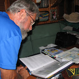
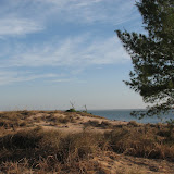
At some point today, Mark and I both uttered our frustration with the “williwonk” winds. We both used the same word and we don’t know where it comes from. I think we made it up based on ‘williwaws’-the winds that sweep down from high points into an anchorage and almost blow you over. They are strong winds, but they are not consistent. Well, that is what we had today. We would have 8 knots for a minute or two and then 25 knots for another minute or two. Trying to figure out which sail configuration to go with was hopeless, but even with the crazy winds, we had a good sailing day and reached our destination by 3:00 in the afternoon. That gave us time to go ashore and visit the Ranger Station here. The highlight of that visit was that we got to see a sand iguana (best guess of the Ranger) up close and personal. This was on the way to the station. And I must mention the tracks we saw on the beach where we landed the dinghy. We thought we saw crocodile tracks and a huge hole where the crocodile must have laid eggs. But when we got the station and talked with the ranger, he was sure it was turtle tracks. This was much to our relief. We visited the cultural center at the Ranger Station and read some of the history of this area. This land was inhabited by Aboriginals. Long before Europeans arrived there, the Aboriginals were trading with the Macassans from Macassar in Sulawesi, Indonesia for trepang (sea cucumbers or ‘beche-de-mer’). The Macassans then traded the trepang with the Chinese who considered it a delicacy. In the 1830’s, the British tried to establish a small, isolated community here. After more than a decade of trying to establish a settlement, the settlers left Victoria. It is hard to imagine how they must have felt after spending eleven hard years trying to make it here. We had hoped to get to see the ruins of the settlement, but it would be another day’s sail to it and another back, so we are not going to do that. Instead, we are moving on tomorrow to Alcaro Bay near Cape Don and from there staging our last overnight to Darwin. We really are ‘almost’ there.
by Judy Handley | Jul 2, 2008 | Australia Seisa to Darwin, Sailing Logs Year 3 |
Day 54, Year 3: Arrival at Valencia Island
Date: Wednesday, July 2, 2008
Weather: Another Beautiful Day; Winds SE 15-20
Latitude: 11 degrees 23.693 minutes S
Longitude: 132 degrees 47.551 minutes E
Location: Valencia Island, Northern Territory, Australia
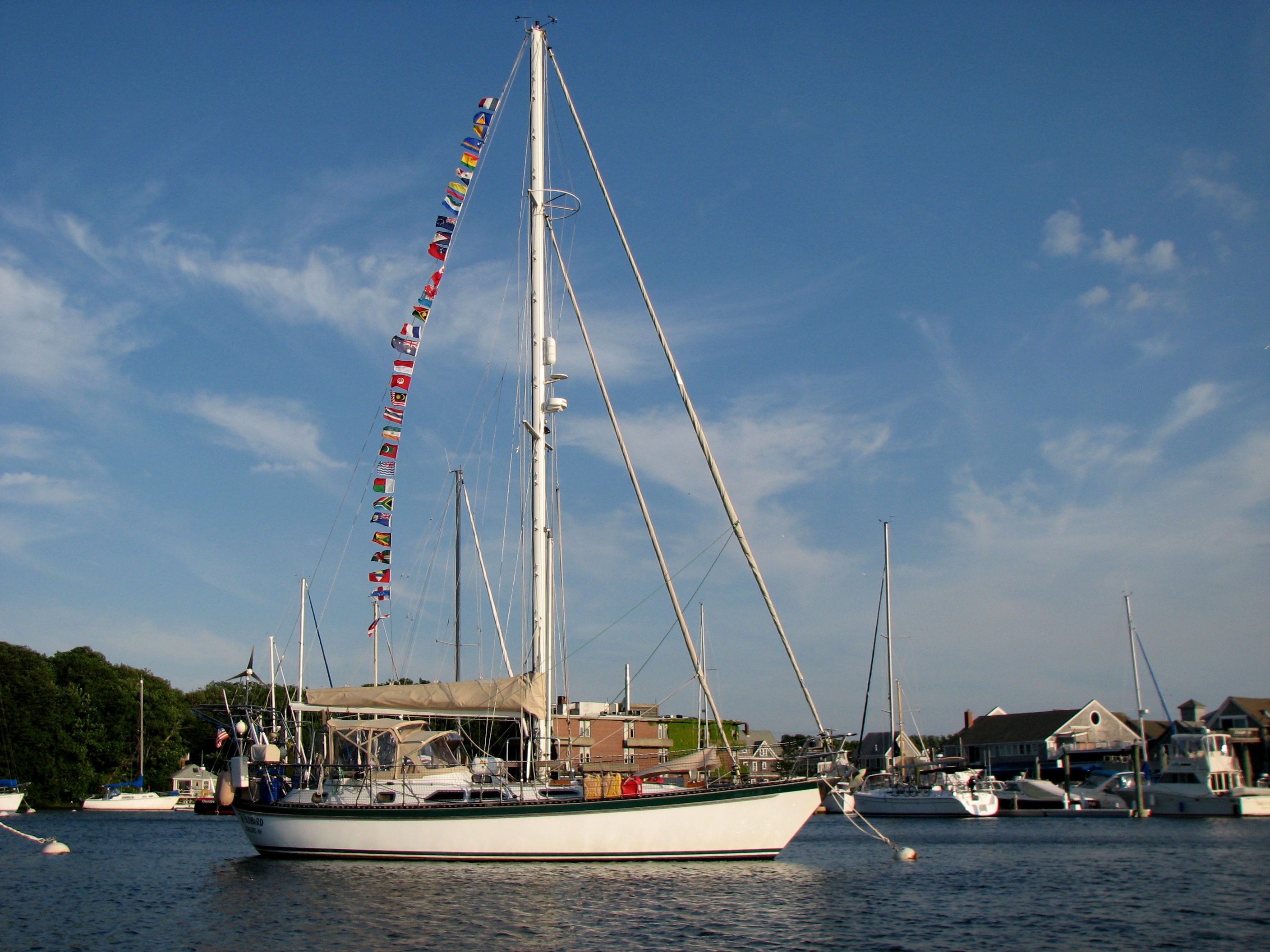
We made it to our destination of Malay Bay this afternoon and then kept on going to nearby Valencia Island. Stopping here for the night gives us a jump on tomorrow’s 60 mile trek to Port Essington, so that is why we changed our destination. Our overnight passage continued to be uneventful which was good. However, we didn’t get the 20 to 30 knot winds that were predicted. Since our run was downwind, the 30 knots would have been great, but instead we got variable winds that made sailing a bit difficult. We sometimes had to give ourselves a motor assist while at other times we sailed along nicely. But the important thing is that we made it across the expanse of the Arafura Sea and tomorrow we start the final assent into Darwin. We have to travel through a pass tomorrow during ebb tide. That requires that we leave here at 5:30 in the morning. We will arrive at Black Point in Port Essington and stay there one night so that we can visit the ranger station there. Then we will move just a few miles to a more protected anchorage for a second night that will allow us to explore that part of the world. The next day we make our way to Cape Don. From there we stage the last 100 mile trek into Darwin. By the time we get there we will have traveled for almost two months from Bundaberg. And as soon as we arrive in Darwin, we need to start getting ready for the four month trip through Indonesia, Singapore, and Malaysia, ending in Thailand in December. There is much research to be done and many things to do on Windbird to get her ready for this next adventure.
Scot Free got their head fixed just in time for Donna’s birthday today. So happy birthday to Donna. I’m sure that was the best birthday present she has ever gotten.
by Judy Handley | Jul 1, 2008 | Australia Seisa to Darwin, Sailing Logs Year 3 |
Day 53, Year 3: Overnight Passage to Malay Bay
Date: Tuesday, July 1, 2008
Weather: Another Beautiful Day; Winds SE 20
Latitude: 11 degrees 21.634 minutes S
Longitude: 135 degrees 01.760 minutes E
Location: Passage Across the Southern Arafura Sea, Australia
We are celebrating the first of July in an overnight passage to Malay Bay on the western side of the Arafura Sea. We are assuming this is part of the Indian Ocean as we know it is no longer the Pacific, but we need clarification on that. We were in the Coral Sea as we worked our way north up the east coast of Australia. The Arafura Sea is between Papua New Guinea and Northern Australia, and just above Darwin the Arafura gives way to the Timor Sea. The Wessel Islands, of which Raragala and The
Hole in the Wall are a part, are at the western end of the Gulf of Carpentaria, so once we went through the “hole” we were in the Arafura. That’s probably a complicated explanation for something simple, but it is all so new to me. I think simple explanations come once a person is more familiar. Anyway, we are celebrating the first of July because we are having an uneventful day with great sailing. After our night of bumping and grinding on the rocks in the anchorage at Wigram Island and the passage
through The Hole in the Wall yesterday, we needed a quiet day. As Jerry on Oema said on the radio net this morning, “Anticipating going through The Hole in the Wall was like waiting outside the headmaster’s office for punishment. You just didn’t know what it was going to be like going through a crack in the land in the middle of sea.” But we did successfully get through that challenge and we are now making tracks, being blown by a good 20 to 30 knot breeze from the east across this 200 mile wide
expanse of water between us and the islands on the far side. Once there we have about three or four more days of island traversing before the final run to Darwin. But once we complete this overnight passage, we are “almost” there.
Donna and Gerry on Scot Free II are having their troubles today. The one and only head (toilet) is not working and Gerry can’t get at the problem until we reach a quiet anchorage. It makes me REALLY glad that we have two heads. We heard on the net this morning that Patrick and Margaret on Aqua Magic were about 40 miles from Darwin, so they should have arrived today. When we left Seisia, they went over the top of the Wessel Islands and just kept on going. It will be good for Patrick to be in
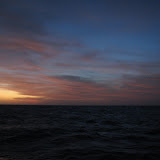
a secure anchorage so his hand can heal properly. It must have been extremely difficult for him and for Margaret with a one-handed captain. A boat named Oema and another named La Passarola are somewhere behind us doing this same overnight crossing. Most of the other Australian boats we know are day hopping along the Northern Territory coast and will get into Darwin about a week after us. Of course, that is assuming all goes well for us. The sun is setting and it is time to get ready for night
watches. As we are sailing wing and wing into the sunset, the winds are increasing and are predicted to stay that way through tomorrow. So we should have a nice downwind ride tonight and through tomorrow. But the emphasis is on the word “should.” With sailing, nothing ever seems to be “for sure.”
by Judy Handley | Jun 30, 2008 | Australia Seisa to Darwin, Sailing Logs Year 3 |
Day 52, Year 3: Through The Hole in the Wall (Gugari Rip)
Date: Monday, June 30, 2008
Weather: Another Beautiful Day; Winds SE 15-20
Latitude: 11 degrees 33.408 S
Longitude: 136 degrees 21.273 minutes E
Location: Raragala Island, Northern Territory, Australia
We had a great, fairly calm, and safe passage through The Hole in the Wall late this afternoon. And that was much needed after the excitement we had last night. I’ll get to the “excitement” in a minute, but first I’ll describe our trip through the Gugari Rip. We left Wigram Island at 2 pm and sailed as slowly as we could the seventeen miles across to time our arrival at the opening at 5:15 pm. As we got closer, there were five other boats going our way, but somehow we ended up being volunteered to go through first. We do have the flat screen monitor in the cockpit that allows us to see the electronic charting very clearly, so it is easier for us to lead through narrow passages than boats that do not have this. We also have a powerful and reliable Yanmar engine that can drive us even against an adverse current.
We led, followed by Scot Free, then Oema (Australia), followed by Double Dutch (South Africa), Helen Kate (Norway), and Antares (Netherlands). The pass is only a mile long and less than 200 feet wide and with only a half knot of current against us, we all made it through easily before sundown. In fact, we were all tucked in nicely in an anchorage just south of the western exit in time to watch the sun set. No one has figured out why the recommended times for going through the pass are not correct this week, but they are at least an hour and half off. In two days, we will have a new moon and neap tides, so maybe that is it, but you would think that all of the “expert” formulas would take that into account. But they don’t, and as we have been told over and over, the tides, currents, and tidal streams in this particular part of the world basically do whatever they want. They surely do not follow the patterns with which we are familiar.
Now to the excitement of last night. The background to the story is that when we anchored we knew we were on the edge of acceptable depth, but we had read that the bay had a sand bottom, and even if we touched, we thought it would be no problem. It was high tide when we anchored and we knew low would be coming up sometime around 11 pm. Gerry and Donna on Scot Free II came over for dinner and very shortly after they left, I felt the first “bump.” I was sitting on the main cabin settee and Mark was washing dishes. Somehow he didn’t feel the jolt, so life continued on as if nothing had happened. This was at 9 pm. By 9:15, there were more “bumps” and a few “grinds” on what was definitely rock, not sand, and this got Mark’s attention. We immediately went to the cockpit and checked the depth sounder, but it told us that we still had at least a foot and sometimes six feet under the keel. Regardless, the bumping and grinding continued periodically. Just when we would get hopeful that the problem was over, we would have more bumps and grinds. By this time, I was at the near panic stage, but Mark was convinced that we would be fine. Windbird is tough, but some of the bumps were so hard that the mast would vibrate the entire boat and the sound of rock grinding away at the keel was not a happy sound. We actually had 45 minute periods with no problem, and then it would happen again. Sometime around 12:30 pm things seemed better and we tucked in setting the clock for one hour. We did this until 4:30 in the morning when we could see that the tide had come in and raised the depth level considerably. It was very dark, but we used the light of the stars, Scot Free’s anchor light, and our charting software to guide us behind Scot Free to anchor there in much deeper water. It was 5 am by the time this was done. We got a couple of hours of sleep, but then we were up for the day. All is well that ends well, but I must say we had a very bad, almost sleepless night. We will turn in very early tonight as we are leaving here at 3 am in the morning. But hopefully tonight will be uneventful and we can get six hours of sleep before taking off across the Arafura Sea toward Darwin. We have 200 miles to travel and should arrive after a day, night, and another day of travel. I made chili today and boiled eggs. That way we can eat granola for breakfast, have a boiled egg and pre-cooked bacon with cream cheese on toast for second breakfast, have a tuna salad sandwich for lunch, and then chili for dinner. This keeps passage cooking to a minimum just in case things get rowdy out there. So here’s hoping for a very quiet night and a calm and safe passage.
by Judy Handley | Jun 29, 2008 | Australia Seisa to Darwin, Sailing Logs Year 3 |
Day 51, Year 3: Gove Harbor to Wigram Island
Date: Sunday, June 29, 2008
Weather: Beautiful Day; Winds SE 10-15
Latitude: 11 degrees 45.701 S
Longitude: 136 degrees 35.021 minutes E
Location: Wigram Island, Northern Territory, Australia
Our sail from Gove Harbor to Wigram Island was delightful. We were part of a convoy of about twelve boats that left the harbor this morning heading west. The winds were light so most of the boats in front of us put up their spinnakers. We followed suit and had a short but great spinnaker run. Then the winds piped up to about 17 knots and that is when we take down the spinnaker and put up the headsail. Once we took the spinnaker down, we then had all our sails up and made our way around Cape Wilberforce. We made a last minute decision to continue on past our designated anchorage of Elisabeth Bay and went on to Wigram Island. As far as we know, most of the other boats went on through the Gugari Rip (The Hole in the Wall) today, but something in their calculations of the right time to start through the pass were off. According to the information we heard from those going through at 3:15 this afternoon, they had a 4 knot current against them. It should have been slack tide. And the last radio communication we heard at 3:50 pm indicated that boats were still encountering a negative current of four knots. Some references say to use Gove tides minus one hour and others say to use Darwin tides plus two and half hours in order to hit slack tide and go though with just a bit of current in your direction. And of course, those two calculations do not give you the same passage time. If you wait too long into the tide cycle you can get from ten to fifteen knots of current, and since the pass is narrow that can be tricky. So we will talk with folks on the net in the morning and see if we can adjust our passage time so we won’t have a negative current. At any rate, we should be spending a relaxing morning here and heading to the pass in the early afternoon. We are probably three hours away and will probably go through around 5 o’clock tomorrow afternoon and anchor just on the other side. Then very early the next morning we plan to start a 200 mile overnight passage across the top end of the Northern Territory to a peninsula that is 200 miles from Darwin. Once we reach the Coburg Peninsula we will day hop for a couple of days and then make the last 100 mile run into Darwin in an overnight passage. We are going to arrive in Darwin later than we had hoped, but still in plenty of time to get ourselves ready for our sail to Indonesia.
The highlight of today was a pod of dolphins that played in our bow wake for more than half an hour. They put on quite a show and made our day. These waters are teeming with life and Scot Free II caught a big Wahoo today that we all enjoyed for dinner tonight. Some of the boats going through The Hole in the Wall today caught as many as four fish. Maybe it will be Windbird’s turn tomorrow.